Appalachian Trail Statistics
Preface: I wanted to see how much I remembered of my journey, so I looked in the AT Guide and started writing. I remember, vividly, all but 2 or 3 campsites. I remember something from each and every day for 130 some days. When in your existence has life been so memorable, so remarkable, that a year and a half later you can remember exactly what you were doing day after day for 4 months?
That was the point of hiking the Appalachian Trail. Lifelong memories made. I have a couple sections to go back and revisit, and I'm glad. I may add pictures to this, match up the camera roll to dates.
Day 1 April 10th, 2012
Starting point: Springer Mountain Parking lot - 1 mile south to Southern Terminus
Ending point: Justus Creek campsite
Total miles hiked: 16
Notes: Very excited to be hiking, gorgeous day, hardly any leaves on the trees yet. Helped a couple guys change a tire on their Mustang in the parking lot.

Day 2 April 11th, 2012
Starting Point: Justus Creek campsite
Ending point: Lance Creek
Total miles hiked: 9.3
Notes: Wanted to go further, but I didn’t have the required bear cannister, so I took it easy so I could skip the entire bear cannister section. Probably should’ve taken it easier the first day.

Day 3 April 12th, 2012
Starting Point: Lance Creek
Ending point: Just beyond Hogpen Gap
Total miles hiked: 14.5
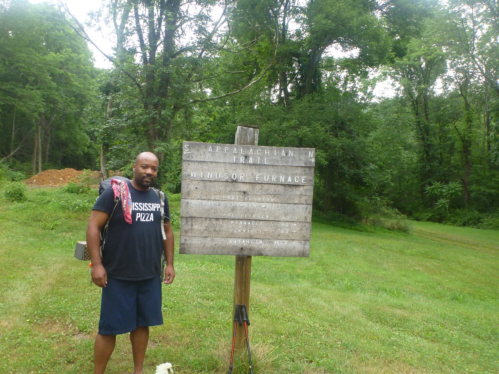
Notes: Had a great morning going over Blood Mountain. Knee began hurting a bit on the way down, enough that I bought a strap to relieve pain. Didn’t stay at Mountain Crossing for long, enough to eat a snickers and pick-up my first drop box. My pack now weighs 50+ lbs. The first few days I’ve found I’m eating less than half what I’ve packed so far. Met a couple guys that hiked the PCT, less than 20lb packs, already doing 20+ mile days. I shoulder my way too heavy pack feeling tired, worn out, beat up for the second half of the day. I drag into Hogpen Gap feeling very down and dispirited - which is what happens when you carry 3 weeks worth of food… I buried several meals to lighten the pack. All alone in a stealth site, first time sleeping with no other folks within ear-shot. No cell service either.

Day 4 April 13th, 2012
Starting Point: Just Beyond Hogpen Gap
Ending point: Blue Mountain Shelter
Total Miles: 11.7
Notes: In the need for human interaction, so I stay at a shelter. Meet some faces I’ll see a few more times, learn about a pancake breakfast a few miles distant for the following day. Meet a cab driver that hadn’t ever hiked before trying the Trail in jeans and cotton hoodie and a massive pack - good luck!! Got in early and mingled. Heard a guy died of a heart-attack and was found in this shelter. Slept in my tent.

Day 5 April 14th, 2012
Starting point: Blue Mountain Shelter
Ending point: Deep Gap Shelter
Total miles: 15.5
Notes: Got some Trail Magic in Unicoi Gap. Got pancake breakfast at Tray Mountain Road from the ‘B’ Team - the ‘A’ Team is a group of section hikers. I can only remember Traumatic the ER nurse. Borrowed TP from the ‘B’ Team, running low. Easy hiking most of the day across the Swag of the Blue Ridge. Kelly Knob, right at the end of the day was a very hard climb, but Traumatic and I passed an 80+ year old woman slowly making her way up. Hippy on top watching the sunset smoking. Down at Deep Gap shelter lots of the younger crowd, took them 2 weeks to get here, had visited every town in GA (apparently there are towns in GA, I didn’t stop) they also had a bottle of liquor. I tented away from the noise. Older lady got there before the hippy. One kid helped her set up her tent.

Day 6 April 15th, 2012
Starting point: Deep Gap shelter
Ending point: Muskrat Creek shelter
Total miles: 15.4
Notes: Started off hiking with Traumatic until Dicks Creek Gap where the ‘A’ Team knocked off. Started hiking with a guy from Maine that smoked every 10 minutes. Crossed over into NC, kept gaining lots of elevation to make it to Muskrat Creek. Tent camped. Kind of a spread out campsite area.

Day 7 April 16th, 2012
Starting point: Muskrat Creek shelter
Ending point: Big Spring shelter
Total miles: 19.3
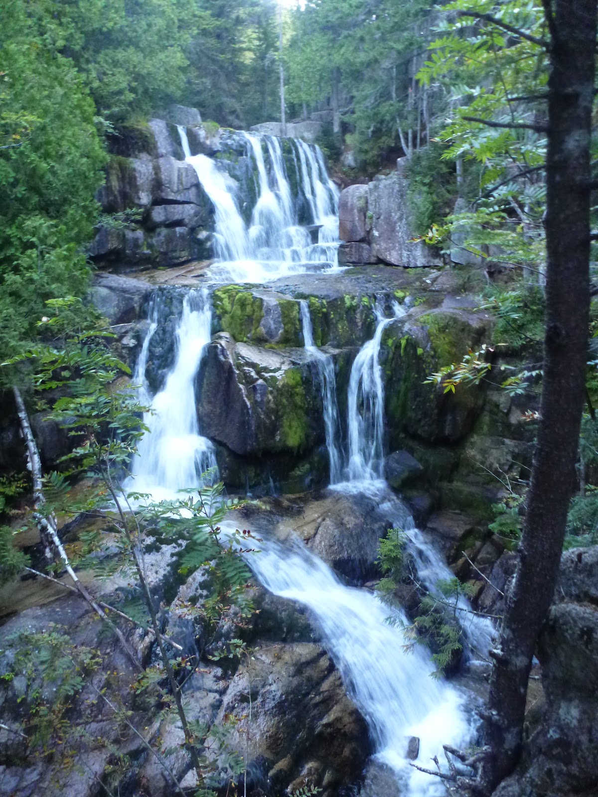
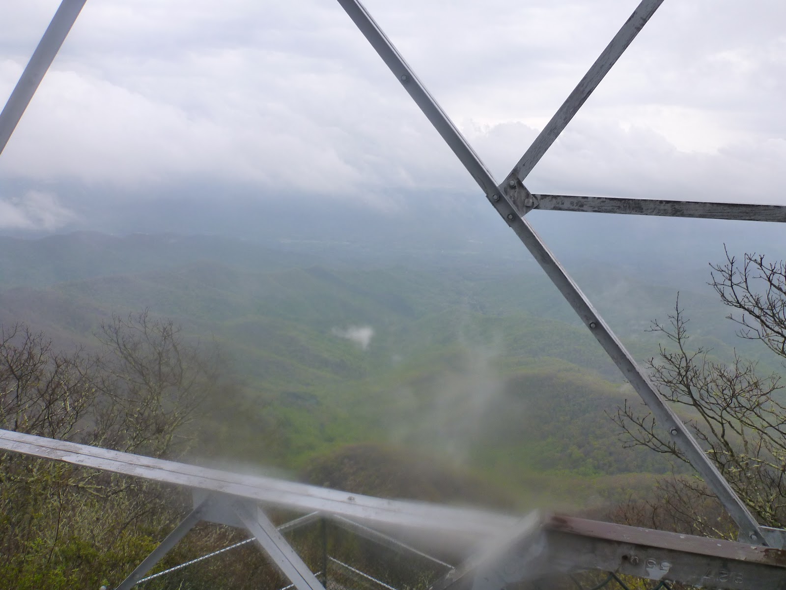
Notes: Good weather to begin with. Standing Indian was a surprisingly easy mountain to climb despite the elevation gain and loss. Rain and fog as I passed Carter Gap Shelters. Thunderstorm as I climbed Albert Mountain, very step, rack stairs. After the storm I got in touch with my dad, they will meet me at Stecoah Gap in a few days. Climbed Albert Mountain fire tower and got a very brief break in the clouds. Made it to Big Spring Shelter just before more rain, hung the bear bag in the rain, first stay inside of a shelter, only 2 other guys there, Crawfish??? 3rd night I’ve stayed at the same place as him, and a guy from TN getting picked up at the NOC.
Day 8 April 17th, 2012
Starting point: Big Spring shelter
Ending point: Siler Bald shelter
Total miles: 13.3
Notes: Made really good time, ended early. Hot Shot was at the shelter. Dried out some stuff and laid out my sleeping stuff. The shelter got really full quickly. One guy, Teddy Bear was really low, hadn’t talked to his wife in too long, I let him borrow my phone to call her. I saw him again months later in Maine doing a flip-flop. I remembered why I hate shelters, too crowded noisy stinky but it started misting so at least I was dry and warm.

Day 9 April, 18th 2012
Starting point: Siler Bald shelter
Ending point: Nantahala Outdoor Center (NOC)
Total miles: 23.3
Notes: Passed Hot Shot early, he caught up at the tower on top of Wayah Bald, a deer had been stalking him up the mountain. At some point during the day I decided I would push on to the NOC to try and get a hamburger or other made food - 9 days on Trail food, and a couple pancakes. Knee hurting and shin splints hurting losing all that elevation. Made it to the NOC just as the grill was closing. Got hooked up. Server offered to have me stay at his plce once I found out the bunk rooms were full. I got a bed, some beers, a pizza, and a ride the next morning - fantastic.

Day 10 April 19th 2012
Starting point: NOC
Ending point: Just Beyond Simp Gap
Total miles: 11.5
Notes: Lots of elevation out of the NOC, took my time, tried to smell the flowers. Meeting my parents tomorrow so I can take the day slow and easy. Made a dry camp on a ridgeline beyond Simp Gap just a few tenths shy of Stecoah Gap.

Day 11 April 20th, 2012
Starting Point: Just beyond Simp Gap
Ending point: Stecoah Gap
Total miles: 1.9
Notes: Broke camp leisurely. Met my parents at 11am at Stecoah Gap. Went to McDonalds, drug store, grocery store, and hotel. Went out to eat at a buffet in the next town over. Slept in a bed.
Day 12 April 21st, 2012
Starting point: Stecoah Gap
Ending point: Fontana Dam
Total miles: 13.9
Notes: Mom and Dad hiked the first couple miles, turned back right before the start og Jacob’s Ladder. Meeting Jim tomorrow to hike the Smokies, supposed to meet tomorrow at noon at the Post Office in Fontana. Made better time than expected. Was at Fontana and decided to splurge and go to the lodge. Got a shuttle ride to the lodge, had a room, and a nice meal and yet another show - really having a run of those lately. Shin splints and knee still hurting continuously to some degree or another.

Day 13 April 22nd, 2012
Starting point: Fontana Dam
Ending point: Birch Spring Gap
Total miles: 7.1
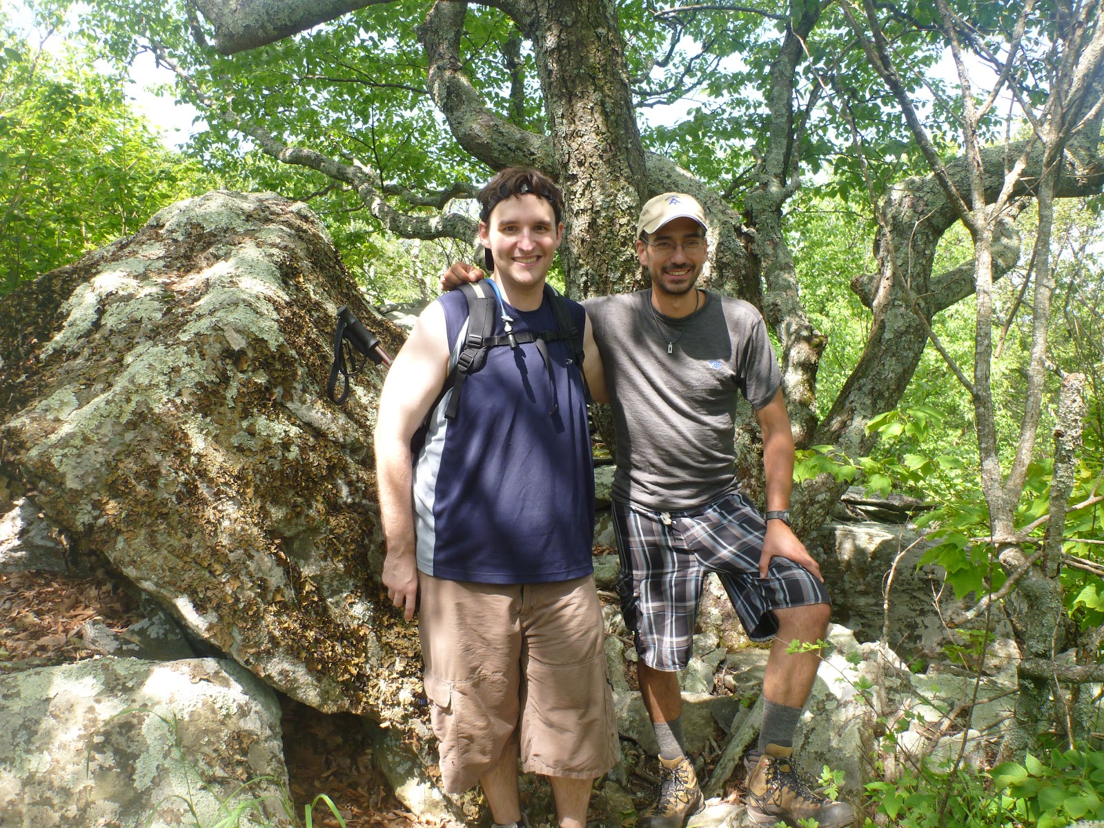
Notes: Got to the Post Office early and went through the mail drop carefully, getting better at not carrying extra food. I gave my parents some stuff to take to lighten my load too. Met Flip (Jim) around noon and hiked over the dam and up into the Smokies - stopped and looked at the sketchy Shuckstack fire tower - the wind was blowing like crazy and the things was swaying and groaning. Steps were missing. I went up one flight of stairs and turned back. We made it to the campsite (water was flowing) and had backpackers pizza, first of several good meals Flip had meticulously packed.

Day 14 April 23rd, 2012
Starting point: Birch Spring Gap
Ending point: Derrick Knob shelter
Total miles: 17.1
Notes: Today we saw snow flurries on top of Thunderhead Mountain, as well as view back to Shuckstack and Fontana - wow how far you can go by foot in a day and ½! Got to a very full shelter and camped out away from the TP field - there was no latrine. The group here was about 25 to 30 thru hikers that were traveling 7 miles a day, shelter to shelter, and having a ball doing it. One guy bragged he had a bottle to pee in so he didn’t need to get out of his tent at night.

Day 15 April 24th, 2012
Starting point: Derrick Knob shelter
Ending point: Icewater Spring Shelter
Total miles: 21
Notes: Saw a bear first thing this morning after I climber from the tent. After we packed up and bolted we saw a wild pig and then got stalked by a wild turkey. We made it to Clingmans Dome by lunch and made a hot lunch. Flip went in search of a water fountain or a soda machine, we were running low on water. No go. On the blacktop summit trail a hover round was struggling up the incline, the gentleman's wife was pushing and no one else was offering a hand. Backpacks donned, Flip and I pushed the hover round to the top. As we descended some day hikers offered us some ice water since we were nearly out, they also offered orange juice and beer - declined the beer! Around the next corner we found a spring of course. Just as we got to Newfound Gap the sky opened up. We hiked up to Icewater Spring shelter in a torrential downpour. Nearing the top it slowed to a drizzle. We found the shelter occupied with no one willing to move over and make room for two more. We setup the tent under a leaden sky. Flip and I decided my Trail name is Johnny Walker Black.

Day 16 April 25th, 2012
Starting point: Icewater Spring shelter
Ending point: Tri-Corner Knob shelter
Total miles: 12.6
Notes: As we broke camp the sky opened up, we grabbed all the gear before it could fly away and hide in the shelter. Very strong sideways gusts, rain, hail, lightning and thunder. If we’d left 20 minutes before we’d be out in that mess! We packed and when a break in the storm presented itself we split. Hiked some with Hot Shot, passed the people we were with the night before. It hailed while we hiked, some hail golfball-sized, hunched over with our packs to protect us. There were some trees down over the Trail. We made good time and were the first to the shelter. A cold misty night, we made sure that everyone that showed up stayed in the shelter, upwards of 20 - all the same folks that wouldn’t shove over for Flip and I plus more. Very wet night.
Day 17 April 26th, 2012
Starting point: Tri-corner Knob shelter
Ending point: I-40 underpass
Total miles: 17.6
Notes: Started out kinda rainy and patchy fog, hiked with Hot Shot for awhile again. Went down down down out of the Smokies. Passed a couple of guys I’d see later, can’t remember their Trail names. We got in touch with the owner of the hostel and got a ride to Hot Springs to Flip’s car. Once there he drove us to Asheville where we got a hotel at a lot of food and dried our soggy gear.

Day 18 April 27th, 2012
zero day - Asheville, NC
Day 19 April 28th, 2012
Starting point: I-40 underpass
Ending point: Walnut Mountain Shelter
Total miles: 20.8
Notes: Gorgeous spring day. Run into Hot Shot early in the day and hike out with him. Find Trail Magic at Brown Gap. Have a awesome day to go over Max Patch. Make it to Walnut Mountain as it gets dusky. Only Hot Shot and I there, very small shelter, so that’s a good thing. My shin splints have gone away and never come back.

Day 20 April 29th, 2012
Starting point: Walnut Mountain shelter
Ending point: Tanyard Gap
Total miles: 19
Notes: Hot day - oi - doesn’t help Hot Shot likes to walk in front and farts a lot… Made it down to Hot Springs and found Elmer’s is full, I picked up a drop box from Cara and found her fun pictures and coconut water!! Went to a brewery in Hot Springs and had a beer. The Steripen gave up the ghost (POS) so I sent it home and got Aquamir drops. Lovers Leap in the heat was rough, evening began to fall and couldn’t find a good campsite. Right after Tanyard Gap Hot Shot and I camped right on the side of the Trail. Annoying car alarm bird was above my tent. Jerk!

Day 21 April 30th, 2012
Starting point: Tanyard Gap
Ending point: Log Cabin Drive
Total miles: 9.9
Notes: Made it to Hemlock Hollow hostel, Hot Shot had to go home to GA for a day or so to get some personal stuff in order so he can continue receiving unemployment. Hemlock Hollow folks are very nice but seem like some hikers have taken advantage of them. Met a kid I see again up in PA. I decide to do a Slack Pack the following day and stay here again, great place.

Day 22 May 1st, 2012
Starting point: Devil Fork Gap
Ending point: Log Cabin Drive
Total miles: 19.2
Notes: Great slack, great day to not have a pack on. I just flew along. Nice open rocky ridge that had a foul weather re-route if needed. I did not! On the final descent back into the hollow Hot Shot was on his way out.

Day 23 May 2nd, 2012
Starting point: Devil Fork Gap
Ending point: Bald Mountain shelter
Total miles: 16.2
Notes: Climbing Bald Mountain had many spring flowers growing. You could see a housing development on the next ridge over and the largest mountain on the east coast beyond that, Mt Mitchell. The trail skirted a road on the ridge going along Bald Mountain to a water tower. Bald Mountain lived up to it’s name, quite pretty. Going down the other side was surreal, lots of pretty flowers and twisted trees. Honest Abe was at the shelter.

Day 24 May 3rd, 2012
Starting point: Bald Mountain shelter
Ending point: Curely Maple Gap shelter
Total miles:21.1
Notes: Trail side slabbed a bunch of valleys, small elevation gains and losses. Started raining at No Business Knob Shelter for early break. Made it to Uncle Johnny’s by early afternoon on a humid cloying day. I was feeling worn down and anti-social. Uncle Johnny’s gave off a bad vibe, grabbed a soda and left. I was glad to be out of that town. Curely Maple water source had TP all around it and seemed to be down valley from where everyone went to the bathroom. I didn’t get water here and stayed healthy. Shelter was fairly empty, can’t remember if I stayed in our out.

Day 25 May 4th, 2012
Starting point: Curely Maple Gap shelter
Ending point: Clyde Smith shelter
Total miles: 22
Notes: Unaka was a tough climb, but gorgeous on top, seemed like I was in the north country. Kept pushing on, I remember passing the cut-off for Greasy Creek Hostel, but I have no recollection of the shelter area where I stayed.

Day 26 May 5th, 2012
Starting point: Clyde Smith shelter
Ending point: Doll Flats
Total miles: 20.7
Notes: Took a wonderful crap before the second climb of the day. Strange what one remembers two almost two years later… Climbed Roan on the new trail, not too steep and quite pleasurable. Gorgeous forest, great tread-way. The highest shelter on the AT, Roan High Knob, had a door against the elements and smelled of urine. Carvers Gap, Round, Jane Balds were all awesome. I debated and decided to skip Overmountain Shelter and push on to Doll Flats. As I climbed Big Yellow Mountain it rained. Had I gone to Overmountain I may have regretted it - apparently around 30 through hikers were there, being Cinco de May, there was a huge binge drinking, pot smoking fest that I didn’t go to. Actually very glad I skipped on that!!

Day 27 May 6th, 2012
Starting point: Doll Flats
Ending point: Upper Laurel Fork
Total miles: 15.1
Notes: Felt very lethargic all day. All the nearly non-existent hills were flagging my strength so quickly. It was also a very hot day. The trail passed around old farmers fields, around old cemeteries, skirted mountain laurel groves and had numerous country road crossings. At Jones Falls I met up with 3 hikers, 2 dating, that I would see again over the next few days and then again in Damascus. I had no intention of stopping at the hostel, I wanted to keep going, but my energy level and general malaise drove me to the hostel. The hostel owner had had a concussion so was very drugged up and out of it, going through the motions but not really there. That night I tried and failed to eat dinner but ate a pint of Ben and Jerry’s - sometime during the night I went and puked everywhere in the outhouse.

Day 28 May 7th, 2012
Starting point: Upper Laurel Fork
Ending point: Kincora/Dennis Cove Road
Total miles: 11
Notes: With an empty system, I was even more lethargic this day than last. Started hiking with a guy right at the end of the day that I’d met at the end of the Smokey’s. At the road crossing to Kincora I had the choice to go to a private cabin to the right, a hostel to the left, or my tent straight ahead. I was exhausted and followed the guy I was hiking with to Kincora. Mistake. It was just beginning to rain and the place was packed. I got a bunk in the bunkhouse. The place was noisy and packed. Baltimore Jack was there helping the owner of Kincora. Cats infested the place, while I love cats, the ones that have fleas, not so much. That night I was kept awake by Tree Piper that idiot hippy playing his recorder all night, as well as the broke hippy that loved telling stories about herself and how she would brusk (aka beg for money) to be able to keep hiking but broke her instrument. On top of this unfortunate choice of not getting any restful sleep, I was supposed to meet my friend Dan in Damascus in 2 days, so ~60 miles to go in two days while feeling this sick. I set a too ambitious pace and was wearing myself thin.
Day 29 May 8th, 2012
Starting point: Dennis Cove Road
Ending point: Side trail to Hampton, TN
Total miles: 2.7
Notes: The day began grey and soon began raining. I made my way to Laurel Falls and through these deep pine forestts echoing with rushing water. The rain fell harder and as I apporoached the ascent to Pond Flats I decided there was no way I would meet my deadline with Dan and then be able to continue hiking. I took a side trail to Hampton, called a shuttle and got taken to Damascus. In Damascus I rented a room in a house downtown, I ended up being the only hiker there, so I basically rented a house. I ate a lot of food and watched TV. It rained all day and into the next.
Skipped: 47.9 miles from Side trail to Hampton, TN to Damascus, VA south
Day 30 May 9th, 2012
Zero day
Notes: I bought a new tent, the rain was leaking into my tent. I sent the HubbaHubba home and purchased a Black Diamond UL tarp tent along with a piece of Tyvek for flooring. I sent home more stuff too. I dream about a lighter pack.
Day 31 May 10th, 2012
Starting point: Damascus, VA north
Ending point: Saunders shelter
Total miles: 9.2
Notes: Met with Dan (named himself Woodteeth) and hiked out around noon. The day was perfect, nicely warm but not too warm. We hiked on the Creeper Trail then side slabbed a hill making it to the shelter. An older guy was there that we would see quite a bit over then few days. The campsite was under pine trees and provided a soft bed and good experimentation of the new tarp tent I had purchased in Damascus.

Day 32 May 11th, 2012
Starting point: Saunders shelter
Ending point: Whitetop Mountain Road
Total miles: 11.9
Notes: Didn’t want to break Woodteeth with too many miles. We took our time and enjoyed the walk and the talk. Joined the Creeper Trail again for a bit before ascending a good sized, but fortunately steady incline up Whitetop Mountain. The older guy from the night before kept pace. Camped with Cheddar for the next few nights.

Day 33 May 12th, 2012
Starting point: Whitetop Mountain Road
Ending point: Wise Shelter
Total miles: 11.8
Notes: These low miles days are great for me, I feel like I’m getting stronger again by degrees. This day brought rain and mist, and also ponies. Grayson Highlands in the fog seems like the Scottish Moors. We met some very muddy trail maintainers that had just put in some steps and water bars, we were the first hikers to traverse the new trail. Can’t remember if it was just a lunch spot, or if this was the place we stayed, lots of rain.

Day 34 May 13th, 2012
Starting point: Wise Shelter
Ending point: Hurricane Mountain shelter
Total miles: 10.9
Notes: Sodden day, crossed some fields, I remember ‘The Scales’ paddock and crossing through some horse fencing. In the shelter that night I was reminded yet again why I hate shelters. Eight people snoring and farting all night. I didn’t sleep. But it rained and I was dry.

Day 35 May 14th, 2012
Starting point: Hurricane Mountain shelter
Ending point: Partnership shelter
Total miles: 19.7
Notes: Pushed over easy terrain and made it to Partnership early enough to get sodas from the visitor center and ordered a pizza to be picked up by the park entrance a tenth of a mile away. Set up under some pine trees, had enough time to explore the area, see a frog pond, mingle in the very festive mood that was leading up to everyone heading to Trail Days the next weekend. Some girl carved interesting designs onto Woodteeth’s hiking sticking.

Day 36 May 15th, 2012
Starting point: Partnership shelter
Ending point: Chatfield shelter
Total miles: 7.1
Notes: Very leisurely morning. Looked at the frog ponds again. Packed up and headed towards the next destination. Saw Hot Shot hiking with another guy I had meet from back in the Smokey’s. We enjoyed the day and took our time, stopping often. Woodteeth decided to go back up the Trail and build cairns every few feet for a few hours. I climbed a hill so I could call Songbird.

Day 37 May 16th, 2012
Starting point: Chatfield Shelter
Ending point: Atkins, VA
Total miles: 4.9
Notes: Went under some noisy power lines and through gently rolling green fields to get to an Exxon gas station to get picked up by Enterprise rental car to take Woodteeth home and go home myself to see Songbird for her birthday. We got a flat tire just south of Roanoke and had to go get it patched before proceeding onward.

Day 38 May 17th
Day 39 May 18th
Day 40 May 19th
Day 41 May 20th
Notes: Drove home. Mowed the lawn. Went to Running Hare. Drove to Bucks County PA and went hot air ballooning as Songbird’s surprise for her birthday. On the drive back on Monday morning I stopped and moved a turtle out of the road of 301 north of Richmond.
Day 42 May 21st, 2012
Starting point: Atkins, VA
Ending point: Crawfish Trail
Total miles: 5.9
Notes: Late start after driving from Southern MD, dropping the car, and getting dropped off at the Trail. Saw one group of very hung-over hikers a few miles in, though they looked more like the homeless than hikers. I kept going a few more miles and camped in a secluded little valley alone.
Day 43 May 22nd, 2012
Starting point: Crawfish Trail
Ending point: Pond
Total miles: 14.9
Notes: Muggy and sometimes rainy day, going through quite a few pastures. Rained and then stopped before making camp behind a pond on the lead up to Chestnut Knob. Called flowers.com and had some flowers shipped for Songbird’s birthday.

Day 44 May 23rd, 2012
Starting point: Pond
Ending point: Laurel Creek
Total miles: 16.6
Notes: At Chestnut Knob shelter met a guy with his dog in the fully enclosed shelter, he had been bitten by something and his skin was rubbing off his foot badly. He was zeroing at the cabin. The campsite that evening was nice, creek had a dirty diaper near it unfortunately.
Day 45 May 24th, 2012
Starting point: Laurel Creek
Ending point:Lickskillet Hollow
Total miles: 20.2
Notes: I remember following a road to 52 and crossing over I-77, down a blacktop road. I pooed in that hollow before ascending the hill. I stopped at the Helveys Mill shelter trail and talked about how the trail dropped like 500’ of elevation to get to the shelter and the water source. The next water source ten miles distant. This was one of the most boring ridge walks in VA, at least in the state of mind that I was in that day. Nothing of note on the map for 7 miles, and then only a dirt road. I made my own camp that night in Lickskillet Hollow after seeing that the shelter area was disabused. One of the few night I made a fire just for my own personal enjoyment.
Day 46 May 25th, 2012
Starting point: Lickskillet Hollow
Ending point: Sugar Run Gap (Woods Hole Hostel)
Total miles: 19.2
Notes: I went to Trent’s Grocery Store early in the day and road walked up to Dismal Falls before rejoining the AT. From there I unsuccessfully tried to cut off a portion of the Trail and got turned around on some horse trails that eventually came back out on the AT. I pushed on, running some, and finally stumbled into Woods Hole Hostel. Great place, around 25 or so people bunking and camping. Pizza and salad was to die for.

Day 47 May 26th, 2012
Starting point: Sugar Run Gap
Ending point: Pearisburg, VA
Total miles: 10.4
Notes: Hiked with Re-tread and another guy. Stopped at Angels Rest for a view and a photo. I stayed right off the Trail at the Rendezvous (now burned down). Walked up to Dairy Queen and Food Lion. I left my guidebook there and didn’t realize it, guy at the hotel called Food Lion and then rode me up there to get it. His was a sad story, and it seemed like that of the town too. A chemical plant is there and it may modify the mood! I was sad the entire time I was in Pearisburg.

Day 48 May 27th, 2012
Starting point: Pearisburg, VA
Ending point: hill-top before Symms Gap
Total miles: 11.9
Notes: Meet a guy with 2 dogs that I would see again in NJ. Currently he had diarrhea something bad. Stopped at a shelter where he’d seen a few copper heads. Kept going, stopped at one of my favorite campsites of the hike, on a hilltop over-looking the distant hills of West Virginia. I had a frog visit me in my tarp shelter. I began worrying more about the bugs to come. This night I also made a campfire.

Day 49 May 28th, 2012
Starting point: ~Symms Gap
Ending point: Kelly Knob
Total miles: 24.7
Notes: Long day. Last bit I ran while on the phone with Songbird to Kelly’s Knob. Pretty sure this was the day it seemed like a huge storm was about to eat me, thunder and wind and then… nothing. I think this was the day I found a fawn right by the Trail side curled up.

Day 50 May 29th, 2012
Starting point Kelly Knob
Ending point: Audie Murphy Monument
Total miles: 18.7
Notes: Talked with at least one person that was going to meet me at the monument, but never showed. Camped alone, yet again. I couldn’t find other hikers. It rained in the afternoon. I had a salamander visit, glad it wasn’t a snake. Beyond the Audie Monument a fallen soldier's boots lie on the cliff-side as a sub-monument.

Day 51 May 30th, 2012
Starting point: Audie Murphy Monument
Ending point: Pig Farm Campsite
Total miles: 21.9
Notes: The day started leisurely. I was meeting Songbird for the weekend and having her pick me up at whatever road-crossing I was near. At Newport Rd I walked to a grocery store and got a ride back to a hostel with the intention of chilling out and then doing a few more miles the next day. I got bored in about ten minutes and so went back to the Trail and began running to make up for lost time. I made it to McAfee Knob at sunset and had the place almost entirely to myself, there was a couple there that took my picture. I made it down to Pig Farm campsite, set up, and got water at dusk.

Day 52 May 31st, 2012
Starting point: Pig Farm Campsite
Ending point: Daleville, VA
Total miles: 15.5
Notes: The 17 year cicada were out in force. One flew up my shorts. This was a very good hike, following the ridge, being able to see the hidden Crescent Lake, hearing the voice of the insect. Tinker Cliffs was even more amazing that McAfee Knob. I saw a treed bear today too. I made it down to 81 with the heat of the day crushing and the stink of dead locust thick in the valley. I hiked over to the Red Roof Inn and met Songbird and Kaya that evening for a weekend.

Day 53 June 1st, 2012
Day 54 June 2nd,2012
Notes: We went to a winery and went to a new Trail Days, that didn’t have many attendees. We camped at Peaks of Otter. I got a bug net to stop the encroachment. I had hiked this section before but I skipped 20.4 miles from US-11 to Bearwallow Gap

Day 55 June 3rd, 2012
Starting point: Thunder Ridge Overlook
Ending point: Johns Hollow shelter
Total miles:14.9
Notes: After Songbird dropped me off I quickly made my way down to the James River and over to Johns Hollow. I had the place to myself and set up my mosquito bug net inside the shelter.

Day 56 June 4th, 2012
Starting point: Johns Hollow shelter
Ending point: Hog Camp Gap
Total miles: 26.4
Notes: Marathon day. I remember bits and parts, like the Ottie Cline Powell Monument and the Lynchburg Reservoir. I remember the campsite, it was actually rainy and chilly that evening, me with no long pants, I probably looked like I had my rain coat on and naked ass. I set my tarp under a nice tree in a fine grassy field.

Day 57 June 5th, 2012
Starting point: Hog Camp Gap
Ending point: Maupin Field Shelter
Total Miles: 28.1
Notes: Another marathon plus day. I felt like I was treading water. I was really strong but still felt like I was going backwards. I’ve been in Three Ridge Wilderness before. That night was the night I swore off shelters. When I first arrived it hadn’t started raining, but began to shortly. More and more people showed up. I was crammed in a corner and got attacked by mice all night. I didn’t sleep.
Day 58 June 6th, 2012
Starting point: Maupin Field Shelter
Ending point: Waynesboro, VA
Total miles: 21
Notes: Got up at 4am or early and left. Stopped a few miles in after some of the rain stopped and made coffee. I took a detour to a visitor center and then hiked down the Blue Ridge Parkway to Rockfish Gap. I got a Trail Angel to take me and another guy into town. We stopped by an art gallery to help his daughter move some pieces of furniture. I got a room at a hotel and walked to get sewing stuff from the dollar store to try and make the bug net suck less.
Day 59 June 7th, 2012
Starting point: Waynesboro, VA
Ending point: Calf Mountain shelter
Total miles: 6.8
Notes: In Shenandoah. After all the big mile days I thought it prudent to slow down. I got into camp very early, no one else showed up, ready a really crappy book, sewed my bug net, got extremely bored. I think I saw some bears that night, I yelled and threw a few rocks. Being on the ground sucks, bugs, and frogs, and salamanders all up in my grill. And the footfalls of deer and bears waking me too.

Day 60 June 8th, 2012
Starting point: Calf Mountain shelter
Ending point: Pinefield Hut
Total miles: 26.2
Notes: So much for low mile days. I decided at some point eff slowing down, I need to speed up! Obviously exhaustion was not helping itself. I had it in my mind I wanted a blackberry drink from the wayside at Loft Mountain. So a day of jogging and hurrying commenced. I made it to the Wayside in plenty of time, spent way too much on not very satisfying food and still had a few miles to go to get to the next shelter area. Foolish.
Day 61 June 9th, 2012
Starting point: Pinefield Hut
Ending point: Big Meadows picnic area
Total miles: 29
Notes: Began the day late. Saw a bear and cub, a bobcat, and a flying squirrel. Had a socks off lunch on an overlook chatting with a couple ladies. Sat and had a soda with Spots wife at a road crossing. In the afternoon I got in touch with Anthony and said we should meet for breakfast at Big Meadows, over 14 miles away, after I’ve already hiked 15. That settled and reception lost. I saw a mother bear and three cubs, I saw how fast bears really are and I hiked until 10pm, had a burger and a beer in the pub and illegally camped in the picnic area.

Day 62 June 10th, 2012
Notes: Met Anthony and Liz for breakfast and then went back and hiked Bearfence Mountain with them, fun rock scrambles and stuff the AT bypassed. I had them drop me off at Skyland Resort with some story of me hiking south and hitching back north. I was yellow blazing, pure and simple. I hated Shenandoah and wanted out. I skipped 7.5 miles. I got a cabin at Skylands, drank some whiskey, smoked a cigar, and ate expensive food.
Day 63 June 11th, 2012
Starting point: Skylands Resort
Ending point: Rangeview Cabin
Total miles: 19
Notes: I was getting tired. The day dragged on. I was frustrated. And I decided I’d make it to Elkwallow Wayside before the closed. I jogged and ran again and made it just in time. The day started getting gray and looked like ran. I hiked on the Rangeview Cabin and slept on the concrete porch.

Day 64 June 12th, 2012
Starting point: Rangeview Cabin
Ending point: Skyline 15.9
Total miles: 6.8
Notes: Got picked up and got a ride into Front Royal. I got a hotel, then Songbird called and offered to come pick me up after work. I agreed, something had to change, I was burning out and on the cusp of quitting. I just skipped 11.6 additional miles. Songbird came and got me and I stayed home for a week before deciding to come back out, bring a hammock instead of sleeping on the ground. I changed out some additional gear and drove my car to Harpers Ferry before getting a shuttle to 522 Front Royal and hiking north back towards my car. Got a shuttle ride with a guy and a girl hiking couple, he wore a bow tie.
June 13th - 17th Day 65 - 69
Day 70 June 18th, 2012
Starting point: Rt 522
Ending point: Jim and Molly Denton shelter
Total miles: 5.2
Total miles: 5.2
Notes: Set up my hammock successfully and the tarp over it awkwardly, but adequately. Couple guys that were roaring drunk eventually made it to camp. The hammock was comfortable and I was glad to be back on the Trail.

Day 71 June 19th, 2012
Starting point: Jim and Molly Denton shelter
Ending point: Hilltop campsite after Rod Hollow shelter
Total miles: 21.7
Notes: Blisteringly hot day. Drank lots of water and refilled often. Decided not to go to Rod Hollow shelter but get to a hilltop and a breeze - apparently there were 40 some people at the shelter, no place for more people, scout troops and all. I had a hill to myself. I had hiked the first couple hills of the Roller Coaster so I could get beyond it the next day.

Day 72 June 20th, 2012
Starting point: Hilltop campsite
Ending point: David Lesser Memorial Shelter
Total miles: 17.7
Notes: Another very hot day, over familiar terrain. I grabbed a couple Dr Peppers at Bears Den and thus enhanced made my way down the Trail. I called and talked to my parents of the ridge above Blackburn AT Center. Little did I know that I was in the county that I would soon live in. David Lesser is a good shelter, swinging porch swing (redundancy is redundant). The spring was rather far away, down over a hill, but cool and sweet.
Day 73 June 21, 2012
Starting point: David Lesser Memorial shelter
Ending point: Harpers Ferry North
Total miles: 9.3
Notes: Made it to the car by 9am on the hottest day of the year so far, over 100 heat index. It was hot by 9am and I was glad I’d begun at 6. I made it to the ATC and got my picture taken. Hiker 578 or something, I need to double check that number. From here I drove home for the weekend and decided not to quit, Songbird took me on Sunday back to the Trail at PenMar. I’ve hiked Maryland before, but I skipped 9.7 miles from Wolfsville Rd to PenMar.

Day 74 June 22
Day 75 June 23
Day 76 June 24th, 2012
Starting point: PenMar
Ending point: Deer Lick shelters
Total miles: 5
Notes: Songbird and I had a nice day, first to the Catoctin Zoo then had a wonderful peach at a farm stand before she dropped me off at the busy park. I saw the guy with the bow-tie again.
Day 77 June 25th, 2012
Starting point: Deer Lick Shelter
Ending point: Caledonia State Park
Total miles: 13.6
Notes: The trail has changed, the pine forests seemed deep, the forest bigger, somehow - this might be just a memory of a memory of me being in this area when I was a child and the trees only seemed bigger. I was also coming off a couple weeks of rest and recuperation, some easy hiking and a few continuous days of rest and bed. Also I had a bunch of things to look forward to between now and after my birthday. Once I got to Caledonia State Park, a place I spent much time as when I was a kid, my grandmothers husbands child Mark Meenie came and picked me up. The live close by and wanted to be a part of my adventure. I got another night in a bed, another meal, Mark and Evelyn also gave me a bunch of goodies (beef jerky!) to fortify my provisions.

Day 78 June 26th, 2012
Starting point: Caledonia State Park
Ending point: Toms Run shelters
Total miles: 15.8
Notes: Hiking in PA is great. The weather has cooled a bit (more than what it was last week). I have a schedule to meet my brother at Duncannon or just beyond, I left the place to open, on the 1st so I have plenty of time to get there. Toms Run shelter is right by the AT midpoint, we came here with Boy Scouts and with my parents. At the shelter I met a father and his 2 kids, the daughter goes to my elementary school, St. Joes D-town.

Day 79 June 27th, 2012
Starting point: Toms Run shelters
Ending point: Foot bridge campsite
Total miles: 14.8
Notes: Saw the halfway mark. Sat for an hour or more in front of the Pine Grove Furnace General Store. I ate a pint of ice cream, none of the half gallon challenge crap. I met Animal for the first time, a regular character to be seen over the few months. He carried a bucket from GA with additional food so he wouldn’t need to make as many town stops due to a limited budget. He also raided every hiker box he could to add to his food stores. I donated some to him too. After the General Store I went and checked out the AT museum. Somewhere just beyond Pine Grove lies my first camping experience on the AT. The genesis of the madness that possesses me to hike this Trail. I have vivid memories of my dad and my brother sleeping under a tarp somewhere around here. The lesson I learned on that trip: Don’t pee on a fire to put it out. It won’t go out and it smells really bad.
I camped down in a valley with some other folks, including Daffy Duck. The ground was over-grown and marshy and I was glad for the hammock as usual. Prior to the campsite I almost went to a campground and got a cabin, but I was on the phone with Songbird and she wisely talked me out of it. Spending too much time indoors lately.

Day 80 June 28th, 2012
Starting point: Foot bridge campsite
Ending point: Boiling Springs, Allen Berry
Total miles: 9.6
Notes: Crossed a bunch of open fields coming into Boiling Springs. Becoming a hot day, and the gnats are really bugging. I started having to look ridiculous by putting my bandanna under my hat to cover my ears to stop the relentless buzzing. It works. I spoke with my bro as I crossed the fields into town to firm up plans. At the regional ATC hq that the Trail passes in front of Daffy and I decided to get a room at the Allen Berry ($20 ea with a meal included). The place was on the other side of the small town. The grounds of the place were really posh, the hikers quarters not bad. The Allen Berry is also a playhouse, I opted not to go see the play about the nuns.

Day 81 June 29th, 2012
Starting point: Boiling Springs
Ending point: Carlisle, PA
Total miles: 6.5
Notes: Very hot day, blistering, really. Hike to the US 11 interchange and then up the road to a restaurant. I stay there for an hour in the AC until Songbird shows up. We get a hotel down the road.

Day 82 June 30th, 2012
Starting point: Scotts Farm Work Center
Ending point: View by the Tuscarora Trail
Total miles: 3.6
Notes: This was a day hike with Songbird. Met a guy I summited with here, so he actually met Songbird. Hiked out and back with her so I could have some miles for the day. I skipped 4.9 miles (2.3 and 2.6 from either end) because of logistics and not wanting to re-hike the same ground. We also went to a Bed and Breakfast to look at it near Hershey, PA where we were going to stay for my b-day.

Day 83 July 1st, 2012
Starting point: PA 850
Ending point: Clarks Ferry shelter
Total miles: 13.7
Notes: Still not seeing the rocks people love to hate in PA, even the guidebook mentions it, and it’s not bad. Maybe state of mind has much to do with it? Quite happy, meeting my brother tomorrow to hike for a week or two. Duncannon is kind of depressing in and of itself. It seems like a tired town. The Trail goes right down Main Street. I stop at the Doyle and buy a shot of Jim Beam for everyone to celebrate the halfway point - I wanted to buy Johnny Walker, but alas they didn’t carry it. I get out of town, hiking past the scary cinder block strip club, cross the Susquehanna and climb the mountain on the otherside. I’d been here with Jim and Rachel a few years ago. Along the top of the ridge the Trail traversed, rocky, I suppose, but not difficult. At the campsite there was a very friendly cat that was hanging out asking for some food.

Day 84 July 2nd, 2012
Starting point: Clarks Ferry shelter
Ending point: Spring near PA 325
Total miles: 13.1
Notes: Met Kevin and Jen at the PA 225 road crossing. Chloe, the dog is also coming with. I think this is the day Kevin saw a bear butt running the other way up the Trail. Lots of ridge walking without too much elevation gain. Good to be hiking with Sir-plus and Paws-of-Fury. Set up the hammock under the tarp, along with Kev and the dog, lots of room.

Day 85 July 3rd, 2012
Starting point: Spring near PA 325
Ending point: Campsite by PA 72
Total miles: 17.1
Notes: Another long ridge walk day, some rock streams but mostly good treadway on flat surface. We met Craisin, another guy I’d summit with. Saw a rattle snake. Went past the ruins of Yellow Springs Village. Rausch Gap shelter was in the middle of being rebuilt so didn’t exists to use. The trail followed old roads, and train beds for some of the day. It rained a sprinkle at camp and I saw a black weasel by the bridge near camp. The water was probably really polluted, down in a valley next to a busy-ish road. Kev’s contraption to cook on works surprisingly well. Chloe is funny, at any given rest break she passes out.

Day 86 July 4th, 2012
Starting point: Campsite near PA 72
Ending point: 501 shelter
Total miles: 12
Notes: A very hot day, and occasionally very rock, especially leading up to PA 501. Lots of ridge walking. The springs are still flowing, I know PA can be dry in the later summer. We get to 501 and pick our bunks, a few other hikers set up their shelters. The full-time caretakers have a 4th of July Feast - dogs and burgers, chips and soda and other good stuff. We walk over to the hang-gliding launch south on the AT and watch fireworks out over the valley, even the top of a big display beyond the valley and the next mountain range. Later, asleep, a HUGE storm rips through, louder and much more impressive natural fireworks, glad we chose the shelter for the first time in a long time!

Day 87 July 5th, 2012
Starting point: 501 shelter
Ending point: Eagles Nest shelter
Total miles: 15.1
Notes: Not much to remember from the day. A long ridge walk, one view early in the day. Some boulderfields to traverse, and some gravel roads to follow. That night met a girl I’d last seen in Shenandoah, partier, more yellow blazing than hiking, I suppose it’ll still be memorable for her. I see her a couple more times. I setup my hammock in some nice grass, Kev and Chloe sleep in the shelter.

Day 88 July 6th, 2012
Starting point: Eagles Nest shelter
Ending point: Port Clinton, PA
Total miles: 9
Notes: We were meeting Jon Banks in Hamburg this afternoon, he reserved a hotel for a couple days for some RnR. I left Kev at the bike trail into Hamburg to grab my box at Port Clinton. It wasn’t there, saw Daffy in town. Came back and Kev said his blisters were bad and Jen was coming to get him in the afternoon. We hiked down the bike trail to the hotel. Jen came and got him and Jon arrived to hang-out.

Day 89 July 7th, 2012
Starting point: Reservoir Rd
Ending point: Port Clinton, PA
Total miles: 5.4
Notes: Jon had a couple hours of work to be done and I wanted a few miles under my belt. I slack-packed back south to Port Clinton. My package still wasn’t there, it actually was, and was sent back home months later after finishing the Trail. Jon picked me up and after cleaning up we went up to YingLing brewery for a tour and tasting, then went to the outdoor store to get some freeze dried meals and a Z-rest. Jon really treated me this day, bought dinner and booze. Really great to have a friend come and visit me! While we ate dinner a big storm lashed the mountains while we sat comfortably inside hardly hearing the back-ground noise that would’ve been terrifying to be out in.
Day 90 July 8th, 2012
Starting point: Reservoir Rd
Ending point: New Tripoli Campsite
Total miles: 22.8
Notes: Jon carried my pack the mile from Reservoir Rd to the AT. The storm that went through the night before did damage. Trees were blown into the Trail, leaves and branches widely scattered. I took a side trail that skipped the Pinnacle, come to find out I missed the best view in PA, damn. At Allentown Hiking Club shelter the storm damage was highly evident, right where people set up tents a tree had fallen, barely missing the shelter as well. Glad no one was injured. There was a bow saw and I cut off a few branches to help the people that came to clean it up - hopefully they have chainsaws! The Tripoli Campsite was just beyond a powerline, some others camped up there. I camped on the clear hill on the way to the campsite so I wouldn’t need to camp way down off the ridge where the water source was. I lit a fire to keep the bugs at bay.
Day 91 July 9th, 2012
Starting point: New Tripoli Campsite
Ending point: Some ridge after Little Gap Rd
Total miles: 18.1
Notes: A very hot and dry day. Knife Edge was fun, not nearly as bad as I’d been told. Some more rock streams, but still not the enduring nightmare. Do people just lie about bad PA rocks? Running very low on water in the afternoon with the next campsite that might have water .6 off Trail more mile than I want to hike with no water. Coming out of Palmerton, a rock scramble up a hot dry face. Up top the place is filthy with raspberries, I know this is a Super Fund (more like Super FUN!) site so the berries might contain mercury, but I needed moisture, my water supply dwindling. This was one of the most enjoyable parts of PA, along a grassy trail with continuous view out over a valley with laden raspberry bushes every few feet. The trees also began a change here, they had more of a north feel, are we in New England yet?! At Little Gap Rd I read that there was a ski resort close by that might have a hose spigot I could refill from, so I hiked up to there and couldn’t find it, but a maintenance guy let me refill from a bubbler - cold! yum! He dropped me back off by the trail by the tower very nice guy. I hiked for an hour more and made a dry camp somewhere on the ridge above the ski resort. Made another fire to keep away the bugs again. There was some barbed-wire in my campsite that I was able to avoid by being in a hammock.

Day 92 July 10th, 2012
Starting point: Some ridge
Ending point: Campsite/Hang-gliding take-off
Total miles: 23.5
Notes: Was able to get water at Leroy Smith shelter, but being a hot long day again, I was getting low by Wind Gap. Supposedly a hotel offered it, but the place was run down and looked like a wreck. The owners said I could buy bottle water if I wanted. I did. Another couple hikers there that had just bought a bottle were charged more than what I paid. After Wind Gap I finally found the ROCK of PA (dun dun dun) They lasted for 7 nearly continuous miles, very exhausting and frustrating, but still, of the 250+ miles in PA only 7 had rocks. Maybe because it’s the last few miles in the state? I went up to Kirkridge shelter to see what it was about - Animal was there, already asleep in his tent. There was no other good place for a hammock so I continued on to a hang-gliding take-off and hung my hammock right on the edge. Another very memorable campsite with great views from the front door. That night Honest Abe and some other guys hammocked across the way. I’d seen Honest Abe on and off again since Hemlock Hollow Hostel in TN. Also this evening someone made a campfire in the clearing and someone else delivered ice cream sandwiches to us hikers!
This was also the day that I Blue Blazed a couple miles of a trail that parallels the AT. Great views, tons of blueberries and fun rock scrambles. I thought the rocks of PA were going to be like this trail, funny that I had to blue blaze to finally find the rocks! Also found a plaque to a dog that had helped re-blaze the trail after years of neglect.


Day 93 July 11th, 2012
Starting point: Campsite in hang-gliding takeoff
Ending point: Camp Rd
Total miles: 16.9
Notes: For everything thing I did this day, I must have gotten an early start. I remember coming down into Delaware Water Gap, the views from the cliffs down into the valley, passing a small pond, and following first an abandoned black-top road then a road through a neighborhood into the town. My yellow and black Salewa boots that Songbird had gotten for me Christmas of 2011 bit the dust, the sole became detached from the boot and I had put duct tape around the toe-box to hold them together. I figured that DWG would have a outfitters to replace them. First I went to one place that had a small selection, then I went to another place that had no selection - without getting a ride out of town or to the ‘new’ side of town I was going to have to purchase what was available. While mulling it over I ate a great lunch at a deli. I ran into Animal that was stopping here at the free church hostel. I wanted to make a few more miles. I went back to the outfitters and purchased a pair of Salomon X- and have since bought a second pair after the Trail. Great shoes for summer hiking.
I crossed over the Delaware into New Jersey! Another state down, passing a sign that said ‘Turtle Beach’. I stopped at the National Scenic Area Visitor Center and sent a postcard to Songbird. I did that regularly throughout the trip. The rocks here in NJ were as bad as PA and maybe worse because I thought they were all supposed to disappear outside of PA! Sunfish Pond, the first glacial lake, the trail finds a rocky path around it, I found blueberries on it’s shores. At Camp Rd I hiked a few short tenths to Mohican Outdoor Center run by the AMC. Not a bad place, and cheap, especially since I got a bunch and was the only one in the building. The kid at the front desk was a douche, making a comment like, “If you don’t pass every White Blaze on the Trail you might as well hike up Route 84 the entire way” douche.

Day 94 July 12th, 2012
Starting point: Camp Rd
Ending point: Brink Rd shelter
Total miles: 14
Notes: Early morning I found a fire tower. Lots of youth groups out in this area. While on top of the tower I watched the group in the field below doing morning stretches. Later I passed several more groups. The Trail so far in NJ is different, rocky opening on tops of mountains, DWG NRA is definitely a unique area. I saw some huge bears completely unconcerned by my passing. I like when they run away better! The Trail followed some gravel roads occasionally and there was a hand pump at one point to get water from deep underground. Passed more youth groups going up Rattlesnake Mountain. At the shelter I found a few familiar faces, the guy with the dogs from Pearisburg (Papa Wolf, i think) and some others. I set up the hammock and was relaxing before dinner, when around 30 kids showed up from a youth group. Thirty minutes later another group of 20 or thirty showed up. Holy crap! They weren’t loud though, must have all been tired.

Day 95 July 13th, 2012
Starting point: Brink Rd shelter
Ending point: Culvers Gap
Total Miles: 3.6
Notes: I made it to the gap early, as I was to get Enterprise Rental Car to pick me up at around 11am for my birthday weekend with Songbird in Hershey PA. The store I was getting picked up at was supposedly notorious for the owner being mean to hikers. I went in bought a few things and sat in the shade next to the place for a few hours and the owner seemed pleasant to me. Later Papa Wolf went in and came storming out all pissed at the owner, “he won’t give me water for my dogs! What an ass. I won’t buy crap from him, eff him.” So I guess the owner doesn’t give things away and that angers some hikers. Got it, don’t be a freeloader and he’s fine with you. Eventually the rental car came and I got wheels. It really surprised me how long it took me to drive from there back to Hershey - I have really traveled a long way on foot! I meet Songbird at the BnB on a horse farm and we have a great weekend! No Hershey Park as originally planned because of a chance of rain that never came about, that’s ok I think I didn’t really want to be around crowds - from the solitude of the woods to an amusement park would’ve been a lot to handle.

Day 96 July 14th, 2012
Day 97 July 15th, 2012
Starting point: Culvers Gap
Ending point: High Point shelter
Total miles: 16
Notes: Sunrise Mountain, a pavilion with a great view and a dark story. I’d read in one of the Trail Journal books that the girl hiking had found someone hung here. How could anyone contemplate suicide with a view like this?! At High Point State Park I did a side trail over to the concession stand and got ice cream before getting back on the Trail and then doing a side trip to the monument on top of the highest point in NJ, the AT narrowly misses it and it is worth the short detour to see it. I had the place to myself. I don’t remember the shelter area, though I remember hiking through the woods after the High Point towards it.

Day 98 July 16th, 2012
Starting point: High Point shelter
Ending point: Wawayanda shelter
Total miles: 23.9
Notes: I don’t remember too much considering how long the day was. I remember having a short road walk to Wallkill, a marshy area with half drained lake, the day was hot and humid. From the other side of the valley, going up Pochuck Mountain I looked back and the HighPoint monument seemed so distant, a small speck of a spire on the mountain far behind me - I’d traveled far from there and had further yet to go. I the next high valley I found the boardwalks of NJ, over marshland and rivers. It seemed these high valleys were just one big muck and mire. The water sources in NJ were all bad, scummy beaver ponds. I had to rely on the many state parks to refill my supplies. As it was getting dark I got to Wawayanda - I think this is the day I met Johnny Walker Red, a character I’d heard about as long ago as the Smokies. We went to the park to grab some water before making our way to the shelter area. I made food by head lamp, that sucks, I hate eating after dark swatting mosquitos when all I want to do is sleep!!

Day 99 July 17th, 2012
Starting point: Wawayanda shelter
Ending point: Wildcat shelter
Total miles: 12.1
Notes: Hands down the hottest day of the trip. By 10am I was almost done all my water, I’d already crossed into NY and the days temps just kept climbing. I was stopping to rest and drink much more frequently. Just when I thought I was in trouble a thunderstorm blew in from the NW. Hiking on a ridge in a thunderstorm, with occasional exposed rocky crowns on the hills is rather petrifying. I climbed down into a valley and hunkered down for a few minutes. I remember thinking to myself, “If I had an easy button to return home, I’d be pressing it right now!” After the brutal heat had sapped my strength, I was now cold! I stopped hunkering and started hiking again, paralleling the AT off of the ridgetop, bush-whacking until the Trail also left the ridge. The rain got harder, then abated. At the next road crossing was an ice cream store - ice cream fixes all ideas of using an easy button. There Johnny Red and a German girl (Claudia) I’d seen off and on for many miles showed up. We dried out and enjoyed ice cream. I filled my water bottles in the bathroom and headed up the Trail in a now overcast drizzly afternoon. I saw a bear and then caught up with Animal. At this point the Trail went up and over some rocky outcroppings and then back down, with a blue blaze circumventing the 25 yards of dangerous wet rock, I blue blazed, shed my pack and climbed up unencumbered. Animal is a purist and climbed over, bucket in hand! What an animal. At the shelter area I set up my dry shelter in a dripping forest and chatted with Johnny Red and Animal.

Day 100 July 18th, 2012
Starting point: Wildcat shelter
Ending point: Black Mountain
Total miles: 20.9
Notes: I hiked with Johnny Red today.I think today was the day that I saw a beaver from a boardwalk. I remember climbing Fitzgerald Falls, and the very cool features of the park I was in. It seemed very large, a wide open understory, big features, with contrasting colors of yellowed grasses and green leaves. We went through the Lemon Squeeze, which I didn’t need to take my pack off for - very happy with how light it is these days! The cliff directly after the Lemon Squeezer was actually more difficult and semi-technical. At Arden Valley Rd JWR and I went down to the park hoping for concessions and ice cream, I found an ice cream vending machine, and all was right with the world. We picked up another guy while there and the three of us continued hiking as the sun came out that evening. We camped on top of Black Mountain, with view of and down the Hudson River. The place was covered in poison sumac, I don’t think any of us got it. That night it started raining.

Day 101 July 19th, 2012
Starting point: Black Mountain
Ending point: Bear Mountain Bridge
Total miles: 8.8
Notes: I woke to hard rain. I hate packing wet gear! During a break in the rain I hurriedly packed and got going. I decided early on that I was going to get in touch with a hotel/BnB that offered shuttle rides from the Trail so I could also easily go and get my mail drop from there. The rain came down hard, it was to be an all day soaker. As I hiked down to where the Trail crosses Palisades Parkway, I was struck by the beauty that surrounded me, the pitter patter of the drops seemed to open my mind and open the forest to somewhere surreal, a hidden world that was nearly visible. Crossing Palisades would be like crossing over the Baltimore Washington Parkway - kinda sketchy with cars flying at you as you scamper over the southbound then the northbound lanes. On the other side the Trail enters Bear Mountain State Park, first entering an immense forest following an abandoned road before following steps and crossing over bear rock faces, that probably have amazing views, I saw only clouds. I did run into some deer and wild turkeys on the mountains ascent. Towards the top the Trail became very well groomed, following stone work step and crushed gravel to the parking lot on the top. The concession stand was closed and there was no shelter from the rain to remove my pack and eat a snack. I resorted ti going into the handicapped port-a-jon so I could be out of the weather and eat. Come to find out after talking to other hikers, a couple guys that sent home their tent because they were staying in shelters had slept in this very outhouse because the shelters were spread too far apart around here! After I was satisfied and a bit warmer I traversed the most expensive few miles of the Trail. All the way down Bear Mountain enormous granite steps 6 feet long and 3 feet wide paved the way. The engineering and money that would take to do that was a bit boggling. At the bottom the Trail came out into a park by a lake that you can tell is very heavily used by the weekend BBQer. I had the place to myself, which is good, I don’t think I’d have enjoyed the place packed. Next the Trail hit it’s lowest point - in a zoo no less! The rain fell heavily and I called the BnB for a ride, glad I had a waterproof cell phone. In no time I was picked up, out of the rain and enjoying a bed! I got in touch with Flip for a meetup in a couple days.

Day 102 July 20th 2012
Starting point: Bear Mountain Bridge
Ending point: Dennytown Rd
Total miles: 14.5
Notes: The day started gorgeous! The views from Bear Mountain Bridge were great, the water placid, a train rolled by. Back up into the hills on the other side - it’s all uphill from here! At US 9 I stopped at the convenience store to buy water - still an issue here in NY too, just no good sources. Canopus Hill was a nice change, up and then down some good trail. The afternoon became very pleasant, I was to meet Flip at NY 301 the next morning at 11ish - I didn’t want to get there today because I didn’t want to wait on him for long. I stopped at Dennytown Rd, there was a building there that had spring water. Apparently a lot of people park there to go swimming at a lake close by. Across a field and back into the woods a huge pine forest stood - the hugeness caused by the vastness of the understory, a cathedral of trees. This is where I hung my hammock. Soon Animal showed up to share the site as well as a couple other hikers.

Day 103 July 21st 2012
Starting point: Dennytown Rd
Ending point: Shoulder top campsite
Total miles: 13.8
Notes: I met Flip at the next road and we almost immediately after starting took a side trip to Clarence Fahnestock State Park. I needed ice cream of course! After the slow start we rolled through the miles on the humid day, catching up on life. We stopped at RPH shelter and got some rusty water from the pump before continuing on. Flip was a hammock convert on this trip so we stopped fairly early up on top of a mountain at what was at one time a campsite. We set up our ruck and settled in to make a campfire. While Flip was cutting firewood he started issuing pained utterances. Apparently he had stepped on a yellow jackets nest and they were none too happy. We stayed away from them and they didn’t chase us, we lived in a tense peace.

Day 104 July 22nd 2012
Starting point: Shoulder camp
Ending point: Hillside Stealth Site
Total miles: 18
Notes: We woke to heavy rain. I took down my hammock but left up the tarp, we both hid out and ate and refilled our water bottles from the water gushing off the tarp. After the deluge abated we packed up and headed down the Trail. I don’t remember much of the day until going around Nuclear Lake, I remember the lake. I remember getting tired and knowing Flip was even more so. The water situation was getting desperate again as we got to the road crossing with the Dover Oak. We went to a Trail Angel that has a hose attached to her gate for hikers. Thanks! Completely needed for that stretch. We continued on and stood on the Appalachian Trail Railroad Depot. No trains a comin’ anytime soon. After a field we came to NY22 and a landscaping company that lets hikers set up tents in the back and use a hose for a shower. I wanted a few more miles, and after learning the pizza man wasn’t there (a truck vendor that sells pizza) we continued on, though I think Flip was ready to stop at that point. We crossed a stile into another field and I began to think we wouldn’t find a suitable campsite. We started up another mountain late in the afternoon and the understory was like it was in the south again, thick and impenetrable. I could tell Flip was getting exhausted, as was I! We tested to prowess of the hammock to defeat any challenge and hung them on a steep hillside. We had to cook our meals as it was getting dark on the trail, as that was the only flatish area around. Still, the meal was great, thanks to the Trail Chef Flip.

Day 105 July 23rd 2012
Starting point: Hillside Stealth
Ending point: CT 341
Total miles: 17.2
Notes: We hiked up into Pawling Nature reserve and saw some storm damage, trees over and stuff. The day got hot in the afternoon and we crossed back and forth between NY and CT a couple times. We climbed one final hill in the afternoon and the heat was really getting to Flip. Not being out in it everyday, plus the big miles we were doing was taking it’s toll. But the reason for miles was to finish a day early, so now I’d get a zeron tomorrow to go to anywhere but Kent (kent sucks). As we descended into Kent where Flips car was parked we were offered a ride in and a hard cider for our troubles. Not only that but it started to rain as we were being driven into town. I went in the outfitters and saw that they were completely out of stock of anything useful, but had plenty of boutique clothes, gifts, and nicnacks - this place is not an outfitters. When I asked the kid working there where the nearest place I might get Aquamir Drops he suggested Walmart or possibly Dick’s - neglecting to tell me in the same mall as Dick’s was an EMS AND and LLBean! We drove to Danbury and hit up the outfitters that carried what I needed.
Day 106 July 24th 2012
Watched Batman, ate a lot.
Day 107 July 25th 2012
Starting point: CT 314
Ending point: Pine Swamp Brook shelter
Total miles: 17
Notes: Always feels weird to have a friend drop you off in the middle of no where and leave you there. Such was my feeling when I got back on the Trail, climbed over that fence and walked into the unknown. The day heated up and the gnats got nearly unbearable. The Trail would go up a hill or two, and come back down to the Housatonic and then again, I was thinking of aqua blazing. That evening in camp it sounded like a huge storm was going to hit and tear me apart, crash! boom! then nothing came of it. The breeze dies and the storm missed. Apparently Songbird had heard the storm was coming through and was worried, tornadoes had been spawned from it, but to the south of where I was. I had purposefully camped near a shelter just in case, since someone earlier in the day had warned of a bad storm approaching.

Day 108 July 26th 2012
Starting point: Pine Swamp Brook shelter
Ending point: Sages Ravine
Total miles: 23.2
Notes: Back in NJ the thought had occurred to me to try to be in Vermont by August first. I hadn’t made it a definite plan because I didn’t want to beat myself up like I had in the south trying to make goals just for the sake of making them. The somewhat easier pace and all the ice cream had gotten me within striking distance and I decide to make a final push. The hiking through this part was easy, despite the gnats, Falls Village I stuck to the Trail and didn’t delve deeper for ice cream surprisingly. Some of the trail through these valleys could’ve easily been the idyllic pasture lands of VA. The town passes through a number of towns in CT and MA, and I didn’t daly in any, except Great Barrington. Lions Head was a steep climb, but a worthwhile view. I contemplated stopping at Riga or Brassie Brook, but I was very close to MA. I could be over the border if I only pushed over the highest mountain in CT. I stopped on the Trail, ate some food, and got going. I made it to Sages Ravine with time to talk to the caretaker. Only us and a family of four in the campsite. I setup my hammock overtop of the provided wooden tent platform.

Day 109 July 27th 2012
Starting point: Sages Ravine
Ending point: Great Barrington
Total miles: 14.6
Notes: The rain began while I was hiking along Mt. Race, the occasional thunder clap had day hikers intelligently huddled in boroughs off the ridge. I continued on through the rain getting soggy all the way through. At the road to Great Barrington I decided to do the three mill road walk into town to find a hotel and escape the rain. The road walk really started hurting my left foot, I began getting plantar fasciitis very painfully beginning this roadwalk. I made it into town and stopped at the first hotel, all rooms were booked, except the ‘hiker’ room - I looked, it was a crap hole, and for $200 an unfurnished room. The ups and down we face, from free five star lodging to way over-priced closet! My foot hurting so bad I could hardly walk and the prospect of a 3 mile road walk to even get to a place to camp in the rain, I bit the bullet and over paid.

Day 110 July 28th 2012
Starting point: MA 23
Ending point: US 20
Total miles: 20.7
Notes: Seeing on the map that I would continue up the road and make it back to the Trail by hiking another 3 miles on the road in the other direction I did that, skipping 8.6 miles of the trail. Once back on the Trail, my foot warmed up and not hurting, I made good, passing over the small hills and over a few small roads. I talked with Lori Passionflower, a blogger I had followed prior to hiking - it was liking meeting a celebrity! She went to Goose Pond for a pancake breakfast (the next morning, it’s what they do) I continued on to a small motel right off the Trail where I had a drop box waiting. I remember talking on the phone with Songbird as I crossed over MA Turnpike I-90. That night I got pizza and ate like a king. Great little place, highly recommend it - $50 for a double bed room very comfortable.

Day 111 July 29th 2012
Starting point: US 20
Ending point: Crystal Mountain Campsite
Total miles: 23.2
Notes:Not much happening today, fairly flat. In the afternoon the town goes right through Dalton MA, I pass through without stopping and camp up on the otherside. Great spring at the campsite. In Dalton I see the guys yard with all the hiking poles out front - I think it might be the Birdcage? I didn’t even pause to consider stopping.
Day 112 July 30th 2012
Starting point: Crystal Mountain Campsite
Ending point: Sherman Brook Campsite
Total miles: 20.9
Notes: Went through Cheshire in the morning, drank some chocolate milk at the store by the Trail. Thus prepared, I began climbing Mt Greylock, up through some very nice spruce forest and into what really felt like north country. There is a gorgeous little pond just below the summit. At the top hang-gliders were swirling and swooping around the monument on top. The lodge at the top has homemade ice cream! The trail down the north side was a bit rutted, you could see where maintainers were in the process of making the AT longer by putting in switchbacks, but the Trail hadn’t been relocated yet. Another valley, and another town, the Trail passed through North Adams. I spoke with my parents today, they are going to come get me from Katahdin.

Day 113 July 31st, 2012
Starting point: Sherman Brook Campsite
Ending point: Bennington, VT
Total miles: 16.8
Notes: Up into Vermont! The elevation started getting steeper almost immediately, though the forest looked the same mostly. I had seen my first pile of moose dung in MA, but now I was seeing it more regularly. I had a mail drop coming to a motel in Bennington, they said they shuttled people from the Trail, when I called they told me to call from the road - little did I know there is no signal on the road, I needed to call from the top of the hill. A four mile road walk ensued, enflaming my foot very badly. In the evening I hobbled around to get food for a resupply. Painful stuff, mostly exacerbated by road walks. I wasn’t enjoying the pain one bit, making it hard to enjoy everything else going on.

Day 114 August 1st, 2012
Starting point: Bennington, VT
Ending point: Story Spring shelter
Total miles: 19
Notes: Not much that I can remember. I was dropped off in the morning by the owner, a nice Indian guy. I hiked back into the woods, back into Vermont. In the Green Mountains, though the terrain and vegetation are very similar to everything else, foot is continuing to hurt. Painful in the morning until it warms up, painful at night to almost not being able to walk.

Day 115 August 2nd, 2012
Starting point: Story Spring shelter
Ending point: VT 11&30 Bromley Sun Lodge
Total miles: 21.1
Notes: I was on the Long Trail now, I had been since the beginning of the state, but now it started to feel different again. The mountains were getting bigger again. With the exception of Greylock everything had been mild climbs since… NC/TN! Stratton Mountain wore me out, early in the day and I was already exhausted. Between how my foot was feeling and now feeling my energy level start to dip I decided I was overdue for a zero day. Coming up was a ski lodge (hotel) that I would spoil myself with. That afternoon I called the lodge to pick me up from the Trail and drive me there. Minutes after I checked in the sky opened up and a nasty storm rolled through. It was very comforting to be inside and watch the water fall!

Day 116 August 3rd, 2012
Hung out in the room, walked next door to the ski lodge turned summer activity center. I learned that for a small charge the ski lift could take you to the top of the mountain. The AT also scaled this mountain.
Day 117 August 4th, 2012
Starting point: Bromley Mountain
Ending point: Big Branch shelter
Total miles: 13.5
Notes: I checked out of the lodge and went to see about this ski lift. Because it was windy or possibly not as busy a day, the lift was only operating to the first drop-off. Halfway up the mountain is better than no-way up the mountain! I got it for free too. To see the elevation (and tree full of bras) float by was a nice change! From the drop off point I had a steep climb up to the top of the mountain and some incredible views in all directions. These mountain tops had the fir trees making it feel like the north. I was surprised that the valleys still felt like the mid-Atlantic environment, many times were I dropped where I stood and asked, “What state are you in?” I could have answered GA, TN, NC, VA, MD, PA, NJ, NY, CT, MA, VT and not been able to differentiate. When they say the green tunnel, to me, it came to mean that. At times it frustrated me beyond anything, I felt like I’d been walking all this way only to see the same tree over and over again. But then I would top a mountain and all that would drop away, the awe inspiring views would blossom before me and make it all worthwhile. I don’t remember the shelter from this evening either.

Day 118 August 5th, 2012
Starting point: Big Branch shelter
Ending point: Upper Cold River Road
Total miles: 21.3
Notes: I remember hiking a ridge and being able to see the valley and the airport below, I remember the gorge and suspension bridge, the area around there had heavy usage, baten down trail following a river for awhile. At Cold River Rd I had planned on going for several more miles as it was late afternoon but not too late. The hurricane in 2011 washed out a portion of the Trail from Cold River to Upper Cold River with a few mile road walk detour. As I hiked along I decided to turn on my phone and see if I had signal, it was spotty at best. Just then, the phone rang. It was my brother and his girlfriend Jen, they were on their way to Maine for vacation and happened to be close to Albany. Which means just a few hours away. Would I like to be picked up this evening for a meal and a hotel? Why yes, yes I would. I explained to them where I would be and then hung up and lost signal. I continued road walking, foot beginning to hurt, until I reached where the At left Upper Cold River Rd, passing some houses and farm land, the sun beginning to lower in the sky. I sat by the side of the road, cooked first-dinner, and read some Harry Potter. The sky grew dark and no sign of Kevin. I began to re-trace my steps along the road to see if they were looking for me elsewhere or if I could find that elusive cell signal. I heard a porcupine, in the distance I heard a car honking. A few minutes later they found me. Apparently Upper Cold River had had a bridge washout and they were looking for me on the other side before circling around to continue up the road. While waiting for them for a couple hours my foot had “cooled off” and I could barely walk, each step incredibly painful. This was very troubling. I was supposed to meet Songbird at or around I-91 this weekend and take a weekend off at her parents place. I would be struggling and maybe hurting myself to do that.

Day 119 August 6th, 2012
My brother asked where I needed to be dropped off. After waking to not being able to walk again, I made a large and, I think, correct call. I had him drive me to Songbird’s parents place in the White Mountains. I was very perturbed that if this pain continued I a)wouldn’t be able to finish at all b) do permanent damage to my foot. I didn’t know at this point where I would get back on the Trail, or how. I needed some time to see how my foot would feel.
Day 120 August 7th, 2012
Stood on the ball of the tractor as Jim was crossing the street to open up the diverter to the pond. Stupid to stand on a ball hitch on a hurt foot! Also, we knocked down the crumbing building in the woods over there.
Day 120 August 8th, 2012
Mowed the lawn.
Day 120 August 9th, 2012
Songbird showed up early and surprised me a day earlier than expected! That would’ve been difficult to coordinate. A very rainy day and night.
Day 120 August 10th, 2012
More weather, almost every morning and afternoon there are storms coming through. Foots getting a bit better, still haven’t decided where I’m getting back on Trail. I’ve definitely decided I’m not going back with Songbird to get my car. I want to walk to Katahdin.
Day 120 August 11th, 2012
Day 120 August 12th, 2012
Day 120 August 13th, 2012
Day 120 August 14th, 2012
I reaccessed and talked myself into doing all of Maine but skipping NH for now. I really want to enjoy NH, as it’s the most exciting of all parts of the Trail. I occasionally wonder if I made the right call, but the rest of the trip was awesome. The people I saw and saw again were awesome. It worked out that my parents were able to pick me up from the end of the Trail, so that’s awesome. I have since made a few in-roads at hiking parts I’ve skipped. I’ve done half the Presidential Traverse, Franconia Ridge, and Lonesome Lake. Part of me also never wanted the Trail to be over, if I had a few more miles to hike my obsession could continue! But whatever my reasoning for the day: I skipped 202 miles.

Day 120 August 15th, 2012
Starting point: Gorham, NH
Ending point: Gentian Pond shelter/campsite
Total miles: 11.8
Notes: the day started foggy and stayed that way. The clouds roiled and rolled about, obscuring any views from the peat bogs on the tops of the mountains. Beyond just the fog and rain, the Trail was in major disrepair. It looked to not have been maintained in years. The log bridges across the bogs often disappeared into the bog and leaps of faith are required. The Trail was washed out around apparent steps that had eroded over time and not been fixed. This is what the AMC does for the AT. Beside this, I was very excited to be back on the Trail. My foot felt better and I had lots of energy. I made it to Full Goose and imagined the views would’ve been truly awesome. I hung my hammock over a wet tent platform, glad that I would be dry and stay dry aloft.

Day 121 August 16th, 2012
Starting point: Gentian Pond shelter
Ending point: Full Goose shelter
Total miles: 9.6
Notes: I felt like I hiked 20 miles this day. I didn’t come anywhere close to that though! The terrain was rugged, the Trail conditions horrible. Step slick rocks up and down, muddy bottomless bogs that would swallow you whole, wooden walkways that would suddenly disappear into said bogs without warning. The rain fell and fell hard. Fortunately the temps were in the 60 or 70s so it wasn’t numbingly dangerously cold. The hiking was hard. I hiked with one guy I had last seen on Cinco de Mayo or a few days before. He went to the shelter with the huge party way back in NC. He snapped a pick of me on the ME border. If all of Maine is like the first 17 miles - WOW - it’s going to be tough!! Stopped at Carlo Col shelter to eat lunch out of the rain. I got to Full Goose after an afternoon much like the morning - difficult. Only 9 miles and it took me all day. I strung up the hammock behind the shelter, the guy I was hiking with continued on after dark. cra-cra


Day 122 August 17th, 2012
Starting point: Full Goose shelter
Ending point: Baldpate Lean-to
Total miles: 12
Notes: The day began with lots of promise, sunny! The most fun mile on the entire AT presented early. The Mahoosuc Notch. I met up with Craisn, Ranger, and Rebound and Tex while doing it. The first 3 and myself kept pace - bouncing through the boulder field. Really really fun, using up body strength to pull up and over huge boulders. I was very glad it didn’t rain this day! The four of us made it through in just around an hour. I’d heard stories, and would hear other stories about it taking upwards of 3 hours to get through that stretch, especially people with dogs. I loved it. Mahoosuc Arm was killer though, up up and more steeply up, again all on unmaintained trail. You could clearly see where stairs once were, once upon a time, only to have been eroded away and canted this way any that. I stopped briefly at Speck Pond for lunch before continuing on down Old Speck, passing lots of day hikers in this area. Upon reaching Grafton Notch, a beer was waiting for me! Some Trail Angels had a cooler of some food, but mostly I remember the beer. Sat and chatted with them for awhile. Tex caught up and we hiked on towards Baldpate Lean-to. As soon as ME 26 was crossed angel began singing… or at least that’s what happened under my feet. The AMC stopped “maintaining” and the MATC picked it up. IMMEDIATELY the Trail improved 200 fold. Stairs, switchbacks, and no more fees for camping (odd, that). As we hiked the last few glorious miles, it began to rain. Donned the poncho and hurried home, did we. I setup the hammock in the campsite behind a screen of trees in front of the lean-to. I remember here for some reason, though I did it most every night, waking and needing to pee. Getting out of the hammock and exiting the end of the hang without unzipping the tarp.

Day 123 August 18th, 2012
Starting point: Baldpate Lean-to
Ending point: East B Hill Road
Total miles: 8
Notes: Tex and I began hiking out together. Nice guy. We made it to the top of this incredible mountain, Baldpate. The mountain was well above treeline, with lots of very open rock walks. I’m glad I wasn’t going over this in the fog/wind/rain, it could be a deadly time! As we came down off the mountain we called a place in Andover we both planned on getting a ride to - the hostel there picks you up from the Trailhead, being 8 miles from the Trail, that is very much needed! We were right by Dunn Notch and falls, having made very good time today, even on the sketchy rock slabs coming down. Tex wasn’t quite as sure-footed and took his time on these. Someone told us of a cut-off trail by the falls, we tried it and ended up back on the AT at the same spot we started, oh well! We went down the correct way and David picked us up shortly after. Andover isn’t much of a town, the hostel, a gas station with a deli and a pizza joint. I got a private room and quite enjoyed the relaxation. I decided that the next day I would do a slack pack back to Andover. The last few days of rain had saturated my shoes, so much so that I had started to get a bad rub on my foot. I wanted to take it easy and let the air get to it as much as possible. Unbeknownst I somehow dodged getting sick while in Andover. Right before and after people were getting an intestinal bug. It was running so rampant that the CDC showed up to investigate. Specifically this hostel. I had heard about it since I had gotten back on the Trail from the break and the skip. I had stopped looking in registry logs as well as stopped signing them. I was keeping away from shelters even more than normal.

Day 124 August 19th, 2012
Starting point: South Arm Rd
Ending point: East B Hill Road
Total miles: 10.1
Notes: As I got dropped off I came to a stream that looked like I might need to wade through. Taking this slack to let my shoes dry didn’t make sense to chance it. I switched to my Teva flip flops and rock hopped successfully across. I continued to hike in the flip-flops the rest of the day. The air helped and my feet healed. I passed Rebound, Ranger, and Crasin on the top of the first hill. The valley between the mountains was very interesting. An abandoned road, winds through to a lake only reachable by that. It seemed kinda magic back there. At Hall Mountain Lean-to was a guy that was holed up in the shelter due to the sickness going around. He was too weak to hike on and was zeroing in the shelter. I did not linger. I made it back to the road and was picked up quickly (after calling from the mountaintop). I was feeling great these last few days.

Day 125 August 20th, 2012
Starting point: South Arm Rd
Ending point: Little Swift River Pond campsite
Total miles: 21.6
Notes: The longest day in awhile, and it felt good! I was on top of Old Blue Mountain very early and across the ridgetop. I blue blazed down Bemis Stream Trail, I really wanted to see a moose and wanted to go away from the “beaten path” to try and find one. I didn’t see one, but I had a trail to myself and it felt like an adventure again. I joined back up with the AT on ME 17 with a great view out over a large lake. That afternoon I hiked past a couple ponds, each very pretty, lapping water a lulling sound. I kept going into the evening to Little Swift. Once there and set up I grabbed a canoe at the site and paddled out into the pond. Very nice! I liked the feel of the paddle and how the canoe handled. A mode of travel that wasn’t solely relying on my legs and feet. that night a father and kids and grandfather stayed there too.

Day 126 August 21st, 2012
Starting point: Little Swift River Pond campsite
Ending point: Spaulding Mountain lean-to
Total miles: 23.5
Notes: Saddleback Mountain is awesome. Now that I’ve done it, as good as Franconia Notch. I’ve never seen Saddleback as a must do hike in Backpacker magazine, but it needs to be. Gorgeous hike, and wild, and widely unknown.

Day 127 August 22nd, 2012
Starting point: Spaulding Mountain lean-to
Ending point: Stratton ME 27
Total miles: 13.5
Notes: Sugarloaf Mountain is apparently a well known ski mountain, the AT passes around the back side and doesn’t get near the summit. Apparently there is a old cabin ½ mile off trail that some hikers have holed up for multiple days because it’s so cool. The Trail going down into caribou valley was very steep and slightly different than other rocks and mountains in ME. I didn’t hitch, but I was offered a ride in the back of a pickup truck into town to a hotel/hostel. Rebond had gotten the sickness and was healing and resting for a day or two.

Day 128 August 23rd, 2012
Starting point: East Flagstaff Rd
Ending point: Stratton, ME
Total miles: 16.7
Notes: I was dropped off on the other side of Bigelow Range. I’d heard it was worth enjoying, and this close to the end I wanted another slack, I was really enjoying Maine! In the most remote place I was spending more nights indoors than anywhere previous. The hike was awesome, especially without a full pack. I floated, nearly ran at times, I was so exhilarated. The views from all the mountains were mind blowing. Just a lovely area. Maine was easily the prettiest state - I’d hafta get back to you on NH. On the other side of the Bigelows I blue blazed down the Bigelow Range Trail that went right down into Stratton so I could walk all the way back to the room instead of needing a shuttle. As I descended a big storm blew in briefly. The moisture was burning off in a bright yellow haze as the sun came back at the end of the day, the forest merrily dripping around me.

Day 129 August 24th, 2012
Starting point: East Flagstaff Rd
Ending point: Caratunk, ME
Total miles: 20.3
Notes: I started the day and came to a beaver pond quickly, I tried jumping over and one foot went in the water, soaking the shoe. After a few miles I could fell it beginning to rub raw so I took off my shoes and hiked in the flipflops again. The last 13 or so miles were in the flops. At some point I was looking at mileage and looking at the ferry across the Caratunk, and decided I could make it by 4pm when the last ferry went across. I ran and jogged the last 3 or 4 miles. Fortunately the Trail followed a river over pine forest flooring so it wasn’t hard on me at all. I got to the river just as another hiker was getting there, he had had the same thought and had run for awhile too. We got the last paddle across the river and the ferryman drove us up to a bed and breakfast. Dirty girl (the guy I ferried across with), was named for the things that went over his shoes to block debris from getting in. Nice guy. Unfortunately he has AIDS. He was hiking for a cause, he loved dogs and was raising money for a shelter in his native CA. We roomed together that night. He and I got a ride to a white water rafting lodge up river for food and beers. Sterling Inn, that was the name of the place. I sent Songbird a postcard from there and got some food from the paid pantry. Very hiker friend place and pantry.
Day 130 August 25th, 2012
Starting point: Caratunk, ME
Ending point: Moxie Pond lean-to
Total miles: 18.8
Notes: I saw a moose this afternoon! I remember Moxie Bald, and I remember Moxie Bald being one of the best campsites of the trip. I hung my hammock right by the edge of a large lake, the sounds of loons this evening. I love it. I also shared a instant cheesecake for a thanksgiving dinner with someone!


Day 131 August 26th, 2012
Starting point: Moxie Pond lean-to
Ending point: Monson
Total miles: 17.9
Notes: A very flat easy walk. Towards Monson kept crossing 4-wheel drive jeep tracks through the woods. I walked into Monson on the Historic AT on lake Hebron. I got to the less famous hostel and met everyone! Hotshot was there. Ranger, Rebound, Craisn. A bunch of other familiar faces were there. It was a reunion. Plus the end was so close. The 100 Mile Wilderness and the END! Wow. I decided on a zero to try and miss Labor Day on Katahdin, I thought it would be packed. I also set up a mid-way “bucket drop” in the wilderness so I could carry less food.

Day 132 August 27th, 2012
Antsy! Why’d I stay here!
Day 133 August 28th, 2012
Starting point: ME15
Ending point: Cloud Pond lean-to
Total miles: 19.1
Dropped off in the morning at the 100 Mile Wilderness with Tex, Ranger, Rebound, and Craisn. The morning was foggy and the roots slick. I passed a bloodied person in the opposite direction, but it looked worse than it was. I fell onto my pack and bounced right up. Lucky. At each stream crossing I’d take off my shoes - I really didn’t want wet shoes! That evening I got to Cloud Pond lean-to, which is gotten to by hiking at the base of a cliff around a pond. The hammock spots were few, the small pines trees 2 or three inches and springy. I learned a trick to go around several trees to keep them from bowing too much. It was COLD with the wind. It felt like autumn was in the air.

Day 133 August 29th, 2012
Starting point: Cloud Pond lean-to
Ending point: Logan Brook lean-to
Total miles: 24
Notes: The Chairbacks were pretty cool. Some very rare sub-alpine creatures live in those swamps between the mountains. The MATC continued a wonderful job through the wilderness. I picked up my bucket drop way ahead of my initial schedule at Katahdin Ironworks Rd and continued rolling through the miles. I stopped in the afternoon on top of White Cap Mountain in the frozen wind and got a bit of signal to say, “hi” to Songbird. Then I rounded the corner and got a great view of the Big K in the distance. I made camp just down from Logan Brook, and as I settled in I heard loud singing coming up the Trail. A large group of college kids camp up the Trail and made camp at Logan Brook, I think.

Day 134 August 30th, 2012
Starting point: Logan Brook lean-to
Ending point: Nahmakanta Stream campsite
Total miles: 27.4
Notes: I rolled through the miles today. A few river crossings, lots of low lands. Not much standing between me and the end. I saw the path from White Cap. Mostly flat with a few lakes and rivers to dodge. I found a cooler of Trail Angel cokes at Jo-Mary Rd. Thanks! Gave me the energy to get much further than expected. Myself and a lady shared the campsite by the banks of a large creek. I had no remorse not going to White House Landing. Got a good view of Katahdin from the shores of a lake. It’s beginning to loom.

Day 135 August 31st, 2012
Starting point: Nahmakanta Stream campsite
Ending point: Hurd Brook lean-to
Total miles: 25.4
Notes: I felt great. The Trail was being kind, and the miles shedding like water off a ducks back! After all the flat hiking Nesuntabunt Mountain seemed huge. I sent a text message to my parents to let them know I’d be earlier than expected. I continued on, winding around a lake and over Rainbow Ledges. Only one other guy was at the shelter, also headed north. Only 3 miles from here to the end of the 100 Mile Wilderness. I got here in time, I could’ve made it there in 4 days 3 nights! Flyin’ low.


Day 136 September 1st, 2012
Starting point: Hurd Brook lean-to
Ending point: The Birches lean-to
Total miles: 13.5
Notes: What a lovely day. Perfectly warm after a nearly chilly start. Three miles to Golden Rd and Abol Bridge. I sat there for a long time. I didn’t know if my parents got my message and would come by and there was no signal to check. I ate, drank coffee, got registered with an ATC guy named Jonathan. Got pictures taken and enjoyed the company of the other hikers on this last day. That afternoon I followed the last few miles of the Appalachian Trail, by myself, along a river, surrounded by gorgeous trees, the sounds of tumbling water, the warm sun beating down. Perfect day. The sun dancing off the lake surface filling me with happiness and a little nostalgia already. I got to The Birches and set up the hammock for the last time. Rebound, Ranger, and Crasin soon got there and set up as well. After dark, I was already in bed reading, when Jonathan dropped by with a CAKE! Got out and ate some of that, for sure!

Day 137 September 2nd, 2012
Starting Point: The Birches lean-to
Ending point: Baxter Peak
Total miles: 5.1
Notes: I was up at 5am or earlier. Excited much?! I had gotten a slack pack the night before, hurriedly packed and left out from the cabin. I signed in seeing some people had beaten me up this morning. The Trail begins benign enough, up through gorgeous pine forest, old roaring creeks, up a shoulder with great views, climbing some well made granite steps. I passed a large group of people right before the “difficult part”, right about the time Craisn caught up with me. We climbed fun part, hand over hand, up some sketchy rocks. In ice this would be super dangerous. In rain too. Fortunately not a worry today. There were clouds huddled over the mountain, but the ceiling was a few hundred feet above the mountain, so we had view. The wind whipped and was a bit chilly but the moisture didn’t come. We made it up to Thoreau Spring and continued over the Tabbleland (appropriately named flat area) to the summit! After awhile Rebound and Ranger arrived. Much celebration ensued. Rebound did a video blog thing (which I should try to find). They popped a small bottle of bubbly. They offered me a ride into town, which I very happily accepted. Craisn went down the Knifes Edge while the other 3 of use made the same way dawn that we came up. We were down by 11am, passing hordes of people coming the other direction while we had the place nearly to ourselves. And thus ends my AT adventure. My parents came and picked me up a couple days later and put me on a flight from Augusta back to home where I lived happily ever after.