Friday, January 11, 2013

Chapter 7 - Summit Tale

Time draws me further and further from the time I stood on top of Katahdin. I have done some long work weeks, and at home we've done some more renovation. The memories of living in the woods fade into the "did it really happen" grey. It seems like another guy did those things. I try to remember the pain I try to remember the discomfort, but as with anything hard done, the accomplishment is remembered but the blisters and bugs are the first to be forgotten.

I get such vivid images in my mind of something from the Trail. The way the light filtered through the trees, the way moss covered a rock, conversations with hikers, and even the pangs of immense hunger. The longing I feel to be re-immersed is extremely intense at times. The simplicity of the days in woods with only my longing to be home to keep me company and hours to think about it. Now home and wanting to see the bend in the Trail again, if only for a weekend or a week.

To matters at hand! I have a whole life time to wistfully think about the Appalachian Trail, and fondly!

The 100 Nile Wilderness! Sounds scary, right? Don't be intimidated, it is also one of the longest sections of easy hiking on the entire Trail. I could've done it in 3 days, but I stopped just short and did the last 3 miles after a leisurely morning, technically walking to Abol Bridge after 47 hours from leaving Monson.

But I'm getting ahead of myself. The day dawned rainy and misty. I was dreading getting wet feet at the start of a long walk I was about to begin. I had 2 days of food on me and had arranged a bucket drop at KI Rd - almost exactly 30 miles in, so two 15 mile days was the thought. I got a ride to the Trail head out of Monson with Craisin, Tex, Ranger, and Rebound. A quarter of a mile or less from the road there's a stream crossing. Though it was misty and the ground was wet my feet were dry and I was keeping it that way! I sat and removed my foot gear and waded across the cool stream. The other guys got across mostly dry. A few minutes later I come upon Tex talking on the phone! Well I guess even the edge of the wilderness gets signal. He was making arrangements to get home after the Trail was done.

The roots and rocks were in treacherous condition, I fell a couple times while trying to get off a rocky ledge (though one of those times I bounced off my backpack back to a standing position unscathed!). However, as the day wore on the fog lifted and the sun came out and began drying the slick rocks. There were a few more streams crossings, some that required show remove, most did not.
No large hills were in my way and I made good time over the small ups and downs, especially after the dazzling sun came out and made the day beautiful. Towards the end of the day I decided that I might as well push a bit over the 15 miles I had thought about originally since there weren't any campsites close to where I'd be getting my food stash. This did mean a 2000 foot climb, but it was actually really easy, nothing too strenuous for a hiking machine!

I climbed Barren Mountain, the wind kicking up and the temperature dropping noticeably. Cloud Pond Lean-to, though far off the Trail, was my destination. Beautifully situated next to a tarn, the trail sidled up next to a cliff and a lake and required board-walk to get around the cliff face to the shelter. The camping spots, even for a hammock, were very limited. Behind the shelter there was a dense stand of fir trees that I hung the hammock; the trees were so small that I wrapped the hanging drop around three on each side so I wouldn't bend in and have my butt on the ground! The wind whipped and I put on every bit of clothing I had glad I had it all! Ranger and Rebound also hung close by bundled up as well. The shelter itself offered no protection from the wind, in fact facing the breeze seemed to catch the air and was colder. After a hurried dinner I hopped in my gloriously warm sleeping bag to read some Harry Potter before drifting of swaying in the wind listening to it blow through my fir stand.
The next morning began bright and sunny, though still cold. The best thing for cold is to start hiking! Over Fourth Mountain and through a bog, over Third and through another bog! These area were incredibly interesting and beautiful with the sun making the green stand out brilliantly.
Soon enough I was at my bucket, making my pack heavy with 4 more days of food. Thus prepared I hiked into Gulf Hagas. The day was still young and I was feeling good! The last mountain between Katadihn and I could either be done today or tomorrow. I decided to go as far as I could and see if I could get to the other side of White Cap, though that would be a 26 mile day. I questioned my decision as I made my way past Tappan Campsite, but the Trail was stairs, though so steep but not difficult. MATC (Maine Appalachian Trail Club) does a wonderful job maintaining this section, between the stairs and the water culverts, all made by hand to prevent erosion, I was very impressed.
Additional motivation to crest White Cap was I heard that this was one of the few spots in the wilds that cell reception was good. I wanted to let Cara know I was doing well. I stopped on the top and the wind began to chill me immediately, but I got a call through and spoke for a few minutes before heading off and down the last few miles of the day. As I rounded a bend, into the afternoon sunlight, I recevied a clear and unabashed view of Katahdin. This was in fact the same mountain I had seen from the Bigelows - I just hadn't been able to confirm it. This was Katahdin! Not the point of my journey, but the end. Like Frodo seeing Mt.Doom, my burden would soon be lifted, my journey at it's end, my precious lost. (nerd alert)
Still, it seems so far. But the lay of the land seems flat. And thinking back to other times on the Trail being able to look back and see where I began and ended in a single day - that time looking back to see the high point in NJ, so far away that I had stood at it's base the afternoon before - or that time in the Smokies with Flip looking back at Fontana Dam and Shuckstack Firetower three days later and seeing how far we'd come - the distance wasn't great. I would be there quickly. Now was the time to reminisce, to try and capture images and keep them in my mind and in my heart. I'd never be here again most likely, almost assuredly. I would stare off into the forest or a meadow and whisper to myself "Remember this". And I do.
The next day was a day of great hiking, through pine forest with soft needle carpets, skirting lakes and following rivers. At Jo Mary Rd, a Trail Angel had left some Cokes! What a surprise, here in this supposed wilderness. On the 2nd day of hiking there was an AMC Lodge that just opened that I could have stayed at. At Jo Mary Rd there is a campground with store and showers. And a few miles later there is a Lodge at Whitehouse Landing. If one choose, one could have slept in a bed or had a shower on several occasions through this stretch of Maine.
I surpassed Whitehouse Landing, after hearing the proprietor could sometimes be on the mean side. After further contemplation  and hearing other stories, I came to the conclusion that was not the case. He just doesn't put up with the "Entitled Thru" - the hikers that expected special treatment because they decided to be homeless for a summer. I had seen the same thing over and over on this trip. People probably said the same thing about the owners of Hemlock Hollow, even though they were very kind and generous  just not to be taken advantage. I ended the day at a completely primitive campsite right by the side of a river - 28 miles from where I had started the day!
Katahdin was much closer when I got the chance to see here this day. Not quite looming yet, but getting there!
The next day was another fabulously easy day of hiking. Following a river here, and a lake shore there. All the rivers that I had to ford were not raging, as I knew they could've been. Some spots were a bit muddy and rooty, but easy to skirt around. Had I been going through here while it was raining or had been a wetter year I could see how the pace would be much slower through the wilderness. I was not here while it was wet, though, and so I flew. Another 25 mile day that I could have pushed and made it to Abol. But why pay for a campsite when I could camp for free? I hadn't seen many people in the last couple days, and was glad someone was at the shelter, he and I spoke into the late evening before turning in. I was envisioning scout troops and weekenders all over as this was Labor Day weekend, but I was thankfully wrong and received a quiet campsite with only one more night in the woods ahead of me.
From Rainbow Ledges I was able to view a cloud-shrouded Katahdin, and glad I wasn't in that fog for my summit day! I had high hopes of a good clear day to mount the Mount! From Nesuntabunt Mountain I was able to shoot a text to my parents, but no more than that. I texted them that I would wait at Abol until 1pm for them the following day if they were in the area to meet me there. Otherwise, I would be summiting Katahdin the following day and I'd try to get ahold of them from the top.
I made it to Abol Bridge with an air of excitement pervading me. Joy and accomplishment and wistfulness too. I sat there for a long time, after making a reservation for myself, Ranger, Craisin, and Rebound for The Birches for that evening with Jonathan from the ATC. My parents never came, but that was alright, I hadn't expected it but just had to be sure.


I started a very leisurely 9 miles into Baxter State Park, following a nearly level trail along the shores of the Penobscot River, watching white water rafters float down stream while I walked under old huge pines on a periwinkle blue sky day. I took my time and savored every step. Soon I got into the tourist section. I knew this when around 50 Indians (from India) asked me for directions. Next toddlers began toddling down the Trail and I knew I was nearing the end. Still the lakes and trails, woods and streams all sang sweetly to me. A day to be locked into my memory forever. I have been so, I can only say, blessed. By whatever there is out there through trial and adventures I always seemed to turn out just fine. I was never seriously injured, I never really wanted or was tempted to quit, though of course I had my low moments, I was able to have days like this!
Later, at The Birches, after dark and already bedded down, Jonathan from the ATC arrived with a cake! Trail magic on the night before Big K!
The next morning I was packed before dawn. My stuff stashed and a day bag packed. I got to the trail head and saw that a group of ten started the trail before me, I was imagining a mobbed summit - but I've been hiking for nearly give months, I can beat them up the mountain. The first couple miles of the trail to the top were great, following Katahdin Creek. The trail began to get steeper, and I soon passed the group of ten. Right at tree line Craisin caught up and we walked the rest of the way up... actually a lot of it was climbing! Up boulders and rock faces, along a incredible rock ridgeline to the tablelands. The wind blew chilly and I had to put a few more layers on. The last 2 miles was spread out before me, the summit still hidden. At last the top came into view! The celebration began in earnest! The sign I never really believed I'd see in person, I was now standing on it! Ranger and Rebound showed up quickly and we all congratulated each other, they spewed champagne all over. I got a bit of signal and got to talk to Cara for a few minutes! After pictures and lots of smiles we headed off the mountain. And that was it -the end of the trip, the summer of hiking over!
I didn't use it


The knifes edge

Coming back down
Here are the blog posts that I posted while I was hiking. They lack pictures, and overlap what these 7 parts have covered, but are more 'immediate' to where I was on the Trail.

Johnny Walker Black

Chapter 6 - Rain, Pain, Elevation Gain in Southern Maine

I was hobbled. My foot in major pain after letting it cool down at all. I would do the 'Ozzy' walk to the bathroom in the middle of the night and in the morning. Fortunately I was at Lovett's Inn for some rest and recuperation. But since I had some time to kill, and sitting around really isn't my thing I tried to help around the property as much as possible. I helped mow the lawn, refill the pond across the street, tear down an old shed, and did some dishes in the kitchen after guests ate in the dining room.
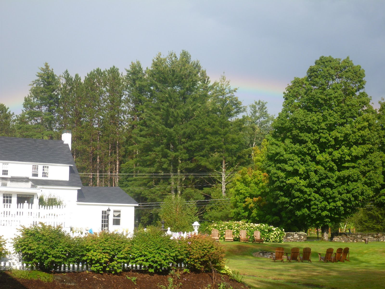
A rainbow in Franconia
While I was there Cara came and visited for a few days. This was going to be the last time I saw her until I finished the Trail, at least another 3 weeks. We had finally been getting used to being apart, at first it was hard for both of us, missing each other constantly. While we didn't like being apart, we were falling into a groove of being apart. It helped I had cell reception everyday and was able to call and chat in the evenings before bed.
While at the Inn it rained everyday, sometimes not much or for very long, but part of the day and sometimes for most of the day. The tops of the Whites obscured by clouds and lashed with rain. I picked a good week to take off. And by the ache in my foot continuing for 4 days unabated, my body needed it as well!
After the six days drew to a close I was prepared to finish the Trail. I made the executive decision to skip over the White's and come back and do them as several shorter section hikes. I have not regretted it. I would follow the same course of action had I to do it again. The section is rough, tough, and beautiful. The Trail steep and apparently in terrible disrepair in places, the AMC apparently only maintains Trails that lead from a road to their huts (the things that make them $100 a night). I heard an incredible amount of whining and complaining from thru-hikers in Maine about how terrible the AMC is and how bad the Trails were and on and on. I was dropped off in Gorham one morning and got to experience first-hand the roughness of the Trail.
The day was misty with threat of rain, as I climbed Mt Hayes. The AMC, apparently, hates the Appalachian Trail and refuses to put trail signs that have the AT mentioned. White blazes, those rectangles that lead us thru the wilderness are often neglected and the AMC only puts them once every 1/4 or more. I had heard that in a few sections in the Whites you would go for miles without actually knowing if you were on the AT. I'm not sure what they are trying to prove. But what I do know is that at the shelters they were able to have a care-taker, tent platforms, and an out-house with a newly printed sign explaining how expensive it was to helicopter mulch in for the composting privies. Strange that nowhere else on the Trail is this a problem...
That first day I was able to hike 12 miles, since I had started at 11 I felt that was good progress, especially in the mist and occasional rain. The campsite at Gentian was gorgeous, and would have been even more so had the views been clear. The next day started rainy and stayed miserable all day. I hiked with a hiker named MMRF that I had last seen in Southern Virginia close to Cinco de Mayo!

The day rained and then stopped and then rained even more and then more again. My shoes saturated, and I stopped dodging puddles. The terrain was tough too, up and down slippery rock faces and washed out trail. On the flat spots above tree-line were swamp meadows, the trail on boards many times and the boards would disappear into the moose muck, so that you had to feel along to where the board ended so as to not fall in and disappear into the quagmire. However, you could tell, like most of the Trail that at one time it had been nice, but people had stopped maintaining it. The boards sinking into the swamp, the old vestiges of stairs washing out and tumbling down the Trail. A lot of work would need to be done to this trail to get it nice again - had there been any maintenance over the years the level of work required would be much smaller. Everywhere else Trail clubs have little money, work on a purely volunteer basis and have much better treadway than the "rich" club of the AMC. Interesting and a bit sad. If they don't want to do a good job give the responsibility to an organization that cares - like the MATC (Maine Appalachian Trail Club). But more on that briefly!

I struggled across the NH/ME border that day, and was only able to make a total of 9.4 miles before the day ran out! Between the trail condition and the weather the going was very slow; I thought I was slow because of the week off but MMRF got no further and he hadn't taken the time off and was a stronger hiker too.
Despite the conditions I was happy to be hiking. I was happy to be making progress. I was in MAINE!! Even with jumping the Whites, I had come so far that my mind has trouble wrapping itself around that package!
The day after all that rain began clear and bright, which was heartening - and important. Today was the day that I would be going through the Mahoosuc Notch. When preparing to hike this Trail some people are kept up at nights worrying about this 1 mile section of Trail. I had heard stories of it taking people 4 or 5 hours to go this one mile. Nonplussed, I did the short climb from Full Goose Shelter over Fulling Mt and down into the Notch (of DOOOOOM). Right at the beginning I met up with Ranger (whom I had met in VA), Craisin (whom I had met in PA when hiking with my bro), Rebound (both Cara and I met him in PA), and Tex (never met the guy). I climbed through the rock scramble, up and under, over and through the boulders. I thought it was easy and fun, nothing too technical and nothing worse than I'd done before. It's like Old Rag but in a valley and a bit longer but nothing more challenging. I made it through, even with getting stuck behind a few slower climbers and losing the Trail in a stream, in right around an hour. My shoes were still saturated, so much so I had put fresh dry socks on that morning and they became immediately soaked. I stopped at the other end of the Notch to take off my shoes and eat a snack before beginning the ascent up Mahoosuc Arm (1600 feet in a mile and 1/2). The Trail condition going up the Arm was terrible, old washed out steps, barren rock with little hand holds, hiker-made trails around some of the worst of it making the whole thing look over-used. Up to Speck Pond the Trail continued to be bad, over slippery rocks and just under-maintained. I was beginning to think it may take me 2 months to get through Maine if the terrain stayed consistently like this, I was beginning to doubt my ability and was frustrated at the horribleness of the Trail. Then coming into Grafton Notch something magical happened. The Trail became NICE! The roots disappeared, the rocks rolled off the Trail, the incline kind, and switchbacks appeared. I made great time down to ME 26. And at the road crossing a couple handed me a beer, and some day hikers handout some fresh vegetables. Oh, yeah and this was where the MATC took over maintenance of the Trail. It was like a switch had been flipped. A line had been drawn, shit trail on the AMC-side, nice trail on MATC-side! How in the world is there such a big difference?!


The hike from the Notch to Baldplate was exquisite, even if I didn't beat the rain storm that got my shoes re-wet after the day of slightly drying.
I was getting low on food, and my feet needed a rest. The rain started giving me blisters and on the third day in wet shoes I became pained again. These weren't blisters I was getting, instead rashes all along the inside of my feet. I needed a night in a room to dry out these shoes, with a hair-dryer or something! I hiked the day with Tex, us with plans to get a shuttle into Andover and stay at the Pine Ellis Lodge. Though it was only 9 miles it was a painful 9 for me. Baldpate was a steep and rocky mountain, much of it above treeline, one part following carins up over a huge expanse of rock to the peak. I was glad the day was sunny and warm. Had the day been misty finding the Trail would have been difficult, in the wind and rain dangerous! We made good time over the balds and down to Dunn Notch where we called for a ride and got picked up and taken into town.

I got a private room and was glad to have my flip-flops on! There was a all you can eat pizza buffet at the Red Hen restaurant and the resupply, both at the Lodge and gas station was more than enough to supplement the essentials I had shipped to myself. I liked the place so much, and dreaded putting my shoes on just as much I decided to do a slack pack the next day for ten miles to see how my feet would fare. The sores on them weren't deep but they were raw. I was afraid my still damp shoes would make them worse if I hiked too far. I was dropped off at South Arm Rd and hiked south on the AT, passing Rebound, Craisin, and Ranger - I figured this would be the last I would see of these familiar faces as they were pulling ahead due to this slack I was doing. I had also heard about lots of hikers getting a virus that was causing vomiting and diarrhea and low energy levels. It was supposedly centered in Andover, though hopefully the worst was over. I met a hiker that was holed up in a shelter, and had other hikers tell me of their plights as well. I was hoping not to catch it and was taking precautions - the biggest one was not signing register logs, EVERYONE pages through those and seems the perfect medium for transmission.
Moose Tracks! (not the ice cream)
I had a greatly enjoyable hike that day. I had hardly anything in the pack and I had taken off the shoes immediately in the morning and was hiking in flip-flops! I figured I would hike until it got too rough, otherwise my feet were loving the air and I figured it would be good to heal them (if I could avoid injury!). I hiked the entire day sans shoes and my feet recovered and my shoes dried! I had no more foot issues the rest of the trip! I was loving Maine now, lovely forest, nice cool mornings, beautiful views, and my time was winding down. I would, literally, soon be able to see the end!
The day after the slack I felt incredibly energized and ended up doing 23 miles, some of that I blue blazed around Bemis Mountain down Clearwater Brook Trail. I wanted to see something other hikers didn't often see, I wanted a greater chance to see a moose, I just wanted to hike the Trail less traveled (per Robert Frost!) as almost always, the Appalachian Trail is the path most traveled. That night I made it beyond the top of the world, beyond Sabbath Day Pond and onto a nice little campsite on the edge of a pond. The pond had a few canoes and I took one out for a spin! What a great way of travel. If a river flowed next to the Trail I would have decided to paddle myself to the end. It was such a nice change. Now I want a kayak, and my next adventure will be on water!

Being camped where I was meant the next day I would be going over the Saddleback Range. Three miles above treeline and one of the last mountain ranges before reaching the end of the Trail. At a road crossing before heading up the mountain I found a coconut water, an onion, and a mango a Trail angel had left. I ate the mango and drank the coconut water immediately, the onion I used for the next week in everything, from tuna sandwiches to cooking it with dinner - I will carry an onion on every trip going forward!


I made it to Stratton and was going to get a ride in from the lady that ran the Inn that I was staying, but a couple ladies pulled over and let me climb in the back of their pickup truck on top of fire wood. At the Inn the guys I had been matching up with were there. Apparently Rebound had caught the virus and was very sick and had to take a day off. This place was nice, nice enough to stay two nights and do a slack? Why yes, yes it is! I got dropped off on the other side of the last biggest mountain range (beside Katahdin), I figured I was doing good on money and I was getting close to the end, why not enjoy these last few climbs without a heavy pack!


The Bigelow Mountain Range was gorgeous, the mountains tough and steep, but gorgeous and alpine. I made good time passing Tex going in the opposite way. The views were great and I even got cell reception from the top as I ate lunch. Another wonderful day of hiking provided by Maine! Instead of getting a ride back into town (for some reason I really don't like it) I decided to do a blue-blaze that continued down the tail end of the range and came out very close to town and within easy walking distance to the Inn. The path was soft with disuse and the views were great, a thunderstorm blew in as I was scampering across the last of the open rocks. The rain didn't last and I stayed dry, soon enough the sun came back out and made for an ethereal hike into the valley full of swirling mist lit by bright yellow sunshine.

Views not seen from the AT
I was dropped off the next morning in the same place, going north instead. Almost immediately I came to a sketchy bridge over a beaver pond that sunk and wet one of my feet. A few miles through easy trail over almost non-existent hills lead me to switching to the flip-flops, this time with a full pack. I wanted to be especially careful with the weight of a full pack. But the terrain was easy and nearly hill-less. At some point in the day I looked at my watch and figured out if I hiked really fast I could make it across the Kennebec River on the ferry. The last ferry across leaves at 4 and just the right amount of time to get there, maybe, if the terrain continued to be nice. I booked! I didn't have time to change back into my shoes so I went as fast as I could in the flip-flops, which turned out to be over 3.5 miles an hour and just enough time to get there! As I made it to shore another hiker had had the same idea, Dirty Girl got in the canoe as well. We both stayed at the Sterling Inn, and Hill-Billy Dave dropped us off there since we were the last hikers across and he was going home. The Inn was amazing! Great re-supply, free shuttle down to a restaurant, nice rooms, friendly proprietor. All around great place!
After Caratunk I had another benign hiking day. The weather was near perfect and the bugs non-existent. The mountains were easy and the terrain was kind. I loved hiking through this part of Maine. I was even rewarded with seeing a moose and then camping on the shores of Bald Mountain Pond where the loons howled their mournful song! That night some section hikers made Thanksgiving for the three of us and I shared a Jello No Bake Cheesecake for dessert (it was going to be my dinner).


From Moxie I hiked to Monson the next day and made it very early for lots of reunions! Hotshot, Tex, Rebound, Craisn, Ranger and a bunch of other familiar faces were there at the Lakeshore House Lodge. I was full of restless energy and wanted to bolt out the next day but decided to take a zero, knowing that despite my supposed energy, a day of rest before hitting the 100 mile wilderness push was a completely necessary action to take!

Part 7 - Conclusion 

Monday, January 7, 2013

Sleep System - UPDATE

As I was running around St.Mary's Lake I occupied my mind with a post on how my tent system evolved while I hiked the Appalachian Trail. I spent many nights inside a tent, from theory to practice I am able to to give a more judicious over-view of the gear that I slept in.

I would like to impart my experience with what I had, and the eventual evolution to a system I really really liked.

I began the hike with the MSR Hubbahubba.
The advantages to this tent were:
- Spacious
- I got it for $50 at an REI attic-sale
- For it's size, it's light
The disadvantages:
- I didn't have time to seam seal it before I began the hike
- You sleep on the ground
- At 4lbs, that's heavy - and I still should've carried a ground cloth of some kind
- It took up an enormous amount of pack space, almost basket ball size

I never got wet in the tent, but my buddy did. After that I dreaded that it would rain and I'd get soaked - I was just lucky that not very much rain fell between the end of the Smokies and when I hit Damascus and got a new tent.

Evolution:
The new tent I purchased, the Black Diamond UL was an upgrade, but ridiculously expensive at $300. Had anything else been available in town, any single-walled, use your hiking poles as tent poles tent, I would have gotten that instead. As it was, this was the only thing there, and I was desperate to lose some pounds from my back. As it turned out, it was a great investment that traveled all the way to Maine with me but that was a fluke.

The advantages:
- Light, less than a pound
- Water resistant, after I learned to always use the center pole and not use the loop on top to string it up (it stretches the fabric a bit and allows some water to wick through and drip) I stayed dry in the most violent deluges, even without a floor. But placement is paramount, if you set it up in a natural valley or a low spot you float.
- Spacious. When WoodTeeth visited, right after I got the tent, we were both able to comfortably sleep and keep all our gear in the tent without touching the sides. The manufacturer claims four are able to sleep in the space, but also that the ones on the outside should use bivy's as well since they will be touching the sides, so in actuality, it's a highly spacious 2 person tent.

The disadvantages:
- No floor, so a piece of Tyvek was needed. Bugs and other critters could enter, so a bug net was required once the weather began to really warm up.
- The foot print was larger than the tent squares in Shennandoah so I would stake down properly and a gaping hole was created and made me feel like bears, raccoon, or whatever could waltz through.
- Still sleeping on the ground


A visitor under my tarp
Re-evolution:
I grabbed my hammock from home when I came back for a short hiatus and tried that out for a week and I slept like a baby. My hammock didn't have a bug net so I was still carrying that addition. On my way back out to the Trail after that week trial period I grabbed the Byer's Amazon Hammock from REI. All my woes disappeared! I was able to use the decagonal shape of the tarp to use over the hammock. Two of the tie downs got tied to the rope that connected to the trees that held up the hammock, the other six tie-downs got staked down with a length of rope.
The advantages of this system:
- Light, 2 pounds for hammock and tarp tent
- Water resistant - always was I dry from both above and below in even the most horrendous continuous deluges
- protection from bugs
- large enough to hangout, cook dinner, change, stand, pack and unpack. Easy to sit in the hammock or take down the hammock and just hangout under the elevated tarp. As a bonus, in NY with Flip we sat for a couple hours under the tarp in a rainstorm and filled our water bottles from water flowing off the tarp.
-this setup had the capability to be able to setup the tarp first and take it down last, so even while raining the rest of my gear could stay dry under the tarp.
- I slept under it, as did my brother and his dog and we could've put some else under there too in a pinch
- not sleeping on the ground was, I think, the biggest psychological moral booster that I could have possibly had - as in the difference between continuing and quitting

Throughout this process I also tried out different ground pads, first inflatable, then foam, then nothing, then foam again. I finally settled for a 3/4 ThermaRest Z-Pad and was completely satisfied. It was hardy enough that I could throw it on the ground for comfort while cooking and it is pliable enough that it bends around the body in the hammock without sleeping around. I used a down bag in the spring and in the north, in the summer I used a light weight synthetic bag.

The options that I was afforded with a hammock were large too. In a tent you must have a perfectly flat spot or you roll or slide down hill. The problem being, however, perfectly level spots are where water naturally pools so if it rains you wake in a puddle. Or you setup on a slight slope for water drainage and you slide down hill, touch the side of the tent and... wake in a puddle. I was able to stealth camp anywhere that there were trees... which is nearly everywhere! My options expanded exponentially. And since I still had the tarp tent, had I ever felt the desire to camp on a bald or tent camp I had the ability to do so at any time... the urge just never struck and I was able to hammock the rest of the time without issue or worry.

A lot of this discussion has been in conjunction with rain and protection from rain. I should say that it did rain while I was hiking the Appalachian Trail, but not terribly often and not too terribly much when it did. The first half or more didn't rain much at all, maybe 3 or 4 days with precipitation in the first 500 miles and only 5 or 6 days until summer and the half way mark. So about 1 day a week average, and then the second half probably 2 or 3 days a week after raining once the entire state of Pennsylvania. And of those I was lucky enough to occasionally be indoors, either in a shelter or a hostel or a hotel. But, every time I set up my sleep system I always tried to prepare for rain. I would look above for dead limbs that could fall in a storm. I looked at the land to see if a stream might over flow it's banks or where a puddle may form. Being wet is trouble, big trouble. Having a saturated sleeping bag can be dangerous and could even kill you in the wrong circumstances. I tried to always be cognizant of my surroundings. Many times storms would blow over in the night, even though the sky looked clear the evening before. Having a good sleep system relieves much stress, being able to throw your tarp up and have a satisfying slumber without waking and worrying, without feeling around for dampness in the middle of the night.

In the heat of the summer a hammock has the advantage of having no insulation on the bottom. A slight breeze on a sticky night cools you, where you would feel nothing but cloying humid dampness trapped on the ground in a tent.

I'm a hammock convert. But I won't tell you you have to get one to be comfortable, because I know it's not true. What I say is to try it. Sleep on the ground for a few days and then sleep elevated for a few. When you get into camp at night, will you dread another night tossing and turning with rocks and roots and the soft thumping of hooves and feet waking you from your slumber? Or will you happily hop into your comfortable cocoon and sway gently in the breeze to a restful repose?

Tuesday, November 27, 2012

Where am I?

I haven't finished the last chapter. I know, bad blogger, bad!

But I've been very busy back in the swing of the real world (not the TV show).

I went to Charleston SC for a bachelor party and then work in Colleton, SC the following week.

I flew to Salt Lake City and got teased by mountains, but had long shifts and wasn't able to play in them. On the way back I dodged a hurricane by flying into Charlotte, NC and drove to get home, though we didn't have any damage.
The mountains were calling and I couldn't go...

We went to a wedding in Virginia and enjoyed some wineries on the way out there.

We clean up pretty good for hiker trash
Then Halloween came around.
I'm a Russian pirate. Kaya is a backpacker.

Cara's parents came down right after Halloween. We worked on the house for a bit, replacing windows, deck, door, and back-splash (and RING Shopping!) before flying out again to Florida for work. This time though I got the chance to kayak down the Weeki Wachee river and play with some manatees!


Soon after getting back from Florida, I flew to Atlanta for work for a day to meet a customer.

After that Thanksgiving was right around the corner. Kaya went north with Cara's parents and we went south to Nashville TN to see my parents. On our way back from TN I asked Cara to marry me at Lover's Leap Winery in Kentucky! I'm getting MARRIED in a year and a half!

I have been all over the country since I've been home from the Appalachian Trail. Lots of travel, some of it was actually fun too. But I've been super busy. After flying back from Augusta I've been to: South Carolina, Nevada, Florida, Georgia, North Carolina, Virginia, Tennessee. Up coming we are going to San Francisco in December and Florida in January... but there's plenty of weekends in between that I'm sure we'll get around to some other spots too! We really are Here, There, and Everywhere...

Wednesday, October 17, 2012

Chapter 5 - Arrival in New England, hiking like it's my Job

I hiked out of Bear Mountain, crossing the gorgeous Hudson, the world seeming to be twice a beautiful after the rain the previous day! The Trail follows a road for a couple miles before ascending up a hillside. This section didn't have good water, so as the Trail passed another road I was able to buy some water and get lunch, as well as continue the trend of having ice cream everyday that I had been in NY. There are so many deli's in NJ, NY, and CT that is an easily conceivable goal to have ice cream and soda daily - one day I thought I would only be able to have soda, I went down a state park and found they had an ice cream vending machine!

I was always trying to figure out why, in books and journals about the AT that these states always seemed to be skimmed over, people tales were vividly explained all the way up through PA and then got shy of information until New Hampshire really. I thought the hiking was enjoyable through this region, I was able to eat ice cream daily, and the hills and climbs were sometimes very steep, but always short. NJ had a few sections on board walks crossing over bogs, but that seems to be what hikers remember most about the state - like the rocks of PA, these board walks made up less than 1% of the Trail there.
NY was gorgeous to begin with, and different than anything I had seen, then the Trail lost it's allure and ascended and descended through forest that could have been in Virginia again!
I bypassed Graymoor Spiritual Center - it was early in the day and why would I want to sleep on concrete 1/2 mile off trail? Many hikers seemed to end up staying there with the friars. It was another one of those iconic places along the Trail, shrouded in mist and mystery that I didn't want to visit - some of those places had turned out disappointing! Instead I continued on, over Canopus Hill, a gorgeous tiny mountain with some good views into the surrounding farmland I was now traversing. The day was hot and humid the occasional threat of rain, but as evening neared the day cleared off and became nice.
At Dennytown Rd there is a spring fed water faucet coming directly out of a building, sweet cold water! I had been getting low and was too glad to fill up. I had plans to go 3 more miles to the road crossing I was to meet Flip at the following day, as I walked the 1/10 of a mile over a small freshly mowed field into the cool expanse of woods the forest opened up, the cathedral ceiling stretching above me. And there was a familiar camo tent set up just off the Trail. My good friend Animal was here, I had caught up to him yet again! I decided to camp in this most comfortable spot, the campsite up on a hill overlooking a dry stream bed and further the far view of the forest opening to a pond, the sound of frogs croaking echoing up to the soft flat spot under the trees where our camp lay. Water was close at hand, I had only 3 miles to go in the morning to meet Flip, and I had good company to hang out with this evening. Later more familiar faces showed up, Croc-hunter, Boots, and others also camped near by.

The next morning I made it to Flip at NY 301 - we put our packs on and after reunion and the happy dance we set off - his second AT adventure with me! Less than a mile later around Canopus Lake I insisted we hide our packs and do a side trail to Clarence Fahnestock SP - where we found an open snack bar... with ice cream! After the daily routines, we hiked north once more, catching up on happenings in our lives. Me telling stories of the Trail, he telling stories of the 'real' world, the world waiting to take me back into it's mean embrace the world of work and work and TV and work.
We hiked 10 miles and began looking for a place to stay, we stopped only briefly at RPH shelter, which is more like a hostel that's missing a wall! The water from the hand pump there was red with high iron (rust) content, but tasted just fine. We filled our bottles and headed on up a mountain that had houses on one side and us on the other. I hadn't counted on such a small AT right of way and was concerned we wouldn't find a place to camp and have to continue much further. Fortunately at the far end of the mountain a shoulder opened up and we found a rarely used campsite, though it had been used. There was someone shooting close by, probably a mile or so, in short blasts, anything from 4 shots to 11, obviously from a semi-automatic, and the time between loads was very quick, this continued on for a few hours, we had thoughts of some hill-jack accosting us" 'cause we was on his property".
We set up our hammocks (Flip decided to try the same setup as me) close by, sharing one tree and going off in a 'V'. He used a regular square tarp as the tarp over the hammock. I liked my setup a bit better for head room, but his was a much cheaper and just as effective method to cover the hammock. His setup cost less than $100 and was as light or lighter than a Hennessy Hammock! Not too shabby.
As Flip began gathering firewood I watched as he sawed a piece of wood with his collapsible camp saw (something I would never carry, but the boy loves his fires!!) and as it broke yelped and jumped. I thought he had got himself with the saw, but no, he had stepped in a yellow-jacket nest! Right by the campfire ring too. Damn! Fortunately they weren't as aggressive as some I have seen. They didn't chase us and as long as we stayed on our side of the fire and they on theirs and uneasy truce between our species was had.
Flip, as you may remember, is a gourmet camp cook. And he didn't fail this time either! Bringing back a favorite I asked him and we had backpackers pizza again! Easy, cheesy, and no clean-up, everything I'm looking for in a dinner!
The next morning we woke to rain. Not just a little rain but torrential down-pour rain. Flip dove out of his hammock and sat with me under mine. I took down the hammock and we had lots of room to stretch out and stay dry under the Big Top. We had planned on getting down off this mountain first thing for water, but we decided to wait out the rain. I put my Nalgen under the side of the tarp where the most amount of water seemed to be pouring off - I re-filled all our bottles in no time, fresh clean rain water.
As soon as the rain let up we tore down camp and headed out, the day staying gray and humid, we crossed over pleasant rolling hills, not straining us much. We had no firm plan on how far we were going to hike, just until we were tired! We ended up going 18 miles - not bad for Flip without Trail legs.


Oldest Tree on the Trail
Fortunately, as our water situation got desperate again, a Trail Angel lives 100 yards down the road for the above oak. She provides a hose run out to her fence, where hikers can refill. Thank goodness for the wonderful kindness of people through this area. NY has terrible water, black puddles, and stream running out of shallow beaver ponds.

Are we back in Virginia?! I can't tell

We continued on into the gray evening, passing the much vaulted Appalachian Trail Railroad Station, the only such thing on the Trail. As the next train wasn't scheduled for 4 days in the future we continued on! At NY 22 a garden center allows hikers to setup their tents in the backyard, get a shower, and have access to water. Occasionally a guy sells pizza right by the road as well. We decided to head up the Trail a bit further and find a good place to hang. The Trail passed thru some fields before beginning to ascend Hammersly Ridge - beforehand I had imagined the woods opening up and finding a good camping spot. Instead the woods looked like Shenandoah all over, a jungle-like oppressiveness drove us on and up, Flip was exhausted after the long day and was ready to be in camp, but there were no good spots! Finally as the evening grew dim the woods opened up a bit and we decided that open woods was what we needed, not flat open woods! We setup right off the Trail and Flip cooked directly on the Trail as that was the only flat spot around. We sat and ate dinner in the middle of the Trail by headlamp as it was getting so dark! One of our finer moments, as far as I'm concerned - when presented with difficulty we overcame and still had a really tasty dinner!
The next gorgeous day we made great time, through the Nature Reserve we had been on the edge of and down to the NY/CT border! Another state done!
Thru the hot day we marched, up several very steep inclines. Sonic passed us, and that was the last I saw of him (tho he finished after me). We continued on with the thought of finishing either near Kent, or, if we moved fast enough at Kent - then I could get a zero and we could go watch Batman! Woohoo! The day was very hot, and soon enough, as with these hot days, thunder rolled from far out west. The heat was really getting to Flip. Athletically he is much more inclined than I. He runs all the time, kayaks, rock climbs, and it comes easy to him. I didn't really give a thought to me having been on the Trail in the heat and becoming acclimated to it better than he. Climbing these steep hills in this heat, I was able to keep pace and not over-heat much if at all. Flip was struggling, he was drinking more than I was and having to stop. Hiking every day for 3 months really does do wonders for your body!
Over the final hill and we descended to CT341 and the 9/10 into town. At the bottom a guy offered us a Hard Lemonade and a ride into town - YES! Very nice. I never hitched on this trip, but I did get rides! As we drove into town, the sky opened up, so we dodged that too. Good end for Flip. He went and got his car and we drove down to Danbury.
NOTE: Kent is not a good Trail town. They claim there is an Outfitters there, however they sell over-priced ice-cream, art, and designer clothing. There is one back closet that had barren shelves and nothing a backpacker would want. Do not make this a planned stop for items you might need like fuel, Aquamira, new boots, socks or food. When asked if they had Aquamira they said they were currently out (later I found they had been out all year). When asked where I might get some the guy said in Danbury there's a Walmart and a Dick's Sporting Goods (neither of which ever carry water purification). He FAILED to mention that in the same mall as the Dick's there is an EMS AND and LLBean!!! dude, thanks for looking out. Also of note the cheapest place to stay in Kent is over $200 a night. We drove an hour south to stay in a decently priced hotel.
After a nice zero in Danbury, filled with movies, buffets and laziness, Flip dropped me back off and headed home. Back into the wilds by myself. Parting and going at it alone was always tough. It was hard, sometimes, to accept I was being dropped off by the side of a road by myself in an unfamiliar state with just what I had on my back.
CT is a short state, and I think it might be a fun state to aqua-blaze south-bound. The Trail follows the Housatonic River, then goes up and over a small mountain or two before coming back down and following the river for miles and miles again. The bugs were terrible, there is on type of gnat that continually flies in ones ears, the only way to stay sane was to put a bandanna over my ears. The gnats then moved to fly under my chin, if I looked down there they were.

The bugs drove me nuts!
CT was the only state that I wore the bug net my parents had given me. I was rarely eaten by mosquitoes, and the deer flies only rarely buzzed me. It was the none biting gnats that were there to fly in my ears and my eyes and to just hang out and taste the air around me that drove me mad! I hated them, they made me want to go home. Interesting that something so small could illicit such hate and annoyance from me, but they did!
That night I had been told that there were enormous storms in the area so I pulled a bit short and stayed by a shelter, in case things got too real I could hide there. Terrible thunder in the far distance, the wind began whipping, I thought a bad storm was approaching. But then a light rain fell and the wind died down and the thunder stopped. Apparently in NY that night there were tornado watches and Cara was very worried about me!
The state continued to threaten rain, but so far I had been in the tent and dry. I hiked along the river again into Falls Village, the trees in the forest huge along the crushed gravel path leading into the town. Thru more fields of wild-flowers and skirting pastureland the Trail drew closer to MA, though I could still be in Virginia. At some point during the long day I decided to press on and get out of CT! I ended up doing 23 miles and camping just over the border in Sages Ravine. The climb to the highest point in CT was steep but not too long, the end of the day clearing up and becoming nice.
Highest point in CT is a pile of rocks... go figure
Sages Ravine felt more like New England, seconds into another state and everything changed. The Trail followed a gorgeous little creek that was filled with clean clear water, the pines and birch cradled the ravine in soft beauty.
The following day started misty and began raining in earnest once I ascended a few high hills. In one valley a group of day hikers stood waiting out the rain, I waved and continued. I'm going to get wet either way I might as well walk! I took my time on the wet rocks, especially as the Trail descended off the ridgeline down to a long valley walk and one last crossing of the Housatonic. The rain continued and as I got to the road crossing to go into Great Barrington I decided a dry room would be just dandy! So I hiked the three mile road walk into town. At the Days Inn, normally a cheap crappy hotel, I found the "last room" in town. A hikers room with no furniture but for a bed, for the lowlow price of $250 a night. Damn they got me. Other than that, the town was nice, and the food cheap and good. At this point, after the long road walk my right foot hurt so bad. After removing my pack and showering I limped down the street. This worried me at bit.


MA was gorgeous! Finally the trees began changing and staying changed! The purple lupins in the fields, the pine, and birch, taking over. I could finally say I was out of the south! I made good time out of Great Barrington and made it to just beyond I-90, and to a motel that had a drop box for me. The place was so nice, right on a lake, good accommodations - and $55. Right before this I hiked with Passionflower a blogger I had been following leading up to and during the hike. It was almost like meeting a celebrity! We chatted for a few miles, before she decided to go to Upper Goose Pond, and I decided to continue on to the Berkshire Lakeside Inn.
I did a 23 mile day out of the Inn. The paradox of MA for me was I loved it and I didn't want it to end, but it was just so nice I couldn't help but do a 29 mile day followed by a 23 mile day followed by a 20 mile day!
I remember passing through the towns of MA, Chesire and North Adams, but I didn't stop in them. In one side, down a street, out the other side. Many people have memories of the Birdcage or Tom Levardi's, both were hostels, and both I didn't want to stay at, plus I was making such great time! If I continued on I'd make my goal of VT by August 1st!
Mt Greylock was much easier a climb than I thought it would be, a steep section followed by a long flat section before ascending again to the highest point in MA. At 3491 it was the highest the Trail had been since VA! At the top the forest changed to gorgeous hemlock forest. There, upon the top, lay a lodge that sold, you guessed it, ice cream!
Look closely for the 2 hang-gliders in the back ground!

I camped at the Sherman Brook Campsite just shy of the VT border on July 31. On August 1st I hiked into Vermont and then walked into town to Bennington VT. The hotel there said they would pick me up at the Trail, but there was no signal so I walked 4 miles. They did drop me back off the next morning though.
The mountains began getting bigger again, the climbs longer. VT eases hikers back into it as there was nothing too strenuous, just long, and rather boring. There weren't many views and trying to remember back I can't remember specifics of this area too well. My foot was hurting badly in the morning and evenings, my energy level dropped and I dragged myself over Stratton Mt on a gloomy day. There are very long stretches on the map and in my mind that nothing of note happened. I could feel the big days from MA catching up to me, more in tune with my body I knew I needed a day of rest. I could keep pushing for a week until I saw Cara, or more intelligently, I could take a day off. I got a room close to the Trail head at Bromley Sun Lodge one sunny afternoon... that quickly turned into a thunderstorm once I was inside!


The Lodge picked me up at the Trailhead and offered a ride back after the day off, however on my day off I had visited the adjacent ski area and noticed a lift running up the mountain. I inquired and they said I could purchase a one way ticket to the top the next day - I'll take it! The following day I packed up and checked out and found only the lift running halfway up the mountain was running - because of my inconvenience I got that ride for free. I floated on the lift, thinking about all the steps I wasn't taking! Even with half the mountain done, it was still a long climb.

Moose POO!!
I was hiking around a road walk section that had been washed out by Hurricane Irene in 2011. I turned on my phone and got a text message from my brother - he knew I was in VT, he was heading to ME for vacation and would be passing through VT in a few hours. Would I want to meet up, stay in a hotel for the night, eat at restaurants? Well, duh?! I let him know where I was going to be, on Upper Cold River Rd. I made dinner, sat and read and just a bit after dark they found me on the back roads of VT. My right foot hurting worse than ever, hobbling to see him is an appropriate explanation of how I was walking.
After a night in the hotel in Rutland with Kevin and Jen I had a decision to make: get dropped off on the Trail, hike 3 more days to get to Hanover and have Cara come and pick me up (hopefully my foot would allow this) or have Kevin drop me off at Lovett's Inn in Franconia and wait for Cara there and let my foot hopefully heal so I could enjoy hiking again!
I decided to flip a coin and go with whatever the chances told me!


PART 6