Let's be clear. Packs are for carrying stuff. The things in your pack should make you feel happy, safe, secure, and full. Each hiker must choose their comfort level. This is my take on when and why you should take a certain pack... and why I have so many packs!!
The Daypack
This pack type will consistently get more use than all other packs. You'll use it to go on the day hike, to go to the beach, to go traveling overseas or to festivals. Basically a man-purse (but for women too), but much more... manly (or womanly)!
If you pack correctly, the day pack can be used for a weekend overnighter too. Super UL and you'll have room to spare in your gunny.
The size comfort and cost of a day pack is really negligible. I wouldn't stress about this at all. I have one that was ~$90 with padded straps, bladder pouch, cinches, waste and chest snaps. And I have one that packs down to a small size with no frills at ~$25. Both work exactly the same - fits on the back to carry a snack.
Shoe pairing: Lightweight tennis shoes, flip flops, dress shoes, bare-feet!
The Weekender
The weekender might surprise you. I'd go for anywhere from 10 to 40 lbs. So a day pack could work if you're going for speed and distance, a 45-60 L pack to test out gear, or for winter camping, or bringing that 6 pack of beer or bladder of wine, and packing in your kids or girl-friends gear just to be chivalrous.
Miles are low, and sore shoulders expected, so I see no reason not to bring some trial gear, chairs, whatever. Just realize, it'll be painful!
Shoe pairing: Trail Runners for sub 35 lb loads, boots with ankle support for packs of greater weight.
The Thru-hiker
I would go with a ~20 lb pack or less if you can. If you are carrying gear day after day for weeks or months your body can't handle extra weight, you have a higher chance of injury for every pound extra, you have a higher probability of quitting. Besides rain gear and first-aid, if you're not using something everyday or every couple days, get rid of it or bounce box it ahead. A 24 - 30 L pack is all that should be needed. On the AT, and I would hazard any Long Distance Trail in the east, you can easily resupply every 5 days or less. If it's easy to re-supply in less than 5 days, carry less food. The store is a better place for food than on your back!
This is a comfort balance. You could send home the stove and go cold. You could send home the sleeping bag and just use a sheet. You could send home the tent and hope there is always shelter space. And if you do all those things you'll have a really light pack, and it might be enough for you. Or you could be prepared for many different situations, like the desire for a warm meal or coffee, or a desire to be warm on a cold night or have a roof over your head when miles away from a lean-to. You can still have a really light pack and have all those comforts.
Shoe pairing: Trail runners
The Expedition
Ya know those behemoth packs that every outfitter in the world has dozens more of than anything else? The 65-75+L packs? The ones that 97% of outdoor enthusiasts don't need. But they can charge the most for them, and people seem to love to buy them. Outdoor stores are doing a disservice to people by selling and promoting those packs for non-specific purposes. Take a person that never has backpacked. They walk into REI and the sales guy sells him a Baltoro and enough gear to fill it, so upwards of 50 lbs and $2000, this person puts this enormous load on, back creaking before ever stepping foot on the path. But, "hey, this is what backpacking is supposed to be, this is how it always looks on TV" and they groan and get blisters and are forced to wear huge heavy expensive ankle supporting boots. The get blisters, they get back pain, they put that gear in the attic and forget about it. That's not a good business model. You get someone a right sized pack, so they can enjoy those views they climbed so high to see, you get someone lightweight gear, and there's a much better chance they'll come back again and again for more stuff.
When will this pack come in handy? When you are going to Alaska or Canada and have no resupply points for 2 weeks. I see no other use for actual backpacking with a pack this large. Maybe to put rock climbing gear in, ropes and such the capacity would come in handy. Other than that, it's a scam.
Shoe pairing: Boots with ankle support
Showing posts with label backpacking. Show all posts
Showing posts with label backpacking. Show all posts
Tuesday, May 13, 2014


Wednesday, June 19, 2013
New Hampshire: Harsh, Beautiful, and Wild
This last trip I took the following week off to hike while Songbird had to, unfortunately, come home to go back to work. Flip also took the week off and came up to hike with me. Songbird, departed, and Flip arrived late the following day. We woke to a rainy Tuesday morning; undeterred and set on backpacking, we packed our things donned our rain gear and got a ride from Songbird's dad, Jim, to the trailhead. We were dropped off at the beginning of the Ammonoosuc Ravine Trail, a mile from the Cog Railroad at the base of Mount Washington. The rain had stopped, but the sky was steely grey and we knew this was only a break in the storm, not a passing of the storm. We were hopeful, though as the following days forecast sounded better.
We followed a soft rolling trail for the first couple miles, along a river and over wet roots and rocks. The forest smell of damp and leaf decay both pleasant and familiar. The trees dropped their wet tears down our backs as we hiked full of care-free joy towards the base of the mountain. The streams and rivers did not seem overly swollen from the last day and a half of rain, I wasn't sure if we had any water crossings, but was thankful all the same that they weren't in flood stage! The trail traced close to the banks of the river at some points.


Up we climbed and clambered. The trail crossing steep slick rocks, the trees becoming stunted and gnarled. We were in the rain clouds now. The wind picked up and started to swirl, sometimes those raindrops sounded a bit... heavy, more like ice than water. The clouds blew back and snow fields were visible as the trees finally gave up.


We put back on our packs and braced ourselves for another onslaught. We were surprised and hesitantly elated that the rain had died down. We headed south on the Appalachian Trail towards Nauman Campsite ~4 miles distant. The wind blew fiercely and then calmed. The clouds seemed to be thinning, only over us though. Suddenly: SUN! BLUESKY! What a treat. We were able to walk on this ridge top, this spine-of-the-world, with a circle of clouds obscuring the far views, but allowing us some sun light and some views of the mountains we trod upon. We even captured a glimpse of the Washington Hotel surrounded by its golf course down in the valley below.


We started descending into the woods again, back into the damp. Was it raining again or was that just dripping from the trees? Maybe a bit of both. On our descent we spotted a lynx flash across the trail and then we peered at each other before she gracefully disappeared into the thick sub-alpine woods. We arrived at the next Hut and the hostess ignored us as we walked in, continuing to cut up pieces of paper with her Swiss Army knife. There must not have been any room or other reservations coming in that evening so the pleasantries could be dispensed with. I enquired if this is where we checked in for the adjacent campsite. No, there is a specific campsite host in a tent. We walked over to the campsite and spoke with Dillon, the campsite host. He said he'd never stayed in a Hut, but they were real nice, they even let him come over the night before and hangout since they only had two guests. So the AMC hires a completely different host that must sleep in a tent, literally 50 feet from the Hut. That makes such little sense that I am boggled. We asked if it might be alright if we went up there to prepare our dinner out of the rain instead of inside our tent. He had no idea, he didn't really talk to them, but it might be worth asking. They did have a lot of guests though. Rather than being looked down upon like the homeless tent campers begging for scraps we prepared our meal at the tent.
The next day dawned not bright but rainy. It had began raining in earnest over night and continued unrelenting as we broke camp as quickly as possible, trying to keep as much of our gear as dry as possible. We hiked out into the rainy morning with hopes it would stop any second now. The forecast said, "Chance of Showers" this day and "Chance of Showers" for the following 2 days. There was no chance, it rained continuously. At times it slowed, but then picked up. The bogs seemed to mirror our wet mood.


Crossing over Webster Cliffs and bookended mountains we were blown about. As we descended Webster we got quiet. Thirty minutes of inner thoughts, just struggling not to fall down the rain-soaked rocks and slabs we both said what we were thinking, "Why are we doing this?". We are seeing no views, we are not enjoying any of this, we are endangering our bodies unnecessarily. We both knew if we continued on to the next Hut and began setting up a wet saturated tent and peeling off wet socks and shaking out wet rain coats, that we would not be able to resist the Sirens call. We would pay the $125, or $500 if they asked it of us, to stay in the Hut. The forecast for the following day was the same as this day, so would we wake to more pattering rain? Another all day slog through puddles and down wet rocks.

We each fell on several occasions. I wasn't hiking the AT anymore. I wasn't doing this to prove something. I was doing this for enjoyment. And my saturation level surpassed my enjoyment! We decided we would go back to Lovetts Inn, we would dry off and we would day hike the following day, rain or shine. Having a dry place to go to makes all the difference in the world. When I hiked the AT and there were days like that, I often found a way to be in a dry room. A wet miserable day drove me to Great Barrington to pay $250 for a bad room.
We finished our tumbles down Webster Cliffs (there might be nice views, but I can't tell you that for a fact!) and came to Crawford Notch. I had no cell service, which I knew was going to happen from previous research in the area. It had been raining too hard up top to get the phone out or take the pack off. I knew there was a shuttle service, and hoped there would be one coming soon. Otherwise a 4 mile walk up the road to the Highlands Lodge was in store for us. But I was completely prepared for that, It's happened before! The shuttle schedule had a shuttle visiting this spot twice daily. One of those times in 30 minutes! How fortunate. Of course, in typical AMC fashion, those four miles was going to cost us $10 each! But we paid. And we got to the Taj of Huts. More like one of the resort areas in the Shenandoah. Outside people played bocce ball in the rain, knowing a warm shower was only a few feet away. We used the 4G service to call Jim and he drove the 20 minutes over to pick the up the drowned hikers.
That night we celebrated! Alive and warm! A semi-successful hike. Under the circumstance we made the right call. The Whites will wait. The day will come that they will be enjoyed, not slogged through.
The following day we decided to hike the crown jewel of the White Mountains: Mount Lafayette and Franconia Ridge. The day began sunny and nearly cloud-free. What?! Same exact forecast as the preceding day. If I've learned anything it is to completely ignore the forecast for this region of the world, because it's wrong. This valley might have a totally different weather than that one. We packed up our gear and drove over to the bottom of the Old Carriage Trail, we made the steep climb up Lafayette, rock scrambling up steps and rock faces. Our light day packs enabling us to bound up the mountain, light on our feet and energetic. Views became apparent behind us and we could see for miles. What a difference a day makes. Clouds rolled in but stayed far aloft, leaving our views unscathed. In a short amount of time we came upon Greenleaf Hut. A very nicely situated hut nestled on the shoulder below the treeline of Lafayette by a mountain tarn.

We ate lunch here and let our sweaty backs dry before gaining more elevation and a lower temperature. The last mile was a few thousand steps, above treeline, the views are amazing, the hard granite wall rising above to envelope the sky in front. We reached the summit and had panoramic views all around us. A valley that looks untouched by the influence of man, the road in the Notch a thread hardly visible. Franconia Ridge looked like a shark fin breaching the waters of a green ocean, our path evident down the ridgeline. This bit of trail is on many of the best hikes lists, and again and again showcased in Backpacker Magazine. I agree with this. This was an amazing hike. Views draw your eyes up and outward from yourself. Consciousness expands with the views. There are other places like this on the AT, but the others aren't so accessible. Saddleback Range in Maine is as good, if not better. Katahdin is similar as well as Avery Peak also in Maine. Big Hump and Little Hump in Tennessee is incredible, but in a different way.


We traversed the Ridge and began down the Falling Waters Trail. Uneventful and easy descent over rocks and down stairs lead to an unexpected series of waterfalls. Of course, with a name like "Falling Waters" I assumed there would be waterfalls, but I wasn't expecting as nice or spectacular of falls. We crossed and recrossed the river multiple times, avoiding wet feet - barely! A very spectacular ending to an awesome 7 mile hike. After the falls the trail leveled out and we quickly made our way back to the car.


Songbird called and told me she had to hide from a tornado while at work. She came home to the majority of the big old maple in the backyard no longer standing. The house was not damaged fortunately, but the trees were a mess. I made the call that I needed to come home and clean this mess up before heading back to work, so we had to leave a day early from the New Hampshire adventure. We've a score to settle NH, I'm GOING to enjoy every bit of trails you've got to offer!!
 |
| Kaya is impressed, as am I!! |


Tuesday, April 2, 2013
Light weight backpacking
I'm not sure when it happened. I'm sure over the course of last years Appalachian Trail thru hike I certainly enjoyed a light pack. I remember hiking from Tinker Cliffs to Daleville with 1/2 a days food, with a wonderfully empty my pack!
Since getting back I've only been backpacking once - a fact which I plan on remedying - and on that trip to Massanutten I took the top flap off the Osprey Talon 44 and still had room.
Over the course of the last few months I've made a few low cost purchases to reduce weight. I refuse to pay $100's per ounce to lighten my pack by grams. I refuse to count grams. I don't have that kind of disposable income for one thing, and even if I did I would rather buy plane tickets with that money! That being said, you can later call me a gram weanie for the few ounces I am saving!
I replaced my carabiners for a lighter pair. The other ones that came with my old hammock are heavy. They clunked and weighed the whole setup down. I don't have a postal scale, but I probably saved 8 oz or something to the new climbing 'beaners I purchased. I used part of a gift card I got for Christmas so the net cost of this purchase was $0!
Next I purchased a Therm-a-Rest Alpine Down Blanket. It's basically a down blanket with a foot box completely eliminating the zipper, bottom of the 'sleeping bag'. My winter bag (the Grouse Mountain) doesn't have stuffing on the bottom to eliminate weight, this goes a step further and totally eliminate the zipper, hood, bottom of the bag. It is rated for 35 degrees but the reviews say more like 45 degree. I figure since drafts can happen and you aren't building the encapsulated layer of body heat it is more a spring/summer/fall bag. But it is only just over a pound - a full TWO pounds lighter, and much less bulkier than the Grouse Mountain. I used the remaining gift card and my dividends and bought the Alpine Down Blanket for $40 with an in-store pickup so I incur no shipping charges. Not a bad cost to reduce my bag by 2 pounds!
I weighed my gear as I was packing for this upcoming weekend hiking in southern Massanutten and my base weight is 11 pounds 12 ounces. Add 2 liters of water and a couple days of food and it'll still be under 20 lbs. That's impressive. And I don't feel like I am doing with out. I don't feel like I'm skimping or cutting corners. I have all the essentials, plus a pillow, first aid, camera, extra battery. I don't know when exactly it happened but I'm bordering on UL.
For the trip coming up I could plan on going without a stove as well, try out the "cold" method. I would leave home the aluminum cup, MSR Pocket Rocket, fuel, and cooking utensil. This would save another pound and a half or two. I plan on having a campfire, over which I could easily roast some summer sausage. My biggest regret with this would not be having coffee in the morning or Sleepy Time Tea in the evening. For a weekend of roughing it I suppose I could forgo these small pleasures, but on any kind of thru the pleasure of something warm out-weighs (pun intended!) the extra weight.

 |
| That pack looks small, but that's the 58L, I soon got a 44L and still had room in it. |
Over the course of the last few months I've made a few low cost purchases to reduce weight. I refuse to pay $100's per ounce to lighten my pack by grams. I refuse to count grams. I don't have that kind of disposable income for one thing, and even if I did I would rather buy plane tickets with that money! That being said, you can later call me a gram weanie for the few ounces I am saving!
 |
| Black Diamond tarp shelter prior to hammock hanging. After it looks similar, but for the hammock under it! |
I replaced my carabiners for a lighter pair. The other ones that came with my old hammock are heavy. They clunked and weighed the whole setup down. I don't have a postal scale, but I probably saved 8 oz or something to the new climbing 'beaners I purchased. I used part of a gift card I got for Christmas so the net cost of this purchase was $0!
 |
| My hair weighed too much and wasn't dual use so I cut it off |
 |
| Going through the 'Lemon Squeezer' with my pack on - a testament to how small it got! |
I weighed my gear as I was packing for this upcoming weekend hiking in southern Massanutten and my base weight is 11 pounds 12 ounces. Add 2 liters of water and a couple days of food and it'll still be under 20 lbs. That's impressive. And I don't feel like I am doing with out. I don't feel like I'm skimping or cutting corners. I have all the essentials, plus a pillow, first aid, camera, extra battery. I don't know when exactly it happened but I'm bordering on UL.
 |
| Descending Big K with day packs, not carrying all that jazz up a hill and back down! |


Friday, March 15, 2013
Introduction to Backpacking
I have this friend, we'll cal him Tortuga, that doesn't have any experience backpacking but he wants to.


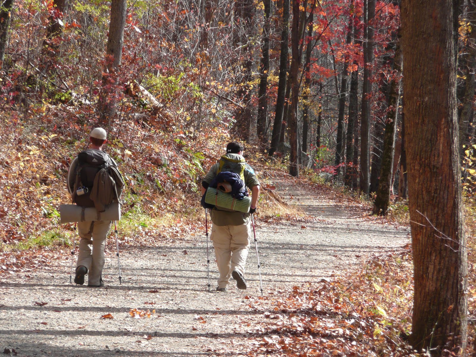
A couple Novembers ago (time flies) Flip and I took Tortuga along with another friend on his first backpacking adventure. We had him hike over Old Rag in full pack. Granted his pack was less than 20 lbs, but ascending and descending several thousand feet with rock scrambles and some non-technical climbing along with necessary collaborative effort stuff, really was a good test for him. He did good. We camped on the far side of Old Rag by one of the cut-off trails off the fire road.
He's hiked some more in the interim, but has not backpacked. After asking and really showing he has an interest in this sport we've finally got together and set aside time to go back out in the woods. Flip and I have not invited him on a couple trips that he and I have gone on since Tortuga doesn't have the gear or the experience to do some of the hikes Flip and I enjoy. Flip and I are also sometimes masochistic and didn't really want to have to worry about someone else's happiness when we are out hiking to punish ourselves with glee!
Flip came up with a plan while he and I were backpacking in Massanutten a few weeks ago, we would test T's resolve and get him to a level that he will enjoy trips (or not), plan them himself with or without us. He is interested in buying a new backpack, as well as some other gear, he is interested in sleeping in his own pitched tent, and cooking his own food. We want him also to be able to read a map, make a fire, and be self-reliant. Flip and I both have a high regard for the others skills and experience and know each is capable alone, but stronger together in a survival situation. We want T to not be a liability, to not need us.
I will be there at REI to kind of coach him through the process, not to tell him what to buy but to tell him what a waste of money many of the items are. I'll be the Jimmine Cricket hopefully, and from all the money I've wasted on useless gear guide him to some smart choices. His desires will differ from mine, and I will try to keep that in mind. His mindset is the weekend hike. My mindset is the Long Distance Hike - and while a light pack can be appreciated by anyone, there is definitely a balance to be struck. Hiking the Appalachian Trail is prevalent in all my thoughts about gear, I ponder the ounces that I'd like NOT to be carrying!
We are probably going back to Massanutten, and I am really looking forward to seeing some first signs of spring, hopefully they will be stirring there, at least in the valleys. Spring is here in SoMd, the first Peeppers (frogs) began singing on March 10th (in my mind that is the first day of spring), the birds are going crazy, the daffodils have sprung up through the soil, and the buds on the trees are giving the trees a reddish hue. To feel this connection to the natural world has always been so magical to me. I can feel the life-force growing and feel it's anticipation and joy that's about to burst forth across the world.

Ok, I'm definitely swerving off into the weeds that will soon be growing. Stay on topic, Johnny Walker.
Massanutten! Flip, Tortuga, and I will meet and park our cars in two different locations so we can do a straight through hike. We've not decided the route yet, but ideally something with views, good water sources, and possibly some different route options. Prior to going Flip and I want to provide T with a room of gear (besides what he buys) and let him decide what he should or shouldn't carry, this way he'll go over the lists in his mind and either carry too much and regret it on that first ascent or get into camp and realize he forgot an important item. Flip and I will be on the hike with him so he'll not be in any danger, but still will suffer the realization that not having X item is a bad thing - OR it's not actually a bad thing and is something that you just improvise to get around.
Once there I want to go over the route with him on the map, hand off the map to him and let him be our guide. He will have to be aware of his surroundings, and keep distance, side trails, time, and daylight in mind. Once in camp he can start a fire and cook his own food as well. Cooking can be collaborative, as in each of us make one item for a potluck, but the actual cooking will be left to each of us.
 I think he'll be better for it. He didn't have the advantage of growing up doing this. Or being in Boy Scouts. Or having parents willing to go on wilderness canoe trips for 2 weeks at a time. To feel comfortable in the woods, you've got to go through the steps. You've got to be able to take care of yourself.
This should be a fun trip to report on!


A couple Novembers ago (time flies) Flip and I took Tortuga along with another friend on his first backpacking adventure. We had him hike over Old Rag in full pack. Granted his pack was less than 20 lbs, but ascending and descending several thousand feet with rock scrambles and some non-technical climbing along with necessary collaborative effort stuff, really was a good test for him. He did good. We camped on the far side of Old Rag by one of the cut-off trails off the fire road.
He's hiked some more in the interim, but has not backpacked. After asking and really showing he has an interest in this sport we've finally got together and set aside time to go back out in the woods. Flip and I have not invited him on a couple trips that he and I have gone on since Tortuga doesn't have the gear or the experience to do some of the hikes Flip and I enjoy. Flip and I are also sometimes masochistic and didn't really want to have to worry about someone else's happiness when we are out hiking to punish ourselves with glee!
Flip came up with a plan while he and I were backpacking in Massanutten a few weeks ago, we would test T's resolve and get him to a level that he will enjoy trips (or not), plan them himself with or without us. He is interested in buying a new backpack, as well as some other gear, he is interested in sleeping in his own pitched tent, and cooking his own food. We want him also to be able to read a map, make a fire, and be self-reliant. Flip and I both have a high regard for the others skills and experience and know each is capable alone, but stronger together in a survival situation. We want T to not be a liability, to not need us.
I will be there at REI to kind of coach him through the process, not to tell him what to buy but to tell him what a waste of money many of the items are. I'll be the Jimmine Cricket hopefully, and from all the money I've wasted on useless gear guide him to some smart choices. His desires will differ from mine, and I will try to keep that in mind. His mindset is the weekend hike. My mindset is the Long Distance Hike - and while a light pack can be appreciated by anyone, there is definitely a balance to be struck. Hiking the Appalachian Trail is prevalent in all my thoughts about gear, I ponder the ounces that I'd like NOT to be carrying!
We are probably going back to Massanutten, and I am really looking forward to seeing some first signs of spring, hopefully they will be stirring there, at least in the valleys. Spring is here in SoMd, the first Peeppers (frogs) began singing on March 10th (in my mind that is the first day of spring), the birds are going crazy, the daffodils have sprung up through the soil, and the buds on the trees are giving the trees a reddish hue. To feel this connection to the natural world has always been so magical to me. I can feel the life-force growing and feel it's anticipation and joy that's about to burst forth across the world.

Ok, I'm definitely swerving off into the weeds that will soon be growing. Stay on topic, Johnny Walker.
Massanutten! Flip, Tortuga, and I will meet and park our cars in two different locations so we can do a straight through hike. We've not decided the route yet, but ideally something with views, good water sources, and possibly some different route options. Prior to going Flip and I want to provide T with a room of gear (besides what he buys) and let him decide what he should or shouldn't carry, this way he'll go over the lists in his mind and either carry too much and regret it on that first ascent or get into camp and realize he forgot an important item. Flip and I will be on the hike with him so he'll not be in any danger, but still will suffer the realization that not having X item is a bad thing - OR it's not actually a bad thing and is something that you just improvise to get around.
Once there I want to go over the route with him on the map, hand off the map to him and let him be our guide. He will have to be aware of his surroundings, and keep distance, side trails, time, and daylight in mind. Once in camp he can start a fire and cook his own food as well. Cooking can be collaborative, as in each of us make one item for a potluck, but the actual cooking will be left to each of us.

This should be a fun trip to report on!


Thursday, February 21, 2013
Trail Report: Massanutten North
It's always a successful weekend when you are sore on Monday morning!
I pulled this trail together from a map I happened to have. The Massanutten range isn't widely advertised, what with Shenandoah within sight with it's easily accessible day hikes. Flip and I were looking for backpacking though! After tossing around the idea of Dolly Sods in West Virginia or the Black Forest in Pennsylvania, we wanted something closer. I looked at the map for Great North Mountain and on the other side was the Massanutten Mountain range. After perusing the map for a bit I put together a point-to-point hike. This range is comparatively very close to both of our houses, and it feels like wilderness as well.
Friday January 11, 2013
Flip and I met after work in Front Royal for dinner before heading out. It only took 15 minutes to get to Bear Wallow parking area to drop off the 1st car. From there we drove back north out of the park and turned east and then south on to Panhandle Road. The road skirts the eastern flank of the mountain range and we quickly came to the Veach Gap parking area. We began hiking at 8pm into the darkness. The history for the forest road we started on was that it was created at the direction of George Washington in case the Continental Army lost they would have a place to retreat into. The 'Fort Valley' in front of us is a range of mountains that creates a natural fort that has limited access without a hard climb over mountains.
Some trail maintainer had placed small reflectors on some of the blazes going up Veach Gap so the trail was easy to find. The rain that had been falling earlier had stopped and the clouds were breaking up. As we climbed across the hillside we began to have views of the valley below and the stars above. The rock under our feet was still a bit slick, and there were puddles we had to dodge around but the trail conditions were not too steep or too jumbled.
We crested the mountain after two miles, having shed layers long ago, and being comfortably warm in the ambient weather we continued after a short water and map break. We were still on the Tuscarora Trail, as we had been going up Veach Gap trail, but now we were also on the Massanutten Trail. The Massanutten Trail loops the entire range and is 71 miles long, a trail that I would like to see every mile. We began losing altitude again going between two high ridges and down into Veach Gap itself, under Little Crease Mountain. Soon enough we arrived at Little Crease Shelter, the only shelter on the Massanutten Loop, but a good spot to stay after dark on a damp-grounded night. The log book indicated that the shelter is rather not heavily used, the last over-nighter to sign was before Christmas. The shelter was very clean and well cared for, and the history of it's care-taker was given at the front of the log book: Ed Pickens has been the care-taker for 26 years. After retiring from the Air Force he went on a hike and found this shelter, in poor run-down condition. The following year he saw that the PATC was looking for a maintainer and he signed up. The shelter is in excellent condition and obviously Mr. Pickens has done a wonderful job throughout the years.
 We arraigned our sleeping bags and pads and went to sleep, anticipating a great hiking weekend! The temperature was in the forties but warm in my sleeping bag. I didn't sleep too well as the ground pad I have doesn't protect well against the hard wooden platform. We had opted to not bring the hammocks and just sleep under the Big Top tent and this shelter, and I didn't sleep as deeply as I could've, but I was dry and warm - and that's the two most important things!
Saturday January 12, 2013
We woke to a beautiful sunny morning. We leisurely made coffee and packed our gear, sorting out the food we would eat this day and looking at the map to confirm our route.
 We refilled our water bottles from the spring close by and headed out from Little Crease Shelter. This will not be our last encounter with this charming out-of-the-way shelter. I like this side so much more than the crowds and hustle of Shenandoah, just across the valley.
We soon crossed Mill Run and turned up valley. The sun was warming us already and we were down to T-shirts in minutes, the climb was steady up this high lonesome valley. The forest had seen a fire recently, maybe a couple years ago? The rocky ground had under-growth coming back but the charred ground was still evident. We followed Mill Run to it's source, a trickle coming out of the ground before ascending to the top of Little Crease Mountain on the Tuscarora/Massanutten Trail. The view from the top is amazing!


The mountains in the distance are Shenandoah, and the valley below us shrouded in mist. To those valley dwellers the day was foggy and cloudy without the brilliance we experienced from the top! The trail began following the ridge line, with views to our east and west, it would rise and we were able to see how far we'd already come and where the trail was about to take us next.
We quickly passed by the split to Sherman Gap, a way down to Fort Valley and where we had parked, but we were taking the much longer route continuing north to see as much of these mountains as we could this weekend.
A few more miles later, the same stunning views buoying us along, we came to High Peak after a brief lunch stop. The circuit trails heading west off the ridgeline, and us along with them. The other trails that diverged here are one that goes east back down to Panhandle Rd and one that continues north to Buzzard Rock before descending to another parking lot.

We took the Shawl Gap route following the Tuscarora as we had been all day. The trail dove off the ridgeline towards Fort Valley Rd, north of where we parked. We saw a couple other back-packers and a mountain biker carrying his bike up the hill. After a couple miles we came to Passage Creek and followed it south to the Elizabeth Furnace Day use area, and a bridge over the rather substantial creek. This would be a good place to stop in the summer and cool off in the river. The day use area also has water spigots, though Flip and I had refilled our water from a stream on the way down. We crossed over Fort Valley Road and followed the Massanutten Trail that finally diverged from the Tuscarora. We followed signs for Signal Knob, first up the valley then up a step mountain-side. We figured we would need to start looking for a campsite as we crested the ridge as day-light quickly runs out this time of year and it was already going on 3pm.
As we followed a brook up a steep-sided valley we passed an amazing looking log cabin/rock structure. It had the look of something the PATC might own and rent out - I have since looked it up and it is the Glass House cabin. Great location and so close to a good array of trails.
On our way up we passed a bunch of day-hikers coming down and several scouting troops. The trail gets real rocky towards the top, and the footing treacherous, especially after ascending over 1000 feet in a couple miles. My legs were burning from exertion, my breathing coming in gasps. WOW, I am out of shape! I was an iron man just a few months ago. Now I'm back to my old self. I pushed through and the juice was worth the squeeze though, as it always is!

Flip and I spied a good campsite a ways off the trail and went about making it home. I set up the Big Top tent and he gathered firewood and remade the fire-ring. The day was warm and there was virtually no breeze, we could've brought the hammocks and been completely comfortable hanging in this weather. Our chores done, and the fire started we prepared dinner. Flip made polenta with bacon and I made just-add-water chili mac with beef jerky added. We ate every last bit of both meals, stuffed and satisfied we drank a glass of wine and watched the fire. Talking about prior trips, and future trips the time slipped by as it does around a campfire. Flip checked the Ravens score and put on audio for the last quarter and into over-time. He's a huge football fan, and I'll admit the game was harrowing and I was hanging on every play and was elated when they won.
 I slept much better on the softer ground. Under the Big Top there was plenty of room for the two of us and our gear with little worry about critters coming to visit us in the floor-less shelter.
Sunday January 13, 2013
I woke to a slight wind ruffling the fabric of the tent, and the sun-light peaking through. The temperature was very mild and I crawled out after Flip. We broke camp slowly, talking and eating breakfast while enjoying the morning. We had no rush to get anywhere and nothing to look forward to but more views and good hiking before heading home.
We made plans and remarked on other camping spots as we left the camping spot and went on down the ridge towards Signal Knob. This is a place we will be back to. We passed Maneka Peak Trail and knew that would be a shorter way to go but opted for the longer route and continued on to Signal Knob.
The views from below the TV tower there were sweeping.
 The trail down the back side of this most northern of the Massanutten Range was the road that leads to the TV tower. Had I to do this again I would probably back-track and go down the Maneka Peak Trail to stay on trails for as long as possible! We jogged down the road to the valley below and proceeded to where the Tuscarora crosses the Massanutten Trail. We turned back east on the Tuscaorora and reclimbed the mountain we just descended. The trail was very nice though, with just the right amount of switch-backs and steepness to make it blood-pumping but not too hard. We paused where Maneka re-joined the Tuscarora admiring the views and the sun and the breeze before heading out on the last 4.6 mile leg of our journey.
We quickly descended the mountains back towards Fort Valley, making great time and arriving at the Bear Wallow Spur. We took that and then over-shot the forest road walk to the car and ended up at Sherman Gap and walked back up Fort Valley Rd to the Bear Wallow parking area and the car. We spoke with a PATC trail maintainer and a mountain biker briefly before hopping in the car and heading to my car.
The journey over, we headed home after eating in Front Royal. As soon as we got out of the mountains the fog took over and a sprinkle of rain began falling. The area east, where we live, experienced cloudy weather all weekend. We experienced warm sun-light! That alone would have made this trip! This is an area that I hope continues to be under-utilized and that I plan on visiting many times in the future!

I pulled this trail together from a map I happened to have. The Massanutten range isn't widely advertised, what with Shenandoah within sight with it's easily accessible day hikes. Flip and I were looking for backpacking though! After tossing around the idea of Dolly Sods in West Virginia or the Black Forest in Pennsylvania, we wanted something closer. I looked at the map for Great North Mountain and on the other side was the Massanutten Mountain range. After perusing the map for a bit I put together a point-to-point hike. This range is comparatively very close to both of our houses, and it feels like wilderness as well.
Friday January 11, 2013
Flip and I met after work in Front Royal for dinner before heading out. It only took 15 minutes to get to Bear Wallow parking area to drop off the 1st car. From there we drove back north out of the park and turned east and then south on to Panhandle Road. The road skirts the eastern flank of the mountain range and we quickly came to the Veach Gap parking area. We began hiking at 8pm into the darkness. The history for the forest road we started on was that it was created at the direction of George Washington in case the Continental Army lost they would have a place to retreat into. The 'Fort Valley' in front of us is a range of mountains that creates a natural fort that has limited access without a hard climb over mountains.
Some trail maintainer had placed small reflectors on some of the blazes going up Veach Gap so the trail was easy to find. The rain that had been falling earlier had stopped and the clouds were breaking up. As we climbed across the hillside we began to have views of the valley below and the stars above. The rock under our feet was still a bit slick, and there were puddles we had to dodge around but the trail conditions were not too steep or too jumbled.
We crested the mountain after two miles, having shed layers long ago, and being comfortably warm in the ambient weather we continued after a short water and map break. We were still on the Tuscarora Trail, as we had been going up Veach Gap trail, but now we were also on the Massanutten Trail. The Massanutten Trail loops the entire range and is 71 miles long, a trail that I would like to see every mile. We began losing altitude again going between two high ridges and down into Veach Gap itself, under Little Crease Mountain. Soon enough we arrived at Little Crease Shelter, the only shelter on the Massanutten Loop, but a good spot to stay after dark on a damp-grounded night. The log book indicated that the shelter is rather not heavily used, the last over-nighter to sign was before Christmas. The shelter was very clean and well cared for, and the history of it's care-taker was given at the front of the log book: Ed Pickens has been the care-taker for 26 years. After retiring from the Air Force he went on a hike and found this shelter, in poor run-down condition. The following year he saw that the PATC was looking for a maintainer and he signed up. The shelter is in excellent condition and obviously Mr. Pickens has done a wonderful job throughout the years.

Saturday January 12, 2013
We woke to a beautiful sunny morning. We leisurely made coffee and packed our gear, sorting out the food we would eat this day and looking at the map to confirm our route.

We soon crossed Mill Run and turned up valley. The sun was warming us already and we were down to T-shirts in minutes, the climb was steady up this high lonesome valley. The forest had seen a fire recently, maybe a couple years ago? The rocky ground had under-growth coming back but the charred ground was still evident. We followed Mill Run to it's source, a trickle coming out of the ground before ascending to the top of Little Crease Mountain on the Tuscarora/Massanutten Trail. The view from the top is amazing!


We quickly passed by the split to Sherman Gap, a way down to Fort Valley and where we had parked, but we were taking the much longer route continuing north to see as much of these mountains as we could this weekend.
A few more miles later, the same stunning views buoying us along, we came to High Peak after a brief lunch stop. The circuit trails heading west off the ridgeline, and us along with them. The other trails that diverged here are one that goes east back down to Panhandle Rd and one that continues north to Buzzard Rock before descending to another parking lot.
 |
| Snow on the cool sides of the valley |

We took the Shawl Gap route following the Tuscarora as we had been all day. The trail dove off the ridgeline towards Fort Valley Rd, north of where we parked. We saw a couple other back-packers and a mountain biker carrying his bike up the hill. After a couple miles we came to Passage Creek and followed it south to the Elizabeth Furnace Day use area, and a bridge over the rather substantial creek. This would be a good place to stop in the summer and cool off in the river. The day use area also has water spigots, though Flip and I had refilled our water from a stream on the way down. We crossed over Fort Valley Road and followed the Massanutten Trail that finally diverged from the Tuscarora. We followed signs for Signal Knob, first up the valley then up a step mountain-side. We figured we would need to start looking for a campsite as we crested the ridge as day-light quickly runs out this time of year and it was already going on 3pm.
As we followed a brook up a steep-sided valley we passed an amazing looking log cabin/rock structure. It had the look of something the PATC might own and rent out - I have since looked it up and it is the Glass House cabin. Great location and so close to a good array of trails.
On our way up we passed a bunch of day-hikers coming down and several scouting troops. The trail gets real rocky towards the top, and the footing treacherous, especially after ascending over 1000 feet in a couple miles. My legs were burning from exertion, my breathing coming in gasps. WOW, I am out of shape! I was an iron man just a few months ago. Now I'm back to my old self. I pushed through and the juice was worth the squeeze though, as it always is!

Flip and I spied a good campsite a ways off the trail and went about making it home. I set up the Big Top tent and he gathered firewood and remade the fire-ring. The day was warm and there was virtually no breeze, we could've brought the hammocks and been completely comfortable hanging in this weather. Our chores done, and the fire started we prepared dinner. Flip made polenta with bacon and I made just-add-water chili mac with beef jerky added. We ate every last bit of both meals, stuffed and satisfied we drank a glass of wine and watched the fire. Talking about prior trips, and future trips the time slipped by as it does around a campfire. Flip checked the Ravens score and put on audio for the last quarter and into over-time. He's a huge football fan, and I'll admit the game was harrowing and I was hanging on every play and was elated when they won.

Sunday January 13, 2013
I woke to a slight wind ruffling the fabric of the tent, and the sun-light peaking through. The temperature was very mild and I crawled out after Flip. We broke camp slowly, talking and eating breakfast while enjoying the morning. We had no rush to get anywhere and nothing to look forward to but more views and good hiking before heading home.
We made plans and remarked on other camping spots as we left the camping spot and went on down the ridge towards Signal Knob. This is a place we will be back to. We passed Maneka Peak Trail and knew that would be a shorter way to go but opted for the longer route and continued on to Signal Knob.
The views from below the TV tower there were sweeping.

We quickly descended the mountains back towards Fort Valley, making great time and arriving at the Bear Wallow Spur. We took that and then over-shot the forest road walk to the car and ended up at Sherman Gap and walked back up Fort Valley Rd to the Bear Wallow parking area and the car. We spoke with a PATC trail maintainer and a mountain biker briefly before hopping in the car and heading to my car.
The journey over, we headed home after eating in Front Royal. As soon as we got out of the mountains the fog took over and a sprinkle of rain began falling. The area east, where we live, experienced cloudy weather all weekend. We experienced warm sun-light! That alone would have made this trip! This is an area that I hope continues to be under-utilized and that I plan on visiting many times in the future!
 |
| Flip is part squirrel - actually he was fixing a flag that was tangled on Signal Knob |


Subscribe to:
Posts (Atom)