Thursday, February 24, 2011

Update: Volunteer Vacation

January 11, 2011

I just signed up for my first (official) volunteer vacation through American Hiking Society. I assisted in building and maintaining trails since I was a kid. I helped build a trail on a hill over looking the Susquehanna River for one of the Eagle Scout projects in scouts. Later I went on an Order of the Arrow work trip to Philmont, and while that trip showed me a lot of things about myself at the time and how weak I could be if I let myself, the work was great fun, I should have been in a better place to enjoy the trip more.

The trip is in Washington state. I have wanted to go there for a very long time, but one thing or another always seemed to stand in the way. This year had looked like it was also going to be a bust, as most of my days off had been planned for other adventures. But then a miraculous thing happened and my calendar is my own again, to be filled with other adventures; though the companionship will be missed.

Going on the volunteer vacation will do several things for me. The trip will get me out to Washington, give me a destination and a reason for going also since I'm paying now I won't back out. I will not need to depend on coercing anyone from the east to go with me, to align our schedules and hope we'd still be friends. I enjoy having things planned, it's impossible to plan things with people that you can not depend on for anything.

The trip is difficult, in the back country of the Cascades. Looking at the map I want to plan to fly into Seattle and rent a car a few days before the trip, drive around see the area, maybe Couch Surf or hostel around. From there take a bus to the pickup location do the trip and spend the weekend after backpacking close by. I am very excited for this opportunity! Also it will be nice to meet some new people. It is still several months away, but it gives me something to look forward to!

Update 2/24/2011:
So I am looking at the map of where the Company Creek Complex Trail lies... apparently from Wenatchee it's not far north to another town, Chelan, and from there 50 miles of a dammed river or float plane are the only means of accessing the Trail. There is a resort at the end of the lake where the dam is, close to where our trail work will be done, with rates of $200+ with min of 5 day reservation. And I'll be in the, it seems like, very wild mountains that surround this end of the lake for practically free!

From Wikipedia:
"There is no road access to Stehekin, though several miles of road exist there. It is reachable by passenger ferry, by foot over the Cascade Pass, the Lady of the Lake, or private boat from Chelan, or by floatplane. The vehicles in Stehekin have been barged there on Lake Chelan."

I am very excited! Even more so than before.
So once we get to Stehekin there is a 5 mile hike to where we will be going. I know it's on Company Creek Complex Trail, which is visible on the NPS website, though I will need to get a better map with some topo. Google Earth allows me to see a bit better detail, it looks like a creek runs up through a valley towards Bonanza Peak, the elevations looks easy, actually. We'll be at 3600' while the peaks surrounding us will loom to 9200' (WOW that's huge!!!) I cannot wait! this actually may change things, depending on expense of using the ferry and timing, I may opt to stay up there afterwards and do some exploring, or even hike out over the Sierras, hmmm.

Sunday, February 13, 2011

Dolly Sods in feet of snow

Saturday February 12th

There was a Meetup group that had been setup for Dolly Sods this weekend, to include around 10 people. Midway through the week after everyone had looked at the forecast and heard about the amount of snow on the ground, people started dropping or worrying about conditions. Thursday, after speaking with Newman, he decided to split the group - those that wanted to rent or buy snow shoes and do the hardcore trip, and those others that would opt for a less intense trip. Of course Jim and I don't back down from any challenge, we firmly stated that no matter what we'd get to Dolly Sods. Turns out everyone else that didn't completely drop out, opted to go to North Fork Mountain with Newman.
This was fortunate in a way, as I ended up working until after 7pm on Friday night and hadn't packed yet - I was also dragging all day from a fantastic late Thursday night. So we decided to go up Saturday morning after a good nights rest. I came home and we both packed, figured out food and got to sleep at a reasonable time.
We woke up around 5 and hit the road not soon after, going out 70 to 68 to Cumberland, coming into Dolly Sods from the other side of the mountain to access Laneville, WV without having to go over unmaintained forest roads. What wasn't accounted for was the very elevated high plateau we would traverse coming in from the north. Once we hit 220 we steadily started climbing, little snow resided on the ground, but soon the wind picked up and the snow got deeper, drifts covered the roads at some points, and the sky darkened and began snowing more. Two things of note, a liquor store called, "O'beery McLiquor Store" and a coffee shop with the name "Hypno Coffee" - AWESOME to both! Most of the gas stations were closed, with no fuel, fortunately we had plenty to get us in and out.
We were stopped by a train right by a coal power plant on the plateau, a traffic jam in a snow storm in the middle of no-where West Virginia.
We turned on to the secondary road to get to Laneville, it was mostly covered in snow a bit treacherous on the very tight corners as it wound down into a valley and alongside a river. We made it to the trail head and threw on some layers, and gaiters. We strapped the snow shoes to our packs because it didn't look too deep. After a couple hundred yards away from the car we decided to use our snow shoes, I had bought a set online and Jim had rented a pair from the REI in Columbia. We wanted to try them out regardless. Flurries were still flying, and the temperature was below freezing, the wind making it colder still. Clad in our snow shoes we hiked up Red Creek, crossing over several streams. In a sheltered valley a dozen or so deer bounded easily through the snow ahead of us.


The trail follows the creek, but briefly goes up the valley wall in a bend in the river, the snow shoes did an excellent job of us not breaking through the deeper snow in the bottom, and gave us great spiky grip into the hillside and where drifts covered the trail. I feel we could have done the hiking without the snow shoes, but they were really fun and the snow depth was right on the verge of needing them, so I have to say I'm glad we had them.
After coming back down level with the creek, we decided to follow Big Stone Coal Trail across the creek, up to Rocky Summit and around back to where we wanted to camp - that way we'd get some elevation, go on trails we hadn't been on and get us to a really nice camping spot. The crossing of Red Creek proved tricky. Mostly it was ice covered, and the ice seemed flaky and prone to breaking through. Jim spied a downed tree across to an island, and immediately went to it and shimmied his way across. I threw my snow shoes across the creek and followed suit.


We had been following some rather old, and mostly hidden snow shoe tracks from a previous adventure, but they hadn't gone over the creek. All the snow was fresh and pure, trail blazing was difficult, we searched for small deviations on the hillside and a slight clearing of brush, mostly guessing we were headed on the correct path - occasionally a cairn was placed to confirm our suspicions of there being a trail. We quickly ascended the hill in a long slope, hitting a couple switch backs towards the top. We had the right amount of layers on to balance heat and cold, though stopping for breaks the wind whipping snow particulates in our faces, quickly chilled me. The sun came out as we made our way, making for beautiful sights down into the valley and of the mountain above us.


At the top of the hill we hit an intersecting trail and followed it around to the right, staying fairly level as we went around the mountain. The drifts were the deepest yet, occasionally getting probably close to 3 feet deep. The top layer of snow was light and soft, but somewhere about 4 inches below a crust had formed that we would rarely break through. The trail began sloping down again and re-intersected with Red Creek Trail (514), we headed to the right and back level with the creek we came to a known great campsite. This was the campsite that we'd first discovered on our first trip here with a larger group - we hadn't stayed, but went and had lunch and swam in the river. Also this was the site that I'd stayed with Goose and a friend later in the year. Now covered in snow, the fire pit only discernible by a slight lump.
We dropped our gear and began preparing the site. I began digging into the fire pit, hoping to hit rock to build a fire on, Jim went and collected trees for firewood, wanting to give a try to his new saw. I was hitting pay-dirt about the time he brought the first wood back. We went up the hill and cut a monster that was downed and then carried and threw it down the hills into camp. Very soon we had enough to try our hand at starting a fire in these conditions, I was speculating the fire would make a mud puddle under the rocks I'd set as a base and kill it.We had gathered birch bark on our journey to camp and laid that out along with the driest sticks and a big ball of vaseline covered cotton balls. We both put flame to kindling from different sides. After some coaxing the fire gathered itself and started doing well. We were both VERY pleased to have some merry warmth!


We named the fire Calcifer 

We chose a tent site close by, I began by matting down the snow by walking in circles, then laying down a tarp. Jim had purchased 6 snow stakes, which were absolutely needed, we also used a rock and a tree to help keep the tent up and stable. Our home setup, and a rope strung up to keep our packs off the snow, I began dinner. I brought a cheesy noodle thing, since we were sharing and adding ingredients, I cooked it in the pot instead of right in the pouch. We'd lightly cooked up a pound of bacon, so some of that was added, as well as snacked on, as Jim roasted it over the fire, we also added oil salt and pepper, more bacon bits, and mashed potatoes as thickener. It turned out really well! Sometimes those pouch noodles are bland... but bacon makes everything better!
We sat up talking into the night, snacking on beef jerky and sour patch kids. Very happy the fire was there to keep us warm. The temp was around 20 degrees when we called it a night - around 9:30 or so. We had warmed rocks by the fire and tossed one in each sleeping bag 30 min before going in ourselves, bringing another with us. Mine was hot to the touch, but wrapped in a cotton bandanna was fine sleeping with.

Sunday

Both of us slept very poorly. My tonsils felt sore and swollen, I felt like I didn't sleep at all or that I was trying to sleep on a stimulant, my mind would not stop, even though I know I dozed and dreamed it was not deep. I had a dream that I was dreaming that I had to pee. So, it was an Inception dream within a dream. In reality I had to get up and use a tree. My snoring or any little sound snapped me back to awareness. Jim's night was similar.
We climbed out of our sleeping bags around 8 and packed up. Jim got a fire re-started while I boiled water for our oatmeal breakfast. We packed the tent and our gear quickly and headed back down the trail, just as the warm sun seeped into our valley floor campsite. First we had to recross the creek, the time with no log, after looking for a spot we both made our separate ways across and joined back as the trail climbed the far hillside. The trail was surprisingly steep in places, though we've both been this way before.
The temperature was 25 when we woke, but quickly rose to the low 40's. Making the snow rather sticky. My snow shoes were more and more prevalent to begin weighing very heavy on my feet, making me stop and knock clumps off, I eventually got good at doing a stutter step and get the snow to come off. After re-joining our old tracks from yesterday we knew we only had one incline and about a mile of trail left. We both opted to take our snow shoes off to see how that went. While in the valley where we'd seen the deer, be broke through a bit, but still made better time without the snow shoes. We made very good time back to the car, and the extra heat cleared the road. We, feeling accomplished for 'braving' the rigorous perils of Dolly Sods when so many others had fled, climbed into the car and made our way back to Baltimore via 55 going passed Seneca Rocks - looks gorgeous - and by now familiar  landmarks to 81 and 66.
A great weekend. I've learned I really like snow shoeing and will be looking forward to next winter where maybe I can go somewhere that has lake effect snow and seeing what they can really handle.


Monday, February 7, 2011

Sugar Knob Cabin

Friday February 4th
I rented a PATC cabin south of Great North Mountain, near Big and Little Schloss Mountains.
Jim and I left from Baltimore to meet Steve at the Park and Ride at the end of 195. We pulled up right at 5:30 and Steve was already there. He threw his gear in the back seat and we headed out. I stopped south of Laurel for gas and we joined the stream of traffic, most everyone else heading home - us heading for the mountains.
The traffic was not at all bad. Once we got into Virginia and onto 66 it slowed down, as is typical of the area. In short order we found a Chicfilla and the end of the traffic after that stop. We rode into the darkness toward 81.
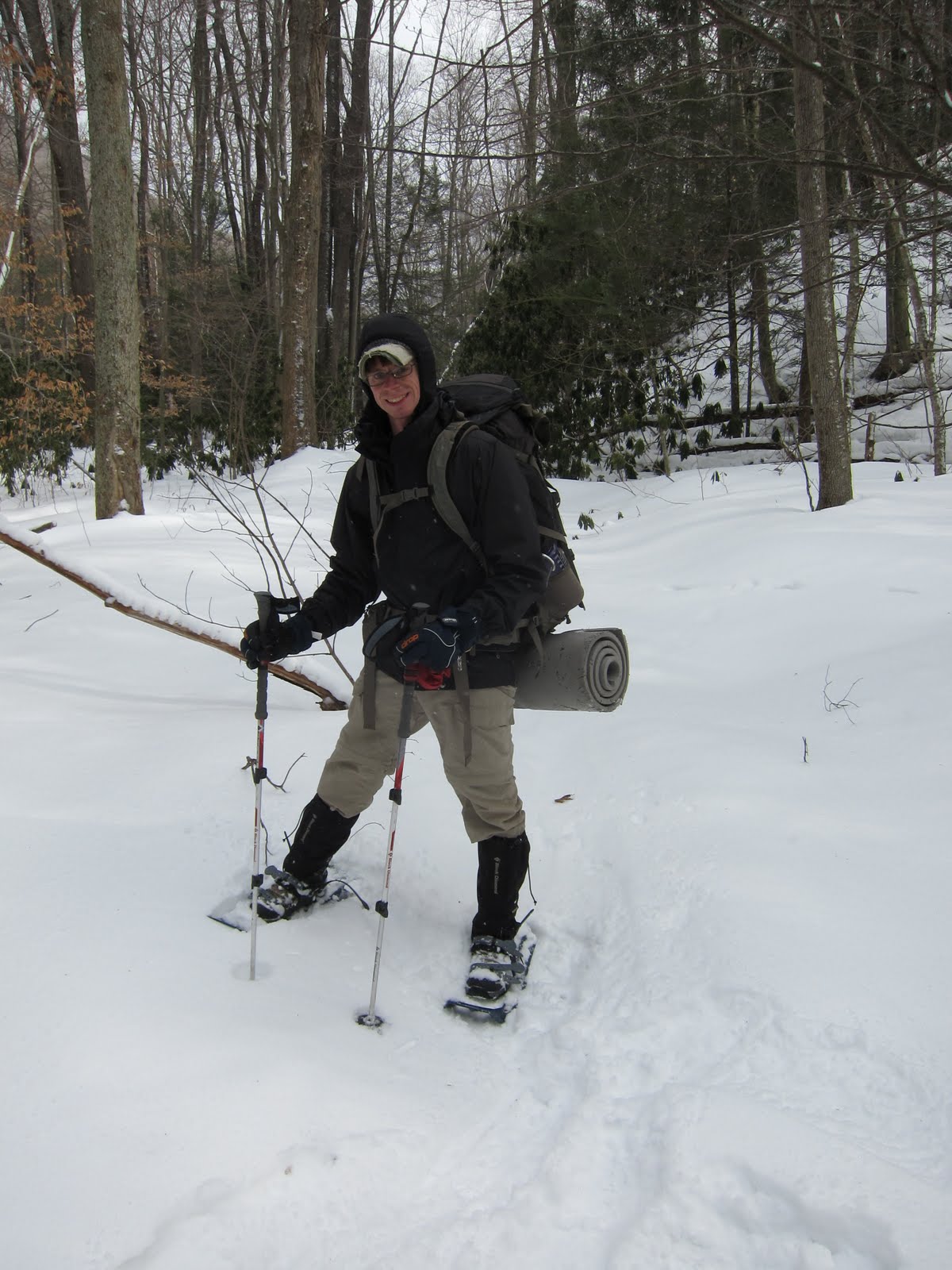
Fortunately Steve was familiar with both the roads getting to the trail head as well as the trails themselves, so we didn't need to rely on directions to get where we were gong. After going south on 81 for a few miles, we headed west on 42 and then took a few side roads to get to the forest road to the parking area. Too bad the forest road was gated closed! We parked the car, knowing our hike just got 4 miles longer. We suited up, tossed on our packs to head out. My pack was very lite, as I had no tent and less warm clothing, knowing we were to be staying in the cabin with a wood stove.
The road walk was very easy, we stayed to the areas where tires had beaten the snow down so the walking was easy. We did the miles in around an hour, getting to the parking lot just after 9pm. The trail leading from the parking lot followed a stream for the first mile and a half, gradually gaining elevation. We didn't use our head lights very much and there was no moon out, making for a very dark, dream-like passage through the forest; the sound of the river to our rights, the sigh of the wind through the trees, the crunch of our feet in the snow. The areas that had no snow, under pines, were darker than dark, pools of inky blackness. Many times we stumbled and tripped over roots and rocks that were hiding in the pitch. Walking on the snow was generally ok, though we slid around a few times on patches of ice. The crunching noise of our footsteps lead to little conversation, without a lot of "what did you say?" so mostly I just walked in the ephemeral darkness, lost in thoughts of dreamlike quality. For a long ways the tracks of a cross country skier snaked through the darkness, leading us up the path. One of us mentioned how much more difficult the path would be to find without the tracks, and they abruptly ended  The trail lead away from the stream, steeper now, ascending the side of the valley. Some bear tracks meandered onto and up the trail for a bit. The cabin lay in a low spot between two mountains ahead of us. We climbed further up, the trail getting steeper, the snow getting deeper, and the tracks from other hikers becoming frozen and treacherous. Finally the spring for the cabin showed up on the right and we were close. We got to the cabin and I pulled out the key.


Inside the cabin was cramped but very well equipped. A bunch of axes, saws, pots and pans, chairs, blankets were out or in bins. A bin full of wood was prepared next to the little stove in the corner. We situated our gear and pulled down the fold up bunks. We decided not to light the fire and just hit the sleeping bags. I went to bed after 1 am.


Saturday

The day was fog shrouded, with occasional rain showers and sleet. Hovering around freezing, the snow was slightly melty.


I slept well on the mattress, pad that I brought and provided wool blanket. We all got up at generally the same time. I was the first out of bed, and very ungracefully slid off the top bunk. We got up and moving and I made a fire as Steve and Jim got some more wood. Jim, grabbing the huge, and largely ineffectual splitting axe. After I got the fire going with some of Jim's fire starter, I put the perkalator on the stove - I eventually got tired of waiting for the stove and used Steve's stove outside to get it perking. After eating our breakfasts we looked at the map and decided to go to Half Moon Mountain as a day hike with our small packs. We tossed lunches and water and some other layers of clothing into our day packs and set off up the trail. At the intersection of the Tuscarora, we turned onto that and followed the trail around to another intersection. On the next part we started seeing bear tracks - first one set on the trail going one way, then another pair  and a third set. We pondered aloud if it was the same bear going in circles or a series of them - some pairs looked smaller or larger. It was really cool to be in the snow and see the tracks - with no snow we would have no evidence of an animal that large wandering around (well, except some scat).


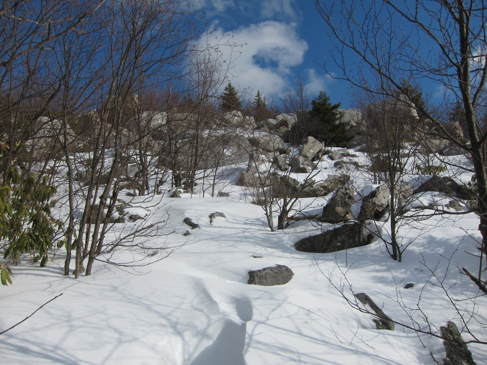
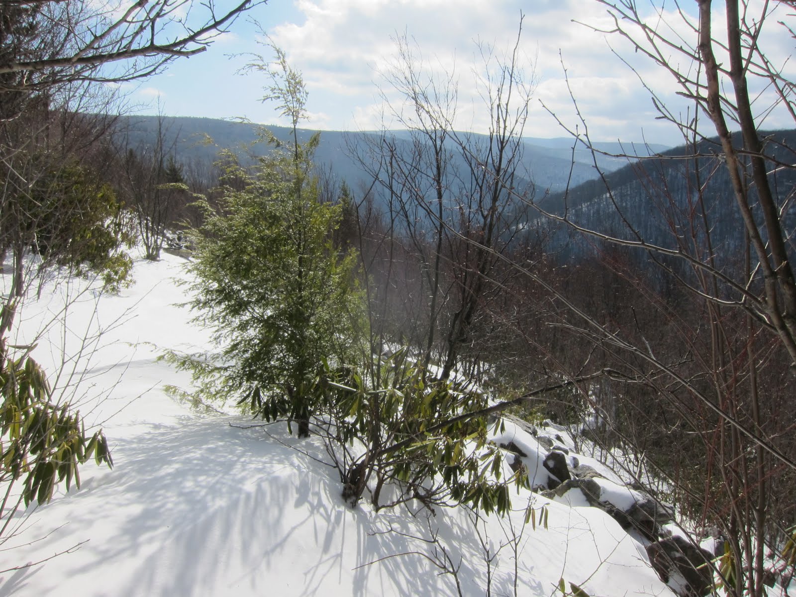
We crossed over a bridge at the bottom of a hill, after a few miles, to a campsite an odd barbed wire enclosure to one side around a wetland. The Tuscarora went right, Half Moon went straight, still 1.7 distant. We continued on after a short break, making good time. The trail at the base of the final Half Moon summit rose for about .7 of a mile, not too steep, as it went all the way across the mountain side. Towards the top the trail switched back and got steep up to an old foundation of a fire tower. The wind was whipping over the mountain, making it very chilly. The woods were engulfed in fog and dripping. There were supposed to be some very good views, all that was viewed was a wall of swirling gray fog. We stayed for a short time, eating a snack, before heading off the peak and out of the wind. On the way down, we passed two guys that looked to be tent camping with full packs, we spoke briefly before heading on our separate ways. The trail ascend back by everything we had came down by earlier, as we were doing an out and back. The melty snow making it difficult going up the hills, as with a full length stride you would slip back a little bit with each step. Our strides shortened and I got very warm. I slowed my pace so I wouldn't be drenched in sweet at the top of the hill. There was an intersection that went steeply up to the right, or back the way we came straight on - for a varied view and to see where it went we opted for the other way - while it was substantially steeper, it was also shorter. At the top of the hill we followed the Tuscarora back to camp on an old wagon trail or fire road.


We were back in the cabin by 4-something. I got the fire going, Steve and Jim cut firewood enough for what we were going to use plus a bit more. The wind picked up even more than when we were up on Half Moon, a freight train running over the mountain in the distance, though the cabin seemed sheltered. We opened the cupboard in the cabin to find a small library and candles and other various sundries.I took a short nap on the lower bunk, enjoying the warmth of the stove. After waking, I walked down to the spring and pumped 2 liters of water. Right after I came back the sky opened up, a few minutes of heavy rain, loud on the tin roof, then it changed over to a silent snow fall. A while later, right at dusk, the clouds blew away and cleared, the moon and stars popping into view, a brief respite from the clouds, the temp dropped as the clouds dissipated, dropping to the high 20's. The wind still howled and an occasional puff dark cloud hurried to catch up with the large mass that already had gone on it's way. We started on dinner and the coffee finally perked on the stove top - I was patient this time. Dinner was a stew with fresh carrots, potatoes, beef cubes, celery, and onion. It took a long while to cook up, but well after dark when it was finished, it went down so good.
We sat around for awhile, listening to NPR on Steve's little HAM radio, sipping whiskey and beer - Jim abstaining from drinking. I got tired in short order and climbed into my bunk. After an hour of sleep I was sweltering, the temp near the ceiling had to be in the 80s, I ripped off a layer or two and unzipped the bag a little to get some air flow and went back to sleep, sleeping through Steve's (and apparently my own) snoring.


Sunday

The day was nearly cloud free, the temperature above freezing. We packed up and ate cold breakfasts. I slammed a 5-Hour Energy rather than brew coffee. We swept the cabin, refilled the fire wood bin, emptied the ashes, and re-latched all the windows. We locked up and headed down the hill. The ice was the worst directly in front of the cabin and the re-froze tracks for a few hundred yards.
We hit our tracks coming up and made great time down the hill, seeing all the sights that were hid by darkness on Friday evening. The sun shone through the trees, eventually we heard the creek as we took the trails only switch back. We followed the path by the river, the snow having melted quite a bit, the trail muddy in some places. We made it to the road and began the road walk. We hadn't noticed, but the road walk was now all uphill - no wonder we made such great time Friday night! We made our way up the shallow grade with a very fast pace, knowing that a car with a stop at Arby's was close at hand. We saw the clear cuts, and the mountains in the distance that were shrouded before. The sun beat down, making the day very pleasant. It only took just over an hour to get back to the car. The gate was still closed, and the car was still there. We tossed the gear in the car, changed our muddy boots, and headed back to Baltimore.

I really enjoyed the trip, especially the cabin. Next time I know that the cabins are well stocked I can bring a day pack with food clothing and a summer sleeping bag, I figure pack weight could be in the teens. We came over prepared as it was, even though I hardly felt like I was carrying anything. Steve Jim and myself got along great, plenty of inappropriate jokes and laughter. We hiked nearly 30 miles, all told - it really adds up quick! Especially on roads and with day packs.


Edit: I talked to Steve last night and he did some research about the area we were hiking through. On a tree by the stream we saw 'LS' spray painted, turns out that is where the forestry folks start dumping lime so the pH of the creek will allow for fish to live in the water, then they stock the creek for people to trout fish. I haven't heard a mention of Acid Rain in a decade or more, for all I knew it was a resolved issue as much as the media covers it, when it used to be all the rage. That is a failure on the environmental groups. Obviously it's a problem, why has it been swept under for the global warming cause? Seems acid rain is a bit more... immediate and uncontested.
Other signs nailed to the trees said something like 'S25'. Steve looked that up and these are birding stations for certain times of the year.
The cabin was built in the 1920's, as a relaxation, recovery, and resupply base for the folks that would man the fire towers in the area. Apparently, it used to be tent based until one day a bear came in and stole a huge slab of bacon - the next day the cabin started getting built!
Lastly, the path by the creek we followed was an old wagon road that lead to places in the woods that made charcoal; a campsite we passed still had evidence of the pits and mounds from the 1860's.

Monday, January 24, 2011

Gerhard Shelter on Great North Mountain

Saturday 22, 2011
Tania's birthday

Tania asked a few days before the weekend if I was able to go backpacking this weekend, it was her birthday weekend and she wanted to get away. Jim worked, so it was just the two of us.

 The night before Tania Jim and I went to Medieval Times, and got to bed fairly late. I woke up at 7 something on Saturday to do some last minute planning and preparation, moving the refrigerated items to my pack, getting on some of my layers, moving everything down stairs. As I was up and moving, Jim and Tania came down and she began packing also. We drank some coffee, decided to take her car, and loaded up.

On our way out of the city we stopped for gas, and then headed west, stopping right off of 66 at a diner for some lunch (with a gluten-free menu). We continued west, Tania driving the entire way, down 66 to 81 S to 55 W up over a mountain, and then turning off right before Wardensville. We missed the faded blue blaze of the Tuscarora Trail and had to turn around for it, but we made it to the parking lot at around 1pm.

We climbed out of the car and suited up, we began walking up the fire road to where the trail cut off and ascended the mountain, we stopped briefly so Tania could shed a layer as the ascent began. The trail had very long switch backs up the mountain, making for a nice climb, but not killer strenuous. Views began opening behind us as we got up high enough. The leaves were deep and untrod in places, attesting to the solitude of the hike. Many of the blue blazes were faded to near obscurity, and some of the switch backs sneaked up on us. The trail, once higher, shared the path of old logging or forestry roads, being fairly level and wide. Patches of snow appeared, mainly in the trail, all pristine until we walked on them.
Leave Only Footprints

The views really opened up behind us allowing for very nice views up the undeveloped valley. In the summer the places to see would be greatly diminished because of the tree cover, but there were some rocky outcroppings and then at the end of the ridge walk, getting close to the shelter, a few mountain meadows claimed the peaks.


The ridge ended and we began to descend quickly from the narrow peak. Soon enough the empty shelter came into view. The red structure was a pleasure to see! We dropped our packs and began setting up camp, after looking at tent spots around the shelter and assuming the wind would be coming from the west, we decided to setup the tent inside the shelter for double protection. Her Coleman 2-person we were using is not free standing, but she had set it up before on a platform. She began that task and I started a fire and gathered fire wood.

For Tania to get the tent to stay up, she put a stick through the loop where the stakes typically go, then she used the sides of the building and several large rocks to hold it up. It turned out standing up just fine, and the double protection from the wind was definitely warranted. The wind hadn't been blowing all day and the temperature was in the teens to maybe around 20. As the sun went down the thermometer dipped down to nearly 10.


Just as the sun was setting I began putting together the hobo dinners. Halving the carrots, meat cubes, onions, green peppers, and potatoes drizzled with olive oil salt and pepper. While I was doing this Tania heated some water for coffee and hot chocolate. The temp dipped but the fire was warm, the rocks of the fire ring had a "winter extension" where some previous camper had moved a smaller ring from the main ring closer to the shelter. I built up rocks behind the pit to act as a heat reflector. The hobo meals, wrapped in foil and on a bed of coals, cooked for over 1/2 hour, I used two sticks to flip and turn and pull more coals down. After I finished my coffee I set the cup down and very quickly I noticed the residual liquid was frozen solid. My Platy hose was frozen, as I didn't take my own advice (or actually advise gotten from Ally the week before) to blow the remaining water back into the hydration bladder before closing it, Tania followed the advise, and it worked fine.We roasted our feet by the fire, and cracked open several hot-hands. I put one in my sleeping bag and two in my pockets.

The dinners were ready, I hoped. I pulled one out of the coals and opened the foil, it looked perfectly done and smelled awesome, the moisture billowing out laden with the scent of cooked vegis and beef. We ate quickly, while the food was still warm out of our respective food dishes. We both finished every last bit. After we were done I broke out the birthday cake and someone had left a candle in the shelter.

Not exactly an auspicious birthday cake, but appreciated all the same I hope! We sat and talked, passing the flasks back and forth, enjoying the warmth of the fire and waiting to be tired. We stood up occasionally and stepped away from the fire to enjoy the star lit sky, wondering which way the moon would rise. Both of us saw separate falling stars, and enjoyed the hints of the Milky Way. The moon rose to our east, cresting over the far mountain, across the dark valley, the valley to our west was developed and much more grand, stretching to the horizon and to the mountains closer to Dolly Sods. The hour finally got late enough that sleep would probably come, at some point clouds had quickly socked in, the stars and moon obscured. I banked the fire, with hopes the coals would be good for the morning. I had put a couple rocks by the fire and before bed, wrapped them in cotton handkerchief and each of us put one in the sleeping bags. My rock stayed warm long into the night, warming my feet, while the handwarmers added heat to my mid-section.

I slept well, falling quickly into dreamland. I did wake when the wind began stirring the tarp partially hung by the entrance of the shelter. I didn't know if it was an animal or the wind stirring it at first. Once I could tell it was just the wind, I fell back asleep - though I did contemplate getting out and taking it down, I just didn't want to get out of the cocoon of warmth.

Sunday 24

I awoke after dozing for awhile to Tania crawling out to go to the bathroom. I laid there for awhile, my own bladder full, not wanting to give up the warmth and face the chill. I heard her stirring the ashes of the fire and figured she was up and not getting back in the tent, so I should follow the example. I put my contacts back in, threw on the down vest and headed out. The sun was shining, and we double teamed the fire and got her blazing again. Neither of us in a hurry, we sat and enjoyed the fire, and then some coffee. Tania's hard boiled eggs had frozen overnight and she attempted to thaw them by the fire, first on the rocks and finally in her cook pot. She then warmed an Ensure over the stove, and unfortunately burnt some on the bottom. Note to self, burnt Ensure = unappetizing!! As we sat there it began to flurry and then snow, the far mountain and valley obscured. Very shortly it stopped snowing and the sun came back, some snow still blowing in the wind lit up like glitter, making for incredibly beautiful scenery.

We began packing slowly. Enjoying the sun and the fire between tasks. In short order we were packed up and ready to go, by around 11am. After looking at the directions, the second half of the loop trail would entail dropping off the mountain directly into the valley and using a series of unmarked trails and fire roads, between the chance for getting mixed up the mile road walk and the lack of view, we decided to go out the same way we came in, for the views and the knowledge of the trail. The first 1/4 mile of trail gaining the ridge top again got our blood flowing, the views gorgeous with the clouds giving the distant views a splotchy look.


As blood flowed back into Tania's feet she stopped to pull off her boot and look, as she said it felt like a burning ember or a stick stuck between her toes. There was nothing there, but ultra sensitive toes, awaking from having no feeling. The wind was coming from the west, sometimes blustery on the ridge. My face was numb from it, but my body warm from the layers of clothing. As we got off the ridge line and began descending into the valley the wind lost its bite, and the sun was quite warming. We made it back to the car in 2 hours. Making it 24 hours and not seeing another human besides each other. This is a very secluded hike, and so much closer than Seneca Creek or Dolly Sods or even Three Ridges. As we got back to the car we saw the the creek was marvelous looking, frozen as it was. We dropped our packs and went exploring. I only busted my ass once, which was totally expected. I only partially fell through the ice and didn't get wet, which was unexpected - I assumed I would've gotten soaked!


 Hard to see, that icy spike
is about 2ft above the water
 Ice skating Legolas
All in all it was a very good trip. We hiked right around 10 miles. Stayed out in very cold weather all night comfortably. And had great conversation and story telling with a wonderful friend around a blazing campfire. What more can anyone ask for?!

Triumphant Tania

Monday, January 17, 2011

Three Ridges Wilderness in VA

Friday 14


I signed up for this meetup group trip early last week. There had been 12 people including myself signed up for it. On Thursday Jim Newman had mentioned that he may have to bail and that I would have to over-see the trip, as I am an assistant organizer for the Washington Backpackers Meetup Group. Jim also talked to another guy on the trip, and he seemed ill prepared and not really wanting to be apart of the group mentality, so fortunately he didn't come.
All ten people going were to meet at the Centreville Virginia Park and Ride. I got there about 30 minutes early, talked to Jim a few times on the phone, and the others began trickling in. First Steve with Damien and Ally riding with him, then Melissa (rhymes with monster) and Ming, Darwin and his two malamut dogs, Vessie carrying a bunch of equipment Jim and meet with her earlier to loan to the group, and last Jasen and Gary.We hurriedly went through the massive amount of equipment Jim had sent, and after polling everyone for equipment everyone owned, it was apparently that all involved were adept at backpacking and had the correct gear. We ended up grabbing a small wire grill, a 4 person 4 season 12 lb tent, and a bow saw. We ended up putting everyone in 4 cars and caravaning down route 29 towards our destination for 3 hours.
Three Ridges is situated very close to Wintergreen Ski Resort. We wound up the mountain and parked beyond the resort close to the Blue Ridge Parkway. We headed out from the parking lot at 10:30pm. After a few minutes searching for the Appalachian Trail we headed up, the trail quickly ascending a ridge steeply. We made it to the top and by earlier consensus we decided to head off the ridge to the shelter campsite rather than stay on the ridge for the night. After 1.6 miles we arrived at an empty Maupin Field Shelter. All of us quickly throwing out our sleeping gear on the floor of the shelter, with only Melissa and Ming opting to set up their tent. We started a small campfire and talked for awhile. One by one heading to the sleeping bag after passing around a bottle of whiskey.
The night was chilly, probably down in to the teens. I neglected to change socks and my feet were chilled off and on all night. Other than that I slept decently.


Saturday 15


I woke up after most everyone else was already out of their bags. I hopped up and packed most of my gear. I ate cold oatmeal and grabbed a bit of coffee from Darwin. I pulled out my food for the day and put it in my pockets so it would unfreeze from my body heat. Melissa and Ming were the last two up and packed. All of us antsy to be off. We had decided the night before to head south on the AT to the Harpers Creek shelter with all our gear, rather than setting up a base camp, and making a loop coming back up the Mau Hurr blue blaze trail.
Steve, Ally, and Vessie were to share Jim's tent, but after feeling the weight they decided to leave it at the shelter and hope that the next shelter was also empty. Steve brought a bivy so he was good to go either way.


We started the journey, heading up a thousand feet to the apex of the Three Ridges, the elevation gain sneaking up on us. The views down into the valleys east and west opening up in front of us. When stopping the wind quickly chilled us, and got us motivated to keep moving, the hills giving us warmth. Gary began having some leg cramps and Vessie gave him some leg cramp medication that seemed to help for awhile, until the cramps moved to other parts of his body. The conversation was lively, much more so when going down hills. We ate while hiking so didn't stop for an extended lunch. My feet were very cold to begin with, but after a mile of hiking, intense pins and needles shot through them and the circulation and feeling returned.
After 8 miles, the last mile down 2000 feet, we arrived at Harpers Creek shelter. The shelter was full of Boy Scouts. Steve went and chatted with them and they lent a tent to the girls to use for the evening since they occupied the shelter.


We all went about setting up our tents. I brought the one-man Sprite. There was plenty of space to set up camp down a ways from the shelter, over the hill from the Scouts. We all broke out food and dined a late lunch that continued until we made dinner. Everyone was very generous with the food they brought, everyone shared chicken and vegetables and sausage and coffee and liquor and anything else we had. Camp life was good! Soon a blazing fire and a huge stack of firewood was situated. The light began to fade from the sky after pumping water and cooking and all the other camp chores. After dark we began passing around flasks and wine. Everything was quickly consumed and we sat around the fire chatting listening to some quiet music. At about 10 or 10:30 we all got sleepy and headed to the tents, full and happy.
The night was much warmer, I think a combination of warmer temperature from a slightly lower elevation, and being in a tent made for a much more comfortable evening. I slept fairly well, but woke up every time I needed to roll over, my hip hurting from sleeping on one side or the other.


Sunday 16


Everyone rolled out of their tents generally the same time. We cooked breakfast, Darwin relight the fire to make some coffee. We all packed quickly and continued conversations from the evening before. Gary had been very sore the previous evening and continued to be hurting. He was worried he wouldn't be able to make it back to the cars, so his exit strategy was to head to route 56 and have someone come and pick him up from the all down hill trail. I said that I would go with him so he would not be alone in case anything happened. 


We all saddled up and headed up a hill for a 1/2 mile to the intersection with the Mau Hurr Trail. At the top of the hill Gary decided to stay with the group, as the trail distance to 56 and back to the cars was similar, if one being up hill and the other being down. At the top of this first climb, my heart beating happily in my chest, the soreness of the night before vanished and the coffee coursing through me, I was absolutely giddy, I couldn't help but smile, I couldn't think of anything I'd rather be doing at that moment.


The trail wound down around the side of a ridge then climbed 500 feet up switch backs, a very difficult hike, all of us overheating and thankfully stopping for a few minutes. The trail continued up for a bit before dropping down to a creek with astounding waterfalls and a campsite. Following the creek was a very difficult climb, rock scrambling and just placing one foot in front of the other, we gained elevation quickly, headed back to the saddle where the Maupin shelter rested. Towards the top we came to a dead coyote, the skin and fur perfectly preserved, but the guts all missing. We speculated on causes of death, and why it was preserved as it was.
In a short time we crested the last of the steep hills and made our way back to the shelter. Jim's tent was still there, undisturbed. A large group of identical tents were setup close by, with no sign of the owners, apparently some group of Scouts had made this their base camp. The last 1.6 miles went quickly, a short uphill and a long down hill to the cars. We unloaded our gear, changed our clothes and headed to the brewery at the bottom of the hill for a late lunch and some more camaraderie. Melissa and Ming left after a brew with Vessie, the rest stayed for lunch. We all headed back towards Centreville and DC. I got home to Baltimore at 8pm.


The group was very good. Everyone was cool and got along. No one was ill prepared. Steve told expansive stories of the past and all his hobbies: pictures of trains, HAM radio, micro-brewing, he is an extremely smart guy and has a lot of good knowledge. Damien seems to be looking for something, he mentioned that the AT sounded very interesting to him, very nice guy and a strong hiker. Ally is very capable and explores the world a lot, every chance she gets, also she has nice eyes. Vessie is just getting over a divorce and is all about getting back into life and trying new things. Jasen and Gary are very good friends, Jasen is competent and is a strong hiker. Gary wants to get back into shape to hike Mount Rainer in the summer, he is very gregarious and I had lots of good conversation with him - he pushed through his cramping and did great on the trip. Mellisa and Ming kept to themselves, some, but when in the group were participated in great conversation, both are strong hikers and very kind people. Darwin brought his male and female malamut dogs, which are just the best behaved big fluffy dogs ever, the boy growls when he is getting pet in the right spot, Darwin is from Ecuador, a very nice guy. I really hope to hike with all these people again! The generosity and cohesiveness of the group made for good times.


Sour Patch Kid


Thanks to Gary for providing pictures, since I left my camera in Baltimore.

Wednesday, December 29, 2010

The Planning Continues

    I learn more about long distance hiking almost everyday. In the process of planning to do the Appalachian Trail I am on a constant hunt for information. Coming across a great bit of information is like finding a puzzle piece that fits.
    Not only does the planning keep me excited about the trip but it keeps me hunting for those bits of information. I try to note the things I learn, or copy the Internet URL. I hope to retain all the bits and pieces I've been gathering. I have a couple documents that are constantly evolving and being updated with equipment lists, recipes, financial goals, and just thoughts and ideas. Being that it is over a year away from going all this is almost certainly unnecessary. But I have all these ideas, all the time! I have a burning desire to hit the Trail. At times I get depressed just thinking about how long I have to wait, but at the same time my spirits are buoyed at the thought of finally deciding that I will go. I live once. I am young(ish). I am childless. I have the financial ability to save for this with hardly any negative consequences beyond losing 6 to 8 months of pay. I am healthy and I have the drive. To let this confluence of fortuitous alignment pass by without jumping on it would be regretful. I could wax philosophically about letting life slip away... but I won't!
    Everyone is so supportive too. It's amazing how anyone in my life that I've spoken with at any length agree wholly I should go. Maybe there is a spark of passion in my eye? I certainly feel more alive just thinking about it. I have read a dozen books about other's AT adventures. I read people's AT blogs and WhiteBlaze forum's. Last year I went to Trail Days in Damascus, VA to hang out with the hiker's.
    Not only do I love the idea of a trail of such long distance, I love that much of it is in our backyards practically. I've been on bits and pieces of the Trail in NC, VA, WV, MD, PA - every time I imagine a thin thread stretching out before me to the terminus, connected by these white rectangles. An electric thrill runs up my spine. What's around the next bend in the green tunnel? The community of the Trail draws me as much as the Trail itself. I'm not the only one that feels as I do about the Trail. I want to meet the people. I want to spread good feeling to those that don't know about the Trail. Lead by example to weekenders and section hikers, both of which I currently am.
    I love the weekend trip that I go on. But there always seems to be a huge ticking clock in my mind. Longer trips, 10 days or so, the clock becomes almost silent by day 3 or 4 but then returns with thunderous noise by day 8 and 9. Being absorbed with time is something I am eagerly anticipating getting away from. I know there will be a schedule, but it seems like it will be a much less involved and demanding schedule. My worries will be boiled down to: move forward, eat, drink, watch the weather.
    I have read where some authors relate the Trail to a pilgrimage, some view it as a coming of age story, other's are looking for answers, or trying to beat a record. I am doing it for love, and removal of the things that breed dissatisfaction. On any given day I find myself angry and bored more than anything else. Mad at the car in front of me, short-tempered that the electronic device isn't as fast as I want it to be, annoyed that a loved one isn't giving me the attention I self-centeredly crave. Or bored, letting my mind melt into the inane TV I try to avoid, or the StumbleUpon site I'm clicking or the computer game. Or I nap out of boredom. I am only really happy when I am around friends, family, and loved ones and I am happy when I'm hiking, pushing myself to do something strenuous, either alone or accompanied . I'm tired of being angry. I'm sick of being bored. I go on this sabbatical to try to find a meaning deeper in life. I know a deeper meaning exists, just from the last paragraph - family, friends, loved ones, and strenuous labor give meaning to an otherwise gray dull life. I go in search of a way to enrich my life. I go to experience life more fully than I ever have.

I began this post with the intention of writing specifically about what planning I have so far done and what yet needs doing. Reading back through I like the direction the post  took instead. Sometimes it is difficult to articulate where I am. Mostly I just try to grin and ignore the anger and the boredom. But it is so prevalent, and so disgusting, I need to confront those emotions, try to understand where they come from.

Monday, December 20, 2010

Maryland AT - year end adventure

12/20/2010
The year is quickly winding down! And what a good year for travel and adventure. A year ago I was getting back from Hawaii. In January I went snowboarding for the first time, and climbed Old Rag in the ice. February drove to Florida on a whim. March I went to Brazil for 10 days. April I went to Seneca Creek backpacking and the Bahamas at the end of the month. In May I went Dolly Sods and to Trail Days. July I went back to Dolly Sods and to NY. August I went to the Outer Banks. September saw me back in Dolly Sods, solo. October I went to Utah to see Zion and Bryce Canyon. November back to Old Rag and NY. And December I hiked most of the Maryland AT in the snow. 
The latest trip went like this:
Friday 17th
Jim and I had discussed doing the AT in Maryland, seeing how much we could do and where we thought we could end. After some back and forth we decided we wanted to end in Harper’s Ferry. It was left to me to decide where we could begin and finish comfortably. After perusing the map I picked a drop off point about 9 miles north of the Pine Knob Shelter at MD 17 Wolfsville Road.
We got to the parking area after dropping my car off at Heather’s in Frederick and Jim driving to the starting location. Night had already fallen, so we climbed out into the chilly night, headlamps on as we threw on layer after layer of clothing. Packs loaded and heavy with water (I had 5.5L of liquid including water, wine, juice). The road where we parked was the bottom of a fairly large hill. Soon puffing our way up the hillside after finding the trail. We turned off the headlamps, the snow on the ground reflecting the ¾ moon strong enough for us to cast shadows. We quickly became warm. I pulled off my wool hat and stuffed it in my jacket, several hundred yards up we stopped to put our outer-most layer in our packs. At this point I fumbled for my headlamp, that was no longer on my head... or in my pocket where I’d stuffed my hat. Shoot! Already losing things! We dropped our packs and headed back down the hill, looking for my head lamp. I was ready to give it up and call it lost but Jim insisted we go a bit further down the hill. And there is lay on the trail, little bugger. I put it around my neck as a necklace the rest of the trip so I wouldn’t lose it.
We put our packs back on and ascended the hill once more, going up a few switch backs. Finally we crested the hill, while the valley behind us was small and dark the valley on the other side of the mountain stretched to the horizon and contained a multitude of lights. Hagarstown lay in that valley, as well as Route 70 and 81. The night was crisp and the air sharp, allowing a long view of the bright valley.
Now that we were on top, we would follow this ridge for 8 miles to the campsite. No large elevation gain or lose was to be had. The trail looked like only a few people had traversed it since the snow had fallen a day before. Wide and easy, Jim and I walked side by side talking about many things, joking, laughing, and sometimes yelling or howling at the moon. The world lay at our feet, the night around us ours. No wind stirred the barren limbs, walking kept us warm. The miles unwound from our boot heels. We hiked down past Pogo campsite and over a still flowing creek, unlike the water in our platypus and camel back bladder hoses. The temperature in the low 20’s had long since made the water sluggish and slushy in our water bottles. We ascended a small hill to pass Annapolis Rocks and quickly made our way to the shelter.
We arrived at the shelter at around 11pm, hoping it would be empty so we wouldn’t disturb anyone. There, shrouded in the darkness of the shelter, lay three prone forms, their packs hanging from pegs in the shelter. Jim and I opted to let them sleep undisturbed and go setup his tent on the tent pads close by. We threw the tent up, and tossed our stuff inside, one final snack and we hung out packs on the bear hanger and crawled in. We put our bottles up next to the outside of our sleeping bags to keep them unfrozen. Each of us had 2 ground pads, closed cell foam pad and children's Thermarest. Sleeping bags and liners to keep us warm to 0 or 5 degrees. I slept soundly, but apparently, according to Jim I snored and kept him awake.
Saturday 18th


I woke up at first light and rolled over for awhile longer. Finally I got up and crawled from the tent. I got my pack down and was preparing to start cooking on a snow covered rock close by the tent. The three guys that were happily snoozing from the night before were up and packing. One guy saw what I was doing and offered to share the picnic table. I gathered my things and went over to the shelter. I talked to them for awhile. One of the guys had recently joined Washington Backpackers Meetup group, so there is a good chance I will see or hear more from him. They all seemed like decent guys, going for a three day jaunt, about 8 miles a day. Today they would be stopping before our halfway mark and finishing on Sunday several miles short of where we planned to spend the night. My fuel canister was still a bit chiily so they let me borrow some hot water to soak it in for a minute or two, then the JetBoil did it’s trick and got our 2 cups of water rolling.
Jim walked up and talked just as the guys were packing it up. I had coffee and oatmeal mixed, Jim had hot chocolate but declined the oatmeal for a bar of some kind. After breakfast we packed up the tent and our gear and set off, going down the hill towards the crossing of 70. On the way down there were two hunters coming back from getting their feet cold that morning. The older gentleman pointed out bear tracks in the snow - sure enough, within ¼ mile of the trail a bear had wandered through! Very cool. Talking to the hunters, we found that it was black powder season and archery, both requiring a shorter shot, thus safer for us to be in the woods.


We crossed over 70 and over several roads in the three miles to Washington Monument. As we were arriving the guys from the shelter were just leaving. We stopped for lunch for about 25 or 30 minutes, looking at the view and snacking heavily. After getting chilly standing still we put the tack back on and headed down off the hill.
The next several miles went quickly, a few more road crossings and we caught up and passed one of the guys, the other guys had already made it to their camp for the evening by the time we went by the blue blaze for it. We began the ascent of the hardest hill yet. For 2 ½ miles we steadily gained elevation, nothing terribly steep, just constant. After trudging and stopping for me to get in touch with Heather briefly we reached the halfway for the day mark. The first part of the next 8 miles, a continuation of the hill. At the top we reached a ridge and cruised steadily for a couple miles.
In Gathland State Park we passed the Civil War Memorial to the War Correspondents and climbed back up from the gap to our final ridge walk as the sun was setting.


Across the valley to the west lay Gobblers Knob, a source of constant amusement. We were dragging by this point, stopping frequently, hoping this last push would happen quicker than it was, we talked about food often. The temperature dropping to the high teens. The last three elevation gains were brutal, though not long or steep, we were weary and drug our selves up each one, hoping the shelter was on the down slope of the next hill. Finally we saw the dark silhouette looming to the left, suddenly our energy level notched up and we strode defiantly into camp, heads held high, Jim laughing maniacally, as he does. The Ed Garvey shelter, 16.5 miles from where we began our day! The shelter stands with a view into the valley east facing, two stories, the top floor having plexglass windows and a door, though still open the chill.


I went about getting food out and ready while Jim went about fire making, our old comfortable roles, done without speaking or telling each what to do. I put the fuel canister in my jacket while cutting up the sausage and getting stuff out. By the time I’m ready to heat water for the Couscous Jim has a nice fire blazing away, melting the snow off the logs placed by the fire. We fry the sausage on sticks over the fire, starring enamoured into the warmth, drinking the wine sharing the couscous from the same bowl. Jim breaks out some gingerbread cookies that were just divine. We climb the ladder stairs and lay out the sleeping gear, I toss my water bottles and fuel canister in the bottom of the bag, then clothing I’m not wearing. Lastly, I put on sock liners, hot hands, then wool socks over that. My feet will be toasty tonight! I go to sleep quickly. Apparently I snored again.
Sunday 19th
I wake with dreams that people are downstairs. I hear Jim thrashing around and assume he is getting up to pee. I hear birds chirping and fluttering downstairs. I finally get the gumption to get dressed and get out of my sleeping bag. Apparently Jim’s thrashing had more to do with him waking up in a puddle of water. His camel back nozzle got rolled on to, leaking water, he rolled again to get off of it some how making it gush. Some of his clothing was wet, pants and shirts, as well as his liner. For the last hour he had been very cold, curled into a ball. We got up and moving quickly, that being the best for being chilled. Hot chocolate coffee and oatmeals later we headed out of the very nice shelter. We had enough water still to get us to Harper’s Ferry so we didn’t have to go down the Steep! ½ trail to the spring. Just as we were about to leave 3 kids camp up, they may have been around 20, two boys and a girl, doing the 4 state challenge from VA to PA. They had started at 3am and planned on finishing by 3am. They mentioned that there was another group ahead of them, maybe I had heard real voices and not dream voices?


After leaving the shelter we went up a small incline, enough to get the blood flowing and the extremities warmed, feeling coming back to my fingers and toes. We quickly made it to the top of Weaverton Cliffs. We dropped our packs and went down to the over look, viewing the Potomac River and seeing where we were heading off in the distance. The trail down the cliffs was very quick, over a secondary road and under Route 340 we made it to the C&O Canal. I called Heather and let her know our where abouts and started heading the 5 miles to Harper’s Ferry. Our pace on the towpath gobbling up the miles very quickly. We made it the railroad bridge into town after seeing three trains on the busy tracks we paralleled. Harper’s Ferry stood out in beautiful relief, as always, with the added beauty of snow clad hills and icy rivers forking around it. As we walked into town I called Heather and she was very close by, Jim and I made our way to a very nice place to eat and she soon joined.


After stopping at the Outfitters and the ATC we headed back to Jim’s car and dropped him off.
This trip was a pleasure, it was also a very good test, as neither Jim nor I have done much cold weather camping recently, with the gear we now posses, and we hadn’t done that distance in a long while either. We are both sufficiently up to the task of handling it and enjoying ourselves doing it too!